Around Solignat via Les Tremoux

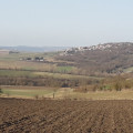
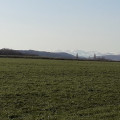
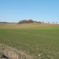
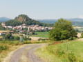
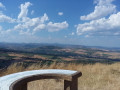
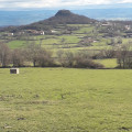
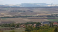
An easy walk through rolling countryside offering beautiful views, sometimes over wide valleys with gentle slopes dotted with splashes of colour—reflecting the variety of crops—and sometimes over ancient volcanoes, small hills scattered across the landscape.

Details

1806260
Creation:
Last update:
Last review:
  • Walking
    Activity: Walking
  • ↔
    Distance: 4.58 mi
  • ◔
    Average duration: 2h 35 
  • ▲
    Difficulty: Easy

  • ⚐
    Back to start: Yes
  • ↗
    Ascent: + 502 ft
  • ↘
    Descent: - 512 ft

  • ▲
    Highest point: 2,142 ft
  • ▼
    Lowest point: 1,631 ft

Photos

Description of the walk

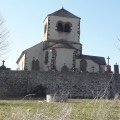
Start at the car park on Rue des Dauphins d’Auvergne (the main street), near the church square.

Yellow-red signposting (GRP® around Issoire)

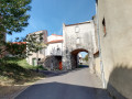
(S/E) Walk down Rue le Court, which runs perpendicular to Rue des Dauphins d’Auvergne, in the opposite direction to the sign for ‘Pic d’Ysson’. Rue le Court becomes Impasse Champ de la Porte. At the first junction on the cul-de-sac, turn right onto Rue Champ de la Porte.

(1) When you reach a side street, take the hairpin bend to the left, following the main road as it continues downhill for 400 metres, until you reach a junction with a cross

(2) Leave the tarmac and take a wide track on the right, which is not very visible from the road as it is hidden behind an agricultural warehouse (bales of hay). Turn left after 100 metres, then right (altitude 527 metres), continuing downhill.

No signposting

(3) Turn left onto a cross-country track, heading uphill to the D32. Cross the D32 and take the track on the left, opposite, towards a slight dip.

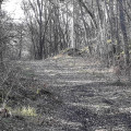
(4) At the crossroads, take the second path on the left, running parallel to the contour lines. The path enters the Tremoux Forest. Ignore the first turn-off on the left (altitude 553m). The route curves left towards the village of Solignat, climbing as it goes. Continue straight on at the first passage under the power line along a little-used track. Pass the water intake (a facility utilising a source of drinking water).

(5) At the crossroads, continue south-east, still uphill. The route runs alongside a farm just before reaching the first houses of Solignat. It becomes the Chemin des Vergers, a tarmac road, following the contour lines. Pass the Chemin de Féniat on the left.

(6) At the junction, finish the walk by taking Rue des Dauphins d’Auvergne on the right, which leads back to the starting point (S/E).


Waypoints

  1. S/E : mi 0 - alt. 2,129 ft - Car park on Rue des Dauphins d’Auvergne
  2. 1 : mi 0.4 - alt. 1,965 ft - Turn left at the hairpin bend
  3. 2 : mi 0.68 - alt. 1,903 ft - Turn right onto a wide, barely visible path
  4. 3 : mi 1.44 - alt. 1,634 ft - Turn left onto the cross-country path
  5. 4 : mi 2.46 - alt. 1,844 ft - To the left, following the contour lines
  6. 5 : mi 3.67 - alt. 2,051 ft - Heading south-east, the path continues to climb
  7. 6 : mi 4.31 - alt. 2,113 ft - Rue des Dauphins d’Auvergne, on the right
  8. S/E : mi 4.58 - alt. 2,129 ft - Car park on Rue des Dauphins d’Auvergne

Notes

Although signposted for only the first third of the route, the walk is not difficult if you use the terrain as a guide: the first half of the walk is downhill, the second half uphill.

Worth a visit

Reviews and comments

3.3 / 5
Based on 5 reviews

Reliability of the description
3.4 / 5
Ease of following the route
3 / 5
Route interest
3.6 / 5
Jacqueline B
Jacqueline B

Overall rating : 3.7 / 5

Date of your route : Jun 24, 2024
Reliability of the description : ★★★★☆ Good
Ease of following the route : ★★★☆☆ Average
Route interest : ★★★★☆ Good
Very busy route : No

A lovely walk, though there were a few minor difficulties in following the route

Machine-translated

jyvalour
jyvalour

Overall rating : 3.3 / 5

Date of your route : Nov 10, 2021
Reliability of the description : ★★★★☆ Good
Ease of following the route : ★★★☆☆ Average
Route interest : ★★★☆☆ Average
Very busy route : No

A pleasant walk in the Dominican Republic; be careful not to miss the turn-off signposted by the shed on the right when you leave the tarmac and pass the haystacks (open-air = it’s not a building); the signposting isn’t very clear

Machine-translated

Jean-Louis Pinault
Jean-Louis Pinault

Thank you for this information. But I don’t quite understand the difficulty with the route, as it’s a GPS track.
Have a good day,
Jean-Louis

Machine-translated

NEMERY
NEMERY

Overall rating : 4 / 5

Date of your route : Aug 19, 2020
Reliability of the description : ★★★★☆ Good
Ease of following the route : ★★★☆☆ Average
Route interest : ★★★★★ Very good
Very busy route : No

A lovely walk – I was with someone who’d done it before.

Machine-translated

Jean-Louis Pinault
Jean-Louis Pinault

Thank you for your comments; I have amended the description as you suggested.
Have a lovely day,
Jean-Louis

Machine-translated

Mounaud Robert
Mounaud Robert

Overall rating : 4.3 / 5

Date of your route : Aug 14, 2020
Reliability of the description : ★★★★☆ Good
Ease of following the route : ★★★★★ Very good
Route interest : ★★★★☆ Good
Very busy route : No

A little bit of uncertainty when you reach the high-voltage power line...
It would be nice to say ‘carry on straight ahead’ along a quiet path…

It’s a shame we’re heading downhill! Then we’ll have to climb all the way back up...

Machine-translated

Jean-Louis Pinault
Jean-Louis Pinault

We are indeed talking about the same village of Solignat near Issoire, aren’t we?
The walk follows the GRP “Autour d’Issoire” trail, marked in yellow and red, which descends from the Puy d’Ysson. Can you see the unmistakable “Pic d’Ysson” sign near the fire station? Well, as indicated, turn your back on it, look for the yellow-and-red markings heading downhill, and there you are! That’s where the walk starts.
Enjoy the walk,
Jean-Louis

Machine-translated

l'huguette
l'huguette

Overall rating : 1.3 / 5

Date of your route : Jun 03, 2020
Reliability of the description : ★☆☆☆☆ Very disappointing
Ease of following the route : ★☆☆☆☆ Very disappointing
Route interest : ★★☆☆☆ Disappointing
Very busy route : No

It was impossible to find the right direction at the start of the walk (even the locals didn’t understand the route description at all). I absolutely do not recommend this walk; it’s impossible to find from the outset.
Please review this.

Machine-translated

Other walks in the area

For more walks, use our search engine .

The GPS track and description are the property of this route's author. Please do not copy them without permission.