Watermills and dovecotes in Auzon

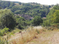
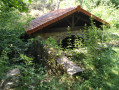
A walk that allows you to discover the mills and dovecotes near Auzon, admire the forests of holm oaks and conifers, and experience the transition between the landscapes of the Cé Valley and those of the mining basin!

Details

1332811
Creation:
Last update:
Last review:
  • Walking
    Activity: Walking
  • ↔
    Distance: 4.18 mi
  • ◔
    Average duration: 2h 35 
  • ▲
    Difficulty: Moderate

  • ⚐
    Back to start: Yes
  • ↗
    Ascent: + 719 ft
  • ↘
    Descent: - 702 ft

  • ▲
    Highest point: 1,975 ft
  • ▼
    Lowest point: 1,375 ft

Photos

Description of the walk

Starting point: Auzon Tourist Office car park.

Signposting: Yellow (PR®419) for the most part, or none at all.

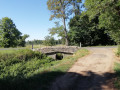
(S/E) From the Tourist Office car park, head towards Rue des Faubourgs and turn left towards the town centre. At the junction, turn left onto Rue de Saint-Martin d’Ollières, cross the bridge and continue right onto Rue des Moulins, following the River Auzon.

(1) Leave the path between the two houses on your left – this will be your return route – and carry on straight ahead. At the Fork in the road shortly afterwards, turn right onto Chemin des Moulins. After passing the mills, you’ll see a sawmill, followed by sports facilities.

(2) Cross the ford over the river and, after 100 metres, take the path on the left which climbs up towards the road.

(3) At the road, turn left, continue for 300 metres, then take the first path on the right. Pass the pumping station on your right and follow the path which climbs and runs alongside the house.

(4) At the junction with a path, turn right and continue until you reach a track.

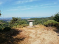
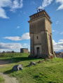
(5) Follow the track straight on as it climbs, passing the orientation table on your left, and carry on until the path splits in two.

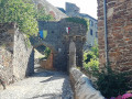
(6) Turn left and stay on the path until you reach the hamlet of Boussac. Walk through the hamlet.

(7) Before you leave the hamlet, take the grassy path to the left of a house, which leads down towards Auzon.

(1) Turn right onto Rue des Moulins and, just before the bridge, continue right onto Rue des Prisonniers de Guerre. Carry on along Rue des Ruisseaux to return to the car park where you started (S/E).

Waypoints

  1. S/E : mi 0 - alt. 1,375 ft - Tourist Office car park
  2. 1 : mi 0.31 - alt. 1,401 ft - Junction of the circular loop
  3. 2 : mi 0.72 - alt. 1,440 ft - Fording the river
  4. 3 : mi 0.96 - alt. 1,581 ft - Route
  5. 4 : mi 1.31 - alt. 1,654 ft - Crossroads
  6. 5 : mi 1.75 - alt. 1,923 ft - Junction with the track
  7. 6 : mi 2.09 - alt. 1,959 ft - Fork
  8. 7 : mi 3.38 - alt. 1,719 ft - Boussac hamlet
  9. S/E : mi 4.18 - alt. 1,375 ft - Tourist Office car park

Always be cautious and plan ahead when you're outdoors. Visorando and the author of this route cannot be held responsible for any accidents occurring on this route.

The GR® and PR® markings are the intellectual property of the Fédération Française de Randonnée Pédestre.

Reviews and comments

4 / 5
Based on 4 reviews

Reliability of the description
3.8 / 5
Ease of following the route
4.3 / 5
Route interest
4 / 5
gboniface48
gboniface48

Overall rating : 4 / 5

Date of your route : Oct 27, 2023
Reliability of the description : ★★★★☆ Good
Ease of following the route : ★★★★☆ Good
Route interest : ★★★★☆ Good
Very busy route : No

The walk is enjoyable, with its variety of scenery and atmosphere. The path is well maintained.
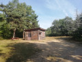
One minor criticism regarding the description of the end of the route. Stage 7 isn’t easy to find. You need to turn left after the bus shelter-like structure with a sign saying ‘Le Relai Gaulois’. Alternatively, as we did, you can continue along the road for about a kilometre and take the GR path that branches off to the left and leads to Auzon.

Machine-translated

pheno43
pheno43

Overall rating : 4 / 5

Date of your route : Jan 19, 2021
Reliability of the description : ★★★☆☆ Average
Ease of following the route : ★★★★★ Very good
Route interest : ★★★★☆ Good
Very busy route : No

Don’t underestimate this walk as ‘easy’.
You need to be well-trained – there are steep climbs, steep descents and a path littered with stones...
It’s no leisurely stroll!
But it’s still an interesting one.

Machine-translated

bcg243
bcg243

Overall rating : 5 / 5

Date of your route : Feb 01, 2019
Reliability of the description : ★★★★★ Very good
Ease of following the route : ★★★★★ Very good
Route interest : ★★★★★ Very good

A lovely walk with beautiful views of the Auzon region.

Machine-translated

henri57
henri57 ★

Hello,

A route with far too many stones on paths that are really narrow:!!!!: the climbs are really tough.

It is for these reasons that you rated:

Reliability of the description: Average
Reliability of the route on the map: Average

See you soon

Machine-translated

monbern
monbern
• Edited:

Overall rating : 3 / 5

Date of your route : Nov 19, 2018
Reliability of the description : ★★★☆☆ Average
Ease of following the route : ★★★☆☆ Average
Route interest : ★★★☆☆ Average

A route with far too many stones on some really narrow paths:!!!!: the climbs are really tough.

Machine-translated

Other walks in the area

For more walks, use our search engine .

The GPS track and description are the property of this route's author. Please do not copy them without permission.