Country:

 City:
City:


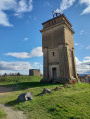
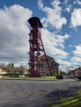
Access: from Brassac-les-Mines, head towards Charbonnier-les-Mines and, on leaving the town, turn right onto the D710 towards La Combelle. Park in the Puits Bayard car park near the headframe.
Yellow signposting (for the most part)
(S/E): From the car park, cross the road and walk round the inter-municipal council building (the former ‘sala des pendus’). Go under the archway, cross the Route de la Combelle and take the Avenue de Solignat opposite until you reach the Avenue des Gueules-Noires.
(1) Leave the road and take a track; after about 100 m, turn right to rejoin Avenue des Gueules-Noires. Follow this until you reach the first track on the left.
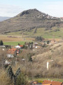
(2) Turn onto this track, which climbs up onto the plateau. You’ll then have a panoramic view of the region: the peaks of Usson, Nonette, Montcelet and Puy de Dôme, the Sancy massif, Villeneuve Castle, etc. Continue until you reach a crossroads of tracks.
(3) Take the path on the left towards La Combelle. At the first houses, turn right and you’ll arrive at the site of the former Graves mine
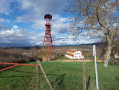
(4) Head down Avenue des Mineurs to the left, then take the first left onto the uphill Avenue du Puy de Dôme La Combelle. Next, turn left onto Avenue d’Usson and, after a few dozen metres, turn right at the end of Avenue du Sancy. You will then see the water tower.
(5) Carry on across the field to the orientation table, cross Avenue du Puy de Dôme La Combelle and continue straight ahead. Take the steps on the right down to Avenue du Cezallier below.
(6) Turn left, pass a flight of steps on the left and take the hairpin bend into Rue Pelle Fesse, which leads downhill. Take the first left to join Avenue Laurent Delhaye. Follow it to the right until you arrive opposite the Chapelle des Mineurs.
::7 Turn left into the passageway leading to Avenue de la Poste, which you should follow to the right. Continue along Rue du Petit Puits and turn right until you reach Avenue de Tansac. Walk left for about thirty metres, then turn right onto Rue des Grises and continue until you reach Descente des Grises.
(8) Turn left. At the junction with Avenue de Transac, turn right and take the first path on the left (Chemin du Bac). You will then arrive beneath the railway bridge.
(9) Go under the bridge, turn left onto Rue de la Batellerie and follow the River Allier to the end of the cul-de-sac.
(10) Take the path on the left which winds its way up to the houses above; continue along Rue de la Roche until you reach the school.
::11 Turn left to go round the buildings, continue along Rue des Écoles and turn right onto Rue Germinal until you reach the next Y-junction. Turn left onto Rue d’Orléans and carry on until you reach a wooden staircase on the right.
(12) Take these steps down to Route de Basse Combelle. Turn left, then take the first street on the left (Rue Marcel Renesio) and continue to the sports ground on the banks of the Alagnon.
(13) Turn left to walk alongside the river; ignore the footbridge on the right and follow the small path on the left that runs alongside the river. Shortly afterwards, leave the river and turn left onto the path that runs past the entrance to the motocross track; join a road and continue to the right until you reach the first path on the left.
(14) Turn onto this track, then after 10 metres, turn right onto Rue des Chambettes. Continue straight ahead along Avenue d’Armois and turn right onto Rue des Moulins. Take the second street on the left (Rue de la Combelle), then pass under the archway at the entrance to the mine shaft and return to the car park (S/E).

 Visorando Member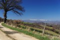
 Average