Lorlanges, paths and castles

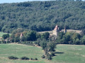
A lovely walk along good paths, offering a close-up view of the castles of Védrines and Vernassal, and a distant view of Léotoing Castle.
This is a variation on the “castles walk” (Respirando No. 497 and Visorando No. 1363868), which takes you closer to Védrines Castle and offers an extended view of Léotoing Castle at the start of the route.

Details

45950884
Creation:
Last update:
Last review:
  • Walking
    Activity: Walking
  • ↔
    Distance: 6.20 mi
  • ◔
    Average duration: 3h 20 
  • ▲
    Difficulty: Easy

  • ⚐
    Back to start: Yes
  • ↗
    Ascent: + 545 ft
  • ↘
    Descent: - 571 ft

  • ▲
    Highest point: 2,067 ft
  • ▼
    Lowest point: 1,683 ft

Description of the walk

Car park in front of the school, on the main road (if needed, there is a second car park about thirty metres further down).

(S/E) Walk up the main street then turn right in front of the war memorial. From the memorial, follow the Respirando signposting for “La randonnée des châteaux” (PR® 497), turning right onto Rue du Clos, then right again onto Rue du Bourguet. Continue straight on along the same street at the various junctions until you reach the sewage treatment works.

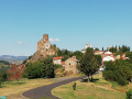
(1) Stop following the Respirando signposts and turn right. The path offers lovely views of Védrines Castle (on the left) and Léotoing Castle (in the distance, on the right). Carry on to the end of the street.

(2) Turn left towards Angelane. Walk through the hamlet and, once you’ve left it behind, head straight on along the track until you reach a spot offering a view.

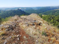
(3) Turn round for a moment to enjoy the lovely view of the countryside, Védrines Castle and Lorlanges. Carry on to the crossroads.

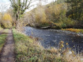
(4) Carry on straight ahead, following the Respirando signposts once more until you reach the finish (the signposted route joins from the path on the left). At the next fork in the road, turn right, then go straight on twice along a track that veers to the left. Continue straight ahead, then turn right along the stream. When you reach the road, follow it to the left to cross through Vernassal. At the crossroads in the centre, continue straight on to the château.

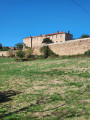
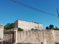
(5) Take in the view of Vernassal Castle before reaching the castle itself, as the high surrounding walls will then partially obscure the building. At the crossroads, turn right, cross the Ruisseau de Vernassa, then turn left. Ignore the track that starts opposite and continue along the road. Climb up to a Fork in the road.

(6) Turn right onto a track, then left. Continue downhill until you reach the road. Then carry on straight ahead to return to the starting point. (S/E)

Waypoints

  1. S/E : mi 0 - alt. 1,873 ft - School
  2. 1 : mi 0.31 - alt. 1,755 ft - Wastewater treatment plant
  3. 2 : mi 1.16 - alt. 1,768 ft - Turn left and head back to Angelane
  4. 3 : mi 1.72 - alt. 1,913 ft - Viewpoint
  5. 4 : mi 2.07 - alt. 2,005 ft - Crossroads, ‘Respirando’ signposting
  6. 5 : mi 4.36 - alt. 1,762 ft - Beautiful view of Vernassal Castle - Vernassa (ruisseau) - Affluent du Saduit
  7. 6 : mi 5.15 - alt. 1,854 ft - Fork
  8. S/E : mi 6.2 - alt. 1,873 ft - School

Notes

-(2): Possible detour (800 m return): instead of turning left, head straight on to the Château de Védrines, but the château does not feature any features that require a close-up view.

Worth a visit

-Védrines Castle (towards (2) and Vernassal)5::

Always be cautious and plan ahead when you're outdoors. Visorando and the author of this route cannot be held responsible for any accidents occurring on this route.

The GR® and PR® markings are the intellectual property of the Fédération Française de Randonnée Pédestre.

Reviews and comments

4.6 / 5
Based on 3 reviews

Reliability of the description
4.7 / 5
Ease of following the route
5 / 5
Route interest
4 / 5
Felix43BVK
Felix43BVK

Overall rating : 4.3 / 5

Date of your route : Nov 09, 2025
Reliability of the description : ★★★★★ Very good
Ease of following the route : ★★★★★ Very good
Route interest : ★★★☆☆ Average
Very busy route : No

A very "smooth" ride with beautiful views: castles, the Forez mountains.

Machine-translated

User 5804250

Overall rating : 4.7 / 5

Date of your route : Aug 15, 2025
Reliability of the description : ★★★★☆ Good
Ease of following the route : ★★★★★ Very good
Route interest : ★★★★★ Very good
Very busy route : No

Nice hike. We did it in the morning because it was a heatwave. Very nice hike with some sections through the woods, which were welcome in the heat. Much of it is out in the open, but normally that's not a problem. The castles are very pretty but can only be seen from a distance. No particular difficulty, just a bit of a climb. We did it in 2½ hours instead of 3¼ hours, for reference, and we are regular hikers.

Machine-translated

Christine43*
Christine43*

Overall rating : 4.7 / 5

Date of your route : Mar 07, 2024
Reliability of the description : ★★★★★ Very good
Ease of following the route : ★★★★★ Very good
Route interest : ★★★★☆ Good
Very busy route : No

A lovely walk near my home. Well signposted. Clear instructions. An easy route; I didn’t come across a single person the whole way. The estimated time given was a bit on the long side, but not everyone walks at the same pace.

Machine-translated

Other walks in the area

For more walks, use our search engine .

The GPS track and description are the property of this route's author. Please do not copy them without permission.