Country:

 City:
City:



Start at the car park near the church in Nonette.
Markings: White-Red forthe GR®® 300 and Yellow-Red for theGRP®® Around Issoire
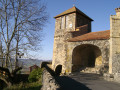
(S/E) With your back to the western gate of the church, head south along the scenic path that runs alongside the castle.
Signposted “La Butte”
(1) Leave Rue du Bourguet on your right and take the next street, Rue Jean de France. The tarmac quickly gives way to a steep path that turns left via a flight of steps, then bends twice to the right to climb up to the cross, again using steps.
(2) At the cross, you’ll be treated to a 360° view of both the Lembron to the east and the Val d’Allier to the west. Turn back, taking either of the two staircases, then follow the path you took on the way up, followed by Rue Jean de France. Take the side street on the left.
White-red or yellow-red markings
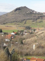
(1) Turn left immediately onto Rue du Bourguet. The panoramic path circles the ancient volcano, offering fine views of the volcanic formations and the Allier river below.
(3) Shortly after a cross, theGRP®® leaves the panoramic path to join the D722, which you will follow for 150 m. Leave the tarmac when the D722 takes a very sharp bend to the right and take the path that runs alongside the town hall. Ignore the turn-off to the right, cross the D123 and follow the small road opposite.
(4) Keep left at the crossroads to head towards Orsonnette and its 12th-century church, located about 50 metres to the right.
(5) Retrace your steps and cross the village.
(6) On leaving the village, leave the main street by turning left onto a small uphill street which leads to a cross-country path; take this path to the right, where it curves sharply. Keep left just before the orientation table. Take the first path on the left, then turn right towards Mailhat.
(7) Keep right at the junction to enter the village, which, with its Romanesque church and castle, is well worth a visit (approx. 200 m).
(8) Turn back to the junction you have just passed.
No signposting
(7) Continue straight on towards the cemetery. Stay on the path, ignoring the various turn-offs, until it becomes tarmac.
(9) Keep left at the junction, cross the D34, then keep right at the Fork in the road. Cross the D722 and continue towards Entraigue. Stay on the small road until you reach theGRP®® Autour d’Issoire, a cross-country route.
White-red or yellow-red markings
(10) Head left towards Nonette, continuing southwards. You will soon reach the village church on the uphill stretch, the starting point of the walk (S/E).



 Visorando Member