Circular walk starting from Chambezon

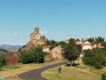
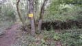
A very lovely circular walk with superb views and Léotoing Castle in view for the first half of the circular walk.

Details

n°47937256
Creation:
Last update:
Last review:
  • Walking
    Activity: Walking
  • ↔
    Distance: 5.27 mi
  • ◔
    Average duration: 3h 15 
  • ▲
    Difficulty: Moderate

  • ⚐
    Back to start: Yes
  • ↗
    Ascent: + 942 ft
  • ↘
    Descent: - 948 ft

  • ▲
    Highest point: 2,359 ft
  • ▼
    Lowest point: 1,499 ft

Description of the walk

Park in the large car park on the left at the entrance to Chambezon.

(S/E) Take the small road, Rue des Acacias, opposite the car park. At the bend, keep left on the road and continue until you reach a T-junction. Turn right onto Rue du Ruisseau to reach a crossroads.

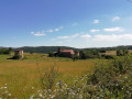
(1) Leave the road and turn right onto this track. Head uphill until you reach the edge of the woodland, turn right at the Y-junction and continue the steady climb until you reach the Caure plateau.

(2) Turn left onto the straight forest track. Note: after heavy rain, you may need to take the meadow to the right of the flooded track. Carry on until you reach the end of this plateau.

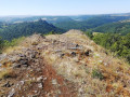
(3) Here, begin a fairly technical descent amongst the sharp rocks of the basalt flow. This descent is not slippery in dry weather but requires great caution in wet conditions. Then cross the Ruisseau de la Roche via a few planks. Join theGRP® Aux Marches du Cézallier, marked in yellow and red.

(4) Follow it to the left for just over a hundred metres, then leave it on the left to join the path running parallel to the railway line. Continue along this path until, much further on, you reach the edge of the forest.

(5) Carry on straight ahead until you reach the junction by a small cemetery.

(6) Turn right to go and see the rock shown in the photo; for details, see the explanation in the ‘Whilst…’ section.

(7) Return to the previous crossroads.

(6) Carry on to the right, entering Chambezon via Rue de l’Allagnon.

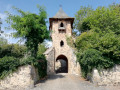
(8) Turn left to cross the Bourg neighbourhood and then return to the car park (S/E).

Waypoints

  1. S/E : mi 0 - alt. 1,765 ft - Car park at the village entrance
  2. 1 : mi 0.46 - alt. 1,896 ft - Path on the right
  3. 2 : mi 1.08 - alt. 2,320 ft - Arrival at the plateau, turn left
  4. 3 : mi 1.68 - alt. 2,329 ft - End of the plateau, start of the descent
  5. 4 : mi 2.5 - alt. 1,519 ft - GRP°°®°° junction
  6. 5 : mi 4.08 - alt. 1,745 ft - Exit the forest, go straight on
  7. 6 : mi 4.34 - alt. 1,818 ft - Crossroads by the cemetery, turn right
  8. 7 : mi 4.62 - alt. 1,854 ft - Rock
  9. 8 : mi 5.11 - alt. 1,759 ft - Chambezon, on the left
  10. S/E : mi 5.27 - alt. 1,765 ft - Car park at the village entrance

Notes

The walk took just over 3 hours, but included a long break at (3) to enjoy the scenery. That makes for 2½ hours’ walking (excluding the route) in a group and in fine weather.

Worth a visit

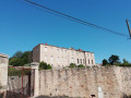
Between (2) and (3) Take in the magnificent views to the left and right. We are higher up than Léotoing Castle, which we can see opposite and which we’ll keep in sight until we reach the Alagnon, where the castle will tower above us in all its grandeur.

(6) We took a detour off the route as we were hoping to see the ‘Rocher de la Photo’ marked on the map, on the other side of the Alagnon. In fact, all we can see is the river’s meander. If you spot a rock with a shape distinctive enough to warrant a mention on a map, please let us know in the comments.

Léotoing Castle

Reviews and comments

5 / 5
Based on 1 review

Reliability of the description
5 / 5
Ease of following the route
5 / 5
Route interest
5 / 5
hellas
hellas
• Edited:

Overall rating : 5 / 5

Date of your route : Apr 26, 2025
Reliability of the description : ★★★★★ Very good
Ease of following the route : ★★★★★ Very good
Route interest : ★★★★★ Very good
Very busy route : No

Stunning views of Léotoing Castle and the Alagnon Valley, fragrant flowering broom and orchids.
The descent from the plateau into the steep valley is manageable if you take your time (despite our age). Best avoided in wet weather due to the risk of slipping.

Machine-translated

Other walks in the area

For more walks, use our search engine .

The GPS track and description are the property of this route's author. Please do not copy them without permission.