The Val d’Allier in Auzon

A walk to discover Auzon’s industrial past and its present-day agricultural and forestry resources.

Details

1379933
Creation:
Last update:
Last review:
  • Walking
    Activity: Walking
  • ↔
    Distance: 4.77 mi
  • ◔
    Average duration: 2h 40 
  • ▲
    Difficulty: Easy

  • ⚐
    Back to start: Yes
  • ↗
    Ascent: + 591 ft
  • ↘
    Descent: - 571 ft

  • ▲
    Highest point: 1,818 ft
  • ▼
    Lowest point: 1,325 ft

Photos

Description of the walk

Starting point: Auzon Tourist Office car park
Markings: Yellow

(S/E) From the car park at the Tourist Office square, cross Rue des Faubourgs and climb the steps between the houses, then continue along the grassy path.
At the junction with Rue des Chauds Basses, carry on straight ahead along Rue des Quatre Cloches, then continue along Rue des Giraudes.

(1) At Rue des Écoles, turn left onto Chemin des Giraudes. At the junction with a path running perpendicular to it, turn right onto this path for 50 metres, then turn left past some agricultural sheds and join the road.

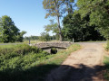
(2) Turn left, cross the bridge and, after 60 metres, take the path branching off to the right. Near the stadium, follow the path on the left, skirting the ponds, and join the D16 road.

(3) Turn right for 100 metres, then turn left onto the road leading up towards the hamlet of Les Granges.
At the entrance to the hamlet, turn right and join a track.

(4) At the first fork in the road after the farm, take the path on the right. At the next fork in the road, take the path on the left and continue through the forest, ignoring the paths coming from the left and right.

(5) At the entrance to Rizolles Haut, take the street that goes round the hamlet on the left, and continue on to Rizolles Bas. At the entrance to Rizolles Bas, carry on straight ahead along the road, ignore the path coming from the left and take the first path on the right until you reach the road.

(6) At the road, first turn left then right, and after 60 metres, take the path on the right which leads down towards Auzon.

(7) In Auzon, turn left onto Rue des Anciens Francs and, after 600 metres, turn left onto Rue des Faubourgs; carry on until you reach the Tourist Office car park (S/E).

Waypoints

  1. S/E : mi 0 - alt. 1,375 ft - Tourist Office car park
  2. 1 : mi 0.76 - alt. 1,381 ft - Rue des Écoles
  3. 2 : mi 1.12 - alt. 1,342 ft - D16 road
  4. 3 : mi 1.9 - alt. 1,355 ft - D16 road
  5. 4 : mi 2.43 - alt. 1,476 ft - Fork in the road after the farm
  6. 5 : mi 3.55 - alt. 1,818 ft - Rizolles Haut
  7. 6 : mi 4.14 - alt. 1,617 ft - Road (left/right)
  8. 7 : mi 4.41 - alt. 1,463 ft - Auzon
  9. S/E : mi 4.77 - alt. 1,375 ft - Tourist Office car park

Reviews and comments

4.3 / 5
Based on 3 reviews

Reliability of the description
4.7 / 5
Ease of following the route
4 / 5
Route interest
4.3 / 5
User 14477511

Overall rating : 3.7 / 5

Date of your route : Oct 30, 2025
Reliability of the description : ★★★★★ Very good
Ease of following the route : ★★★☆☆ Average
Route interest : ★★★☆☆ Average
Very busy route : Yes

Beautiful panorama.
Suitable hiking trail.

Machine-translated

pitoche63
pitoche63

Overall rating : 4.3 / 5

Date of your route : Aug 06, 2025
Reliability of the description : ★★★★☆ Good
Ease of following the route : ★★★★☆ Good
Route interest : ★★★★★ Very good
Very busy route : No

a lovely short hike with beautiful views

Machine-translated

bcg243
bcg243

Overall rating : 5 / 5

Date of your route : Jan 26, 2019
Reliability of the description : ★★★★★ Very good
Ease of following the route : ★★★★★ Very good
Route interest : ★★★★★ Very good

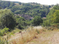
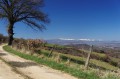
A pleasant and fairly easy walk, taking in the banks of the Allier and offering beautiful views of the Cézalier, the countryside and the forest, with the chance to spot roe deer in the wooded areas.

Machine-translated

Other walks in the area

For more walks, use our search engine .

The GPS track and description are the property of this route's author. Please do not copy them without permission.