Country:

 City:



Starting point: A75, junction 17, towards Ardes-sur-Couze. On the D214, after 6.5 km, turn left onto the D35 towards Augnat.
Car park: Place de la Mairie.
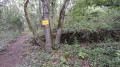
Signposting: Yellow ‘La Chaux de Caure’.
(S/E) Head down towards the town hall, turn left onto Rue des Bergers and, at the fork, turn left onto Chemin de Poudain. Pass under the power line and follow the path straight ahead until you reach the road.
(1) Turn left and, in the hamlet of Poudain, turn right three times, then turn left heading west.
(2) At the next junction, turn left (shared route with anotherPR® – the Apchat route).
Head up towards the plateau and, at the three-way junction (marked by a cross), take the left-hand path to Apchat.
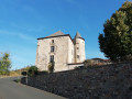
(3) On entering Apchat, continue along the road opposite towards the church. Go round it on the left and return to the main road (16th-century fortified house). Then head towards Perpezat, to the north-east.
(4) Walk through the hamlet, past the wash houses and under the stone arch.
On leaving Perpezat, at the three-way junction, head up to the left until you reach the crossroads on the plateau.
(5) Turn right (signposted for Le Luguet and Le Cézalier). Ignore two paths on the right.
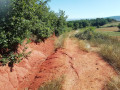
(6) At the T-junction, turn left onto the stony path, pass under the power line and continue straight on towards Augnat.
(7) At the entrance to the village (cross), turn right onto Rue de l’Ancienne Forge until you reach Place de l’Église; walk past the church and go round it on the left, following Rue Sainte Marthe. Then turn left to reach Place du Cézalier.
Head towards the main road, the town hall and the car park (S/E).

 Visorando Member
 Moderate