


Refine your search for walks in Chalampé
Chalampé walks


 Route franco-allemande: Neuenburg-am-Rhein via la Rhine Island de Chalampé
 Visorando Member
 5.01 mi
 +131 ft
 -131 ft
 2h 25
2h 25
 Easy
Easy
 Departure from Chalampé (Haut-Rhin)
The Rhine takes centre stage! On this walk, explore the Rhine Island via the short Pic Vert trail and the village of Neuenburg-am-Rhein with its lovely central square featuring ice cream parlours.
On the slopes of Mauchen
 6.07 mi
+906 ft
-902 ft
3h 35
6.07 mi
+906 ft
-902 ft
3h 35
 Moderate
Departure from Auggen (Regierungsbezirk Freiburg)
Moderate
Departure from Auggen (Regierungsbezirk Freiburg)
A lovely, easy walk along the hillsides overlooking the village of Mauchen, passing through vineyards and orchards full of cherry trees.
Hombourg Castles: the real one, the fake one and the ruin
 5.24 mi
+23 ft
-23 ft
2h 25
Easy
Departure from Hombourg (Haut-Rhin)
5.24 mi
+23 ft
-23 ft
2h 25
Easy
Departure from Hombourg (Haut-Rhin)
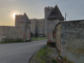
Set off to discover three castles on this walk around the village of Hombourg. One of them is now in ruins; you’ll have no trouble recognising it, of course. But of the two that are still standing, one is an impostor – can you spot the fake?
Between Mullheim and Lipburg
 8.62 mi
+1,253 ft
-1,263 ft
5h 05
Moderate
Departure from Müllheim im Markgräflerland (Regierungsbezirk Freiburg)
8.62 mi
+1,253 ft
-1,263 ft
5h 05
Moderate
Departure from Müllheim im Markgräflerland (Regierungsbezirk Freiburg)
After passing through the superb Eichwald forest near Mullheim, discover the small hamlet of Rheintal, cross through and enjoy the landscapes around Lipburg with beautiful views of the Blauen, then return to Eichwald.
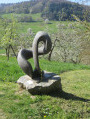
Art in harmony with nature in the Black Forest
 6.73 mi
+915 ft
-909 ft
3h 55
Moderate
Departure from Müllheim im Markgräflerland (Regierungsbezirk Freiburg)
6.73 mi
+915 ft
-909 ft
3h 55
Moderate
Departure from Müllheim im Markgräflerland (Regierungsbezirk Freiburg)
A beautiful hike through a forest of beech and oak trees along the René Schickele-Weg trail to Lipburg, where you will see polished stone sculptures, art and nature in harmony.
Around Obereggenen
 9.19 mi
+1,417 ft
-1,417 ft
5h 30
Moderate
Departure from Schliengen (Regierungsbezirk Freiburg)
9.19 mi
+1,417 ft
-1,417 ft
5h 30
Moderate
Departure from Schliengen (Regierungsbezirk Freiburg)
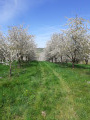
A wide circular route with varied landscapes around the village of Obereggenen along paths lined with cherry trees and vineyards, with a section through the forest to approach Schloss Bürgeln. Superb in spring when the cherry trees are in bloom.
Historical sites and vineyard around Badenweiler
 Association / Club / Walk leader
 4.83 mi
+732 ft
-722 ft
2h 50
Moderate
Departure from Badenweiler (Regierungsbezirk Freiburg)
4.83 mi
+732 ft
-722 ft
2h 50
Moderate
Departure from Badenweiler (Regierungsbezirk Freiburg)
On this walk, you will discover historic sites around Badenweiler while enjoying breathtaking views over the vineyards and toward France. On the return journey, you will engage your senses and experience the landscape in a more playful way. The route leads you through woodlands, farmland, and vineyards, offering stunning scenery throughout.
Round trip from Britzingen to the Neuenfels ruins
 6.80 mi
+1,142 ft
-1,112 ft
4h 05
Moderate
Departure from Müllheim im Markgräflerland (Regierungsbezirk Freiburg)
6.80 mi
+1,142 ft
-1,112 ft
4h 05
Moderate
Departure from Müllheim im Markgräflerland (Regierungsbezirk Freiburg)
A panoramic tour in the Markgräflerland region from Britzingen to the Neuenfels ruins. Along the way, we enjoy great views of the Black Forest and as far as the Vosges mountains.
Discovering Badenweiler
 3.11 mi
+335 ft
-341 ft
1h 45
Easy
Departure from Badenweiler (Regierungsbezirk Freiburg)
3.11 mi
+335 ft
-341 ft
1h 45
Easy
Departure from Badenweiler (Regierungsbezirk Freiburg)
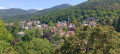
Visit the Sensory Park and the centre of Badenweiler, featuring the Swan Lake, the ruins of the Roman baths, the Kurhaus, the ruins of Baden Castle, the view of the Vosges, the castle grounds and the town centre with its shops. The walk is short, allowing you to try out the facilities in the Park of the Senses, discover the remarkable trees and gardens, statues, pavilions and viewpoints in the Spa Park, stroll through the town’s streets, take a ‘coffee and cake’ break at one of the many cafés and terraces, sit for a moment at the Vogesenblick and simply take in the view.
From the banks of the Quatelbach to the Rhône-Rhine Canal
5.83 mi
+20 ft
-20 ft
2h 40
Easy
Departure from Baldersheim (Haut-Rhin)
A route north-east of Mulhouse, along the Quatelbach, then towards the Hardt, passing by the canal and the gravel pits. Classic lowland landscapes with lovely views of the Vosges and the Black Forest. Much of the route follows tarmac cycle paths and routes.
Sausheim, a spa town
5.82 mi
+16 ft
-16 ft
2h 40
Easy
Departure from Baldersheim (Haut-Rhin)
Starting from Baldersheim, this walk takes us on a tour of Sausheim, showcasing its streams and lakes.
Circular route between Balgau and Nambsheim
 3.77 mi
+10 ft
-10 ft
1h 45
Easy
Departure from Balgau (Haut-Rhin)
3.77 mi
+10 ft
-10 ft
1h 45
Easy
Departure from Balgau (Haut-Rhin)
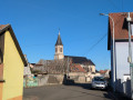
Although located along the Rhine and close to Fessenheim, the villages of Balgau and Nambsheim are anything but industrial. Between farms and housing estates with their carefully tended gardens, you can sense a little bit of Sundgau, nestled between the Vosges and the Black Forest.
Between Niffer and Petit Landau, towards the Grand Canal d’Alsace
 6.50 mi
+33 ft
-33 ft
3h 00
Easy
Departure from Niffer (Haut-Rhin)
6.50 mi
+33 ft
-33 ft
3h 00
Easy
Departure from Niffer (Haut-Rhin)
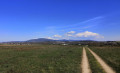
A walk in the Haut-Rhin starting from Niffer and its lock. Along the Rhône-Rhine Canal, then across the plain facing the Black Forest, and back via the Grand Canal d’Alsace (the canalised Rhine).
Autour de Sitzenkirch par la ruine Sausenburg et le Schloss Bürgeln
 8.11 mi
+1,814 ft
-1,814 ft
5h 20
Moderate
Departure from Schliengen (Regierungsbezirk Freiburg)
8.11 mi
+1,814 ft
-1,814 ft
5h 20
Moderate
Departure from Schliengen (Regierungsbezirk Freiburg)
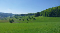
Belle randonnée autour du village de Sitzenkirch entre forêts et prairies. Un itinèraire qui permet de profiter des superbes panoramas depuis le sommet de la tour de la ruine de Sausenburg et de la terrasse du Schloss Bürgeln.
The heights of Habsheim via Zimmersheim and Eschentzwiller
 6.63 mi
+525 ft
-512 ft
3h 30
Moderate
Departure from Habsheim (Haut-Rhin)
6.63 mi
+525 ft
-512 ft
3h 30
Moderate
Departure from Habsheim (Haut-Rhin)
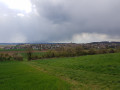
This hike takes you up to the heights between the villages of Habsheim, Zimmersheim and Eschentzwiller to enjoy beautiful views, with short passages through the charming residential areas of these three villages.
On the heights of Rheinweiler, Maria Hügel and Bamlach
 4.07 mi
+341 ft
-367 ft
2h 10
Easy
Departure from Bad Bellingen (Regierungsbezirk Freiburg)
4.07 mi
+341 ft
-367 ft
2h 10
Easy
Departure from Bad Bellingen (Regierungsbezirk Freiburg)
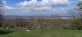
A Way of the Cross, a golf course, a chapel, viewpoints, vineyards, a village, a campsite – this is what this trail, which is signposted all the way, has to offer. We will walk along the Wiiwegli (Red Diamond with a yellow bunch of grapes) and the Way of St James (yellow shell on a blue background), following a Way of the Cross (Stationenweg) on the way there. At the Maria Hügel pilgrimage chapel, we will stop to admire the view over the Rhine plain and the Vosges. There are plenty of benches, and a flight of steps leads to a shelter and picnic tables. The return journey will follow a marked local path. The walk passes through the charming village of Bamlach and its campsite.
Rixheim Hills Route
 5.74 mi
+463 ft
-436 ft
3h 00
Moderate
Departure from Rixheim (Haut-Rhin)
5.74 mi
+463 ft
-436 ft
3h 00
Moderate
Departure from Rixheim (Haut-Rhin)
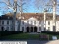
The Rixheim Hills Route crosses the southern part of the town, passing through an urban area, then winds through the countryside and orchards on the heights overlooking the Alsace plain, offering beautiful views of the Hardt Forest, the Black Forest, the Jura, the Vosges, and, on a clear day, the peaks of the Swiss Alps.
The entire route is marked with the Red Ring by the Club-Vosgien.
The beautiful view of Habsheim
 3.70 mi
+253 ft
-253 ft
1h 55
Easy
Departure from Habsheim (Haut-Rhin)
3.70 mi
+253 ft
-253 ft
1h 55
Easy
Departure from Habsheim (Haut-Rhin)
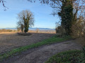
Leaving Habsheim, discover a panoramic view of the surrounding towns and villages as you climb higher! Finish with a short tour of the centre of Habsheim, then through charming residential areas.
On the heights of Habsheim and Rixheim
 2.87 mi
+259 ft
-246 ft
1h 35
Easy
Departure from Habsheim (Haut-Rhin)
2.87 mi
+259 ft
-246 ft
1h 35
Easy
Departure from Habsheim (Haut-Rhin)
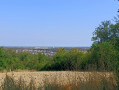
La Bellevue de Habsheim, an apiary, donkeys, sheep, goats and cows, a remarkable garden, calvaries, a shelter, the Rixheim school orchard, the reservoirs and relay antenna in Habsheim, numerous viewpoints over the Rhine plain, the Black Forest, the Vosges, the Tour de l'Europe, Habsheim, Rixheim, the Stellantis site, Entremont Park... so much to see on such a short route!
From Kandern to Lörrach-Haagen
 9.36 mi
+1,243 ft
-1,362 ft
5h 25
Moderate
Departure from Kandern (Regierungsbezirk Freiburg)
9.36 mi
+1,243 ft
-1,362 ft
5h 25
Moderate
Departure from Kandern (Regierungsbezirk Freiburg)
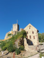
A walk along the Westweg through the Wolfschlucht gorge via Hammerstein and Wollbach to Rötteln Castle and the Schloßberghalle in Lörrach-Haagen. Along the way, the Baselblickhütte is a good place to take a break.
Kandern - Haldenhof
 12.57 mi
+3,346 ft
-1,430 ft
8h 40
12.57 mi
+3,346 ft
-1,430 ft
8h 40
 Very difficult
Departure from Kandern (Regierungsbezirk Freiburg)
Very difficult
Departure from Kandern (Regierungsbezirk Freiburg)
This second stage will take you from Kandern to the Haldenhof Inn. The route follows the Westweg Schwartzwald. Along the way, you will discover Sausenburg Castle. The highest point of the day is at Blauen, which offers a panoramic view of the Black Forest.
Kandern Wolfsschlucht Eitentalweg
 3.66 mi
+410 ft
-417 ft
2h 00
Moderate
Departure from Kandern (Regierungsbezirk Freiburg)
3.66 mi
+410 ft
-417 ft
2h 00
Moderate
Departure from Kandern (Regierungsbezirk Freiburg)
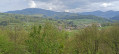
A visit to the Wolfsschlucht is the main attraction of this route, which runs largely through woodland. There is a picnic and barbecue area in the middle of the gorge. Several other spots ideal for a break are located along the route, starting with the car park at the start. In the gorges, with their astonishing rock formations, you are transported to another world. Well worth a visit.
Along the former bed of the Rhine: from the drawbridge to the Ecluse
 4.18 mi
+36 ft
-36 ft
1h 55
Easy
Departure from Kembs (Haut-Rhin)
4.18 mi
+36 ft
-36 ft
1h 55
Easy
Departure from Kembs (Haut-Rhin)
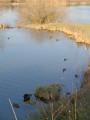
Before the construction of the Canal of Alsace (1928), the Rhine extended its arms east of the Huningue Canal (1806) over a wide area of 1km to 2km. From the Rhone Canal on the North Rhine to the Barre d'Istein on the Old Rhine, along paths and trails often in the protected areas of the "Little Alsatian Camargue.", you'll discover numerous natural and industrial sites related to the history of the Rhine.
Begin with a stroll between the drawbridge of Kembs (1831) and l'Ecluse Le Corbusier (1961).
Walk along the old bed of the Rhine: from Pont-levis to Ferme du Moulin
 2.77 mi
+16 ft
-16 ft
1h 15
Easy
Departure from Kembs (Haut-Rhin)
2.77 mi
+16 ft
-16 ft
1h 15
Easy
Departure from Kembs (Haut-Rhin)
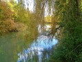
Between the marina and the Ferme du Moulin, this unpretentious little walk allows you to enjoy the tranquillity of the banks of the Canal de Huningue, the Grand Canal d'Alsace and the Augraben, which still feature a few oxbow lakes and ponds, natural remnants of the old bed of the Rhine.
From Riedisheim to Rixheim via the vanished village of Leibersheim
 5.88 mi
+417 ft
-417 ft
3h 05
Easy
Departure from Riedisheim (Haut-Rhin)
5.88 mi
+417 ft
-417 ft
3h 05
Easy
Departure from Riedisheim (Haut-Rhin)
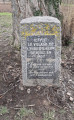
Between the two villages of Riedisheim and Rixheim lies a third, Leibersheim, which ceased to exist five centuries ago. You will also pass by the cemeteries of these two villages, one of which dates back more than two centuries. Finish by climbing the Fuchsberg hill to enjoy the beautiful scenery.
 North-East Mulhouse
 17.35 mi
+72 ft
-69 ft
2.5 hrs
Moderate
Departure from Riedisheim (Haut-Rhin)
17.35 mi
+72 ft
-69 ft
2.5 hrs
Moderate
Departure from Riedisheim (Haut-Rhin)
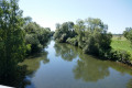
Starting from Riedisheim, the route follows the canal, then through the Hardt State Forest, and finally through the villages of Battenheim, Baldersheim, Sausheim, Illzach and Modenheim.
Reservoir and view of the Alps from Zimmersheim
4.20 mi
+377 ft
-354 ft
2h 15
Easy
Departure from Zimmersheim (Haut-Rhin)
Walk from the centre of Zimmersheim up a steep climb towards the Schoofberg, where the reservoir is located. Pass through the Buchwald and Zuhrenberg woods to enjoy views of the Alps in good weather and a bit of cool air. Return via the south of Zimmersheim, across open terrain.
Between the vineyards and orchards of Huttingen and Blansingen
3.70 mi
+233 ft
-220 ft
1h 55
Easy
Departure from Efringen-Kirchen (Regierungsbezirk Freiburg)
A very beautiful short hike through vineyards and orchards with breathtaking views of the Alps, the Jura, the city of Basel, the Alsatian villages of Sundgau, the Rhine Valley and Kembs just opposite on the way there, and the Black Forest and Blauen on the way back. In the first half of the route, follow the Wiiwegli (wine trail) markings, red diamond with a yellow bunch of grapes, towards Blansingen. The markings are present at each fork. However, you will need to be vigilant at the start of the route and look out for the markings so as not to give in to the temptation to continue straight ahead on a more visible path. Our path branches off twice to the right between the orchards and then twice with a left-right turn on grassy paths.
Cambete route
 Tourist office
 5.48 mi
+49 ft
-46 ft
2h 35
Easy
Departure from Kembs (Haut-Rhin)
5.48 mi
+49 ft
-46 ft
2h 35
Easy
Departure from Kembs (Haut-Rhin)
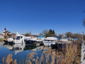
A circular route that mainly follows cycle paths. The route, running alongside the water, allows you to discover the local flora, fauna, history and industry between Kembs-Loechlé and Kembs
The hills of Schlierbach via the Croix and Deux Chênes trails.
 5.60 mi
+289 ft
-305 ft
2h 50
Easy
Departure from Haut-Rhin
5.60 mi
+289 ft
-305 ft
2h 50
Easy
Departure from Haut-Rhin
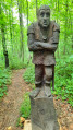
A family hike that follows the Sentier des Croix to the Chapelle des Malgré-nous, then climbs the hills to follow the Sentier des Deux Chênes, decorated with wooden sculptures and dotted with educational panels.
The Way of the Cross on the hillsides of Bruebach
 3.97 mi
+305 ft
-302 ft
2h 05
Easy
Departure from Bruebach (Haut-Rhin)
3.97 mi
+305 ft
-302 ft
2h 05
Easy
Departure from Bruebach (Haut-Rhin)
A peaceful route offering beautiful views of the villages south of Bruebach, with the city of Basel on the horizon and the entire Alpine range as a backdrop. You’ll frequently be able to admire the German-speaking Swiss Alps straight ahead, with the Eiger and the Jungfrau and their magnificent pyramidal peaks, and at the other end, on the right-hand side, when the weather permits, Mont Blanc.