Country:
 City:
City:


Park in the “Waldparkplatz” car park located on the outskirts of the village of Auggen, heading towards Mauchen/Felberg (car park signposted).
(S/E) Turn right (facing the tourist sign at the car park) onto the Manchenerweg path, marked with a Yellow Diamond. Ignore a path branching off to the right at a bench. Leave the Rundweg on your left and the Pfeiffenholzweg on your right, and continue straight ahead (Yellow Diamond). At the top of the small hill, ignore a path on the left
Ignore the path leading down to the right (Rolliweg) and then a path on the left.
(1) At a junction, leave the Mauchenerweg path on your right (towards Mauchen – Mullheim) and continue along the Rundweg (Yellow Triangle). At a bench on your right, turn right onto the path marked with a Yellow Diamond, leaving the Rundweg on your left.
(2) A few metres further on, at a place called Streitecken (416 m), turn sharply right towards Mauchen (3 km). Do not take the path towards Rutte (0.5 km), nor the path marked ‘No horses’.
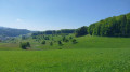
Stay on this wide forest track (Steinackerweg) running along the edge of the woodland, which offers lovely views of the surrounding hillsides. At the start of the vineyard, you’ll reach a tarmac road; turn right onto it.
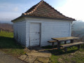
Some 200 m further on, ignore two paths on the right and continue along the tarmac road marked with a Yellow Diamond (on a vine stake on the right). About a hundred metres later, ignore a path coming from the left, then successively ignore a path coming from the left and one from the right. Stay on the ‘ridge’ road until you reach a small white cottage at the junction with a small road coming from the left.
(3) Take this road to the right and continue through the vineyard, ignoring a path on the left and then one on the right. At a hairpin bend, ignore the first two paths coming from the right and take the path on the right as you come out of the bend.
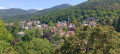
(4) Ignore a path leading down to the left, then another on the right heading into the vineyards, and set off up a “short climb” of about fifty metres to reach a picnic area.
(5) Head back down the “short climb” to the hairpin bend and continue downhill towards the village. Ignore the paths coming from the right and left. Walk past the cemetery and turn sharply left, heading slightly uphill as you skirt the cemetery. At the end of the cemetery, leave the path and turn right, continuing downhill to the entrance of a wine cellar.
At the first house in the village, near a white building, turn right and, a few metres further down, turn left into Ruelle Im Spitzgarten. About a hundred metres further on, leave this lane and turn into Ruelle Am Kirchblick. Continue to the church, then turn left towards the junction with the main road, Mullheimer Strasse.
(6) Cross the main road and take the road signposted ‘Auf des Eck’ (1.2 km), marked by a Yellow Diamond. Stay on this tarmac road, ignoring the paths to the right and left leading to vineyard plots. After a 90° bend, continue uphill for about fifty metres, then turn right, leaving the tarmac road (you’ll see a cross at the edge of this path on the right). Continue uphill. Pass the cross and do not turn right.
(7) About fifty metres past the cross, at a junction, turn left; then, a few dozen metres further on, at a green bench, turn onto the path furthest to the right. Continue uphill, leaving a path on your right that runs under a power line. At the top, enjoy a truly welcome rest on a bench! The path is signposted ‘Helmut Michel Weg’. Carry on for about twenty metres and, at the junction, ignore the path going straight up and continue to the right to reach Auf des Eck, 400 m away.
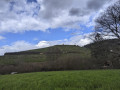
(8) Turn left towards Kaferholz (1 km). Stay on the ridge between the vineyards and the forest, first ignoring a path on the left and then a tarmac road veering off to the right. Follow the ridge (a rather ‘weathered’ wooden sign pointing towards Niedereggenen). When you reach the end of the vineyard, enter the forest and continue straight on (marked by a Yellow Diamond), leaving the path marked by the wooden sign for Niedereggenen on your right. Cross the forest/clearing, ignoring two paths coming from the left, to reach the hamlet of Kaferholz at 372 m.
(9) Ignore the path on the right and the descending track opposite, and turn left towards Lielbuck (0.1 km). At the place known as Lielbuck, leave the path towards Mauchen and turn right onto a descending track towards Langfuhren (0.4 km). At the bottom of this path, at a junction, ignore the path coming in from the right. Continue along Weingartenweg towards Rutte (1.2 km), ignoring the turnings to the left and right, until you reach the road linking Schliengen to Auggen/Feldberg.
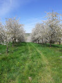
Cross the road and take the path directly opposite, which climbs through orchards to the edge of the forest alongside a young cherry orchard (head for the hunting lookout).
At the edge of the forest, at the foot of the hunting lookout, turn right onto the path marked with a Yellow Diamond. Continue along the edge of the forest until you reach a junction with the Steinackenweg path at a place called Rutte (382 m).
(10) Then turn right towards Feldberg (2.2 km) and ignore the sign for Steinecken (0.3 km). Walk downhill for about a hundred metres and turn left towards Wanderparkplatz (1.2 km), ignoring the sign for Kuhberg opposite. Follow the Saatschulweg path, which runs alongside the road, to the car park (S/E).


 Visorando Member

 Association / Club / Walk leader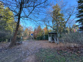
 Easy
Easy