North-East Mulhouse

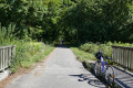
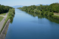
Starting from Riedisheim, the route follows the canal, then through the Hardt State Forest, and finally through the villages of Battenheim, Baldersheim, Sausheim, Illzach and Modenheim.

Details

n°2449583
Creation:
Last update:
Last review:
  • Mountain biking
    Activity: Mountain biking
  • ↔
    Distance: 17.35 mi
  • ◔
    Duration according to the author: 2.5 hrs 
  • ▲
    Difficulty: Moderate

  • ⚐
    Back to start: Yes
  • ↗
    Ascent: + 72 ft
  • ↘
    Descent: - 69 ft

  • ▲
    Highest point: 804 ft
  • ▼
    Lowest point: 732 ft
  • ⚐ Country: France
  • ⚐ City: Riedisheim (68400)
  • ⚑
    Start/End: N 47.753651° / E 7.361953°
  • ❏
    IGN map(s): Ref. 3720ET

  • ◶
    Type of surface:
  •  
     
     
    ■ 33% Road ■ 34% Byway ■ 33% Path
  • ⇧
    Bike carrying: Not specified
  • ▲
    Difficulty: Not specified
  • Hour-by-hour weather

Photos

Description of the route

Start at the entrance to Riedisheim, by the bridge over the canal.

(S/E) Cross the bridge over the canal.

(1) Head uphill along the cycle path on Rue de Bâle.
Note: this section is a bit tricky due to the traffic.

(2) Turn left onto Rue de la Hardt, then carry on almost straight ahead through a very quiet neighbourhood.

(3) When you reach Avenue Bartholdi, turn left and stay on the main road through this part of Rixheim.

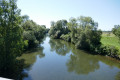
(4) After following Rue du Canal, cross Rue de l’Île Napoléon and take Rue de la Navigation opposite. Then follow the Rhône–Rhine Canal until you reach the Pont du Bouc.

(5) At the cannon, turn right onto the path leading up onto the bridge and cross it.
As you come down from the bridge, turn left straight away, then cross the D55 and turn right onto the cycle path through the forest. Carry on straight ahead and you’ll reach the Salzlecke forest lodge after crossing the railway line.

(6) Take the Battenheim forest track, which is to the left of the Salzlecke forest house.

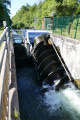
(7) Cross the bridge over the old lock of the former Rhône–Rhine Canal, then, as you come down from the bridge, turn right at the bend onto the “Mulhouse / Baldersheim” cycle path. Continue along this path, passing under the A35 motorway before arriving in Battenheim.

(8) Follow the D201 (Rue Principale) to the left for about a hundred metres, then take the first right. Cross Rue de Baldersheim.

(9) Turn left onto the VV12 cycle path. Head towards Baldersheim, then carry on straight ahead until you reach the roundabout.

(10) Turn right and head towards Illzach/Kingersheim.

(11) After crossing the bridge over the Ill, turn left immediately and continue on the VV12 cycle path towards Kingersheim/Illzach.

(12) When you reach Espace 110, turn right and go up onto the bridge over the banks of the Ill to pass behind the recycling centre. Follow the road which passes through three tunnels

(13) Cross the Quatelbach before emerging into a peaceful neighbourhood of Modenheim. Turn right onto Rue de Rixheim, which runs alongside a beautiful park before reaching Saint-Bernard Church.

(14) Turn right at the traffic lights onto Rue de Sausheim (due to the traffic, this isn’t the most pleasant part of the route...). Pass the Renault and then Fiat garages and continue towards the Nouveau Bassin.

(15) A short tricky stretch: carry on to cross the Nouveau Bassin bridge, then turn left immediately to walk alongside a branch of the canal. Continue until you reach Rue des Bateliers.
At the top of the Rue des Bateliers, you’ll be back at the starting point (S/E).

Waypoints

  1. S/E : mi 0 - alt. 787 ft - Bridge at the junction of Rue de Bâle and Rue des Bateliers
  2. 1 : mi 0.06 - alt. 791 ft - Rue de Bâle
  3. 2 : mi 0.41 - alt. 784 ft - Rue de la Hardt
  4. 3 : mi 1.45 - alt. 768 ft - Avenue Bartholdi
  5. 4 : mi 1.93 - alt. 774 ft - Rue de la Navigation
  6. 5 : mi 4.3 - alt. 778 ft - Pont du Bouc
  7. 6 : mi 7.1 - alt. 751 ft - Salzlecke Forest House
  8. 7 : mi 9.45 - alt. 741 ft - Former lock on the - Canal du Rhône au Rhin
  9. 8 : mi 11.14 - alt. 748 ft - Rue Principale
  10. 9 : mi 11.32 - alt. 745 ft - Battenheim: Rue du Quatelbach
  11. 10 : mi 12.89 - alt. 758 ft - At the roundabout, turn right
  12. 11 : mi 13.48 - alt. 764 ft - Turn left after the bridge
  13. 12 : mi 15.13 - alt. 771 ft - Espace 110 - Ill (rivière)
  14. 13 : mi 15.59 - alt. 768 ft - Quatelbach (rivière)
  15. 14 : mi 15.95 - alt. 771 ft - Illzach-Modenheim: St Bernard’s Church
  16. 15 : mi 16.75 - alt. 778 ft - Mulhouse: Pont du Nouveau Bassin
  17. S/E : mi 17.35 - alt. 787 ft - Bridge at the junction of Rue de Bâle and Rue des Bateliers

Notes

This route mainly follows roads or paths in good condition (often tarmacked).
A hybrid bike is ideal.

Worth a visit

(7) Bridge over the old lock of the former Rhône–Rhine Canal: Stop off to take a look at the small hydroelectric power station.
(9) Enjoy this lovely route along the Quatelbach to Baldersheim.
(15) A lovely stretch, very pleasant as it is well shaded.

Reviews and comments

5 / 5
Based on 1 review

Reliability of the description
5 / 5
Ease of following the route
5 / 5
Route interest
5 / 5
rol6
rol6

Overall rating : 5 / 5

Date of your route : Jul 21, 2020
Reliability of the description : ★★★★★ Very good
Ease of following the route : ★★★★★ Very good
Route interest : ★★★★★ Very good
Very busy route : No

A brilliant route – even towards the end, there was no choice but to go through the town.

Machine-translated

Other walks in the area

For more walks, use our search engine .

The GPS track and description are the property of this route's author. Please do not copy them without permission.