


From Kandern to Lörrach-Haagen


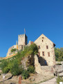
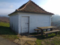
A walk along the Westweg through the Wolfschlucht gorge via Hammerstein and Wollbach to Rötteln Castle and the Schloßberghalle in Lörrach-Haagen. Along the way, the Baselblickhütte is a good place to take a break.
Details
Creation:
Last update:
Last review:
–
–
-
 Activity: Walking
 -
 Distance: 9.36 mi
 -
 Average duration: 5h 25
 -
 Difficulty: Moderate
 -
-
 Back to start: No
 -
 Ascent: + 1,243 ft
 -
 Descent: - 1,362 ft
 -
-
 Highest point: 1,562 ft
 -
 Lowest point: 997 ft
-
 Country:
Germany
Country:
Germany
-
 Area: Forêt Noire
 -
 City:
Kandern
City:
Kandern -
 Start: N 47.713891° / E 7.657208°
 -
 End: N 47.637617° / E 7.673604°
 -


 Hour-by-hour weather


Photos
Waypoints
- S : mi 0 - alt. 1,132 ft - Kandern railway station
- 1 : mi 2.29 - alt. 1,047 ft - Hammerstein
- 2 : mi 3.74 - alt. 1,276 ft - Baselblick
- 3 : mi 7.28 - alt. 1,434 ft - Kleeplatz forest car park
- 4 : mi 8.64 - alt. 1,332 ft - Rötteln Castle - Burgruine Rötteln
- E : mi 9.36 - alt. 1,004 ft - Schloßberghalle in Lörrach-Haagen
Other walks in the area
Kandern Wolfsschlucht Eitentalweg
 Visorando Member
 3.66 mi
+410 ft
-417 ft
2h 00
Moderate
Departure from Kandern (Regierungsbezirk Freiburg)
3.66 mi
+410 ft
-417 ft
2h 00
Moderate
Departure from Kandern (Regierungsbezirk Freiburg)
A visit to the Wolfsschlucht is the main attraction of this route, which runs largely through woodland. There is a picnic and barbecue area in the middle of the gorge. Several other spots ideal for a break are located along the route, starting with the car park at the start. In the gorges, with their astonishing rock formations, you are transported to another world. Well worth a visit.
Kandern - Haldenhof
 12.57 mi
+3,346 ft
-1,430 ft
8h 40
12.57 mi
+3,346 ft
-1,430 ft
8h 40
 Very difficult
Departure from Kandern (Regierungsbezirk Freiburg)
Very difficult
Departure from Kandern (Regierungsbezirk Freiburg)
This second stage will take you from Kandern to the Haldenhof Inn. The route follows the Westweg Schwartzwald. Along the way, you will discover Sausenburg Castle. The highest point of the day is at Blauen, which offers a panoramic view of the Black Forest.
Autour de Sitzenkirch par la ruine Sausenburg et le Schloss Bürgeln
 8.11 mi
+1,814 ft
-1,814 ft
5h 20
Moderate
Departure from Schliengen (Regierungsbezirk Freiburg)
8.11 mi
+1,814 ft
-1,814 ft
5h 20
Moderate
Departure from Schliengen (Regierungsbezirk Freiburg)
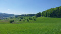
Belle randonnée autour du village de Sitzenkirch entre forêts et prairies. Un itinèraire qui permet de profiter des superbes panoramas depuis le sommet de la tour de la ruine de Sausenburg et de la terrasse du Schloss Bürgeln.
Around Obereggenen
 9.19 mi
+1,417 ft
-1,417 ft
5h 30
Moderate
Departure from Schliengen (Regierungsbezirk Freiburg)
9.19 mi
+1,417 ft
-1,417 ft
5h 30
Moderate
Departure from Schliengen (Regierungsbezirk Freiburg)
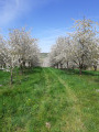
A wide circular route with varied landscapes around the village of Obereggenen along paths lined with cherry trees and vineyards, with a section through the forest to approach Schloss Bürgeln. Superb in spring when the cherry trees are in bloom.
Above Hägelberg: Schöne Aussicht and Saatschulhütte
 2.95 mi
+341 ft
-328 ft
1h 40
2.95 mi
+341 ft
-328 ft
1h 40
 Easy
Departure from Steinen (Regierungsbezirk Freiburg)
Easy
Departure from Steinen (Regierungsbezirk Freiburg)
A walk mainly through woodland on the heights of Hägelberg. As the car park is situated almost at the highest point, the walk initially descends slightly towards the village across open ground, offering stunning views of the Alps in good weather. The paths are wide and signposted, except for the first section.
Hochblauen from Marzell
 5.36 mi
+1,562 ft
-1,558 ft
3h 50
Moderate
Departure from Malsburg-Marzell (Regierungsbezirk Freiburg)
5.36 mi
+1,562 ft
-1,558 ft
3h 50
Moderate
Departure from Malsburg-Marzell (Regierungsbezirk Freiburg)
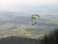
PLEASE NOTE (May 2025): the hotel is currently undergoing renovation and work is not due to be completed any time soon. The upper car park is congested and it is impossible to eat or watch the paragliders; to reach the tower, you must walk around the summit
You will discover the southernmost peak of the Black Forest, which rises to 1,165 m.From up there, you can see the start of the Rhine Plain to the west, the Vosges Mountains to the south and the Jura Mountains to the south. In fine weather, the Swiss Alps and, to the north, the peaks of the Black Forest complete the panorama.
For more walks, use our search engine .
The GPS track and description are the property of this route's author. Please do not copy them without permission.

