Country:
 City:
City:


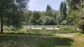
The starting point, where there is a car park, is situated halfway between the two bridges linking the French village of Chalampé and the German village of Neuenburg-am-Rhein.
(S/E) Leave the car park heading towards the Stop sign. On your right, you’ll find an information board about the Pic Vert walk (which we’ll be following). At the Stop sign, head down to the right.
(1) At the Y-junction, leave the Grand Canal d’Alsace on your left and continue diagonally to the right, towards the Pic Vert trail. Walk along the road on the left-hand side. After the road bends to the right, you’ll see a brick building and, just beyond that, an information board. About a hundred metres further on, you can see the Rhine from an information board on the other side of the road (cross carefully if you wish to reach it). When you reach an area with ‘No Fires’ signs and numerous picnic tables, take the dirt track on the left.
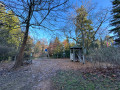
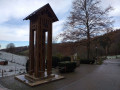
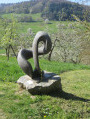
(2) At the wooden kiosk, turn right. After a short flight of steps, you’ll find an information board. Be sure to follow the Pic Vert trail, marked on the directional signs. Along the way, you’ll come across sculptures of small animals. After a few steps, at the T-junction, turn left where you’ll find another information board.
(3) Just before leaving the forest, turn left onto the Pic Vert trail. You’ll pass further information boards, steps and sculpted animals. When you reach a Y-junction, leave the Pic Vert trail and turn diagonally right towards the Grand Canal d’Alsace. When you reach the canal, turn left and walk alongside it.
(4) Before passing under the bridge, at the signs prohibiting swimming, head diagonally left up the tarmac road.
(1) Follow the road back up until you return to your starting point.
(S/E) At the top of this road, just before the Stop sign and the T-junction, turn left onto the path reserved for pedestrians and cyclists. Pass between two picnic tables, then cross the bridge. The border is in the middle of the bridge. Once you have crossed the bridge completely, carry on for another hundred metres or so, still following the road on the left-hand side. Take the first road on the left, following the signs for Rhein-Gärten.
(5) Immediately (just a few metres) after turning, head down to the left along a narrow dirt and stony path through the woods.
(6) At the bottom, at the T-junction, turn left and go under the bridge. Take the first path on the left, marked by a post bearing the number 6. The path runs alongside a fence and a building. When the path becomes tarmac again, carry on straight ahead and go through a tunnel under the motorway. Enter the village’s industrial estate via Fischerstrasse. Ignore Max-Planck-Strasse and then Robert-Bosch-Strasse, and carry on straight ahead. At the large junction, continue straight ahead, crossing the main road with care. Still on Fischerstrasse, ignore Franz-Joseph-Weiss-Strasse, which turns right, and then BaslerKopf, which turns left. Cross a small bridge over the Klemmbach.
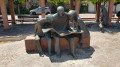
(7) At the T-junction, turn left up Sandroggenstrasse and go under a large railway bridge. At the top of the street, after a right-hand bend near a hotel, at the T-junction, cross the road carefully and take Spiegelstrasse straight ahead. At the end of the street, at the T-junction, turn left into Ölstrasse. After a large fountain, cross Schlüsselstrasse carefully and you’ll reach Rathausplatz, the village’s central square where two ice-cream parlours face each other.
(8) After the square, carry on straight ahead along Salzstrasse. At the end of the street, where you’ll find the church, a fountain and a wayside cross, turn right, following the signs for the Stadtbibliothek. A few metres further on, turn right again, into Dekan-Martin-Strasse. Walk past Konstantin-Schäfer-Platz and then, at the junction, turn left into Rebstrasse. When you reach Marktplatz, turn left and walk under the stone arches where there are several benches. At the end of the square, turn left into Pfarrer-Christen-Strasse. At the end of this street, at the T-junction, cross the road carefully to reach a path that leads straight down. Walk past a Hail Mary statue and, after a bend to the right, you’ll reach the bottom of the dirt track.
(9) At the road junction, go straight on into Jahnstrasse, following the signs for Sportzentrum. Go through a tunnel under a county road. Carry on straight ahead at the next junction, ignoring Ensisheimer-Strasse, following signs for Rhein-Gärten and taking Vogesenstrasse. After ignoring Elsässer Weg, carefully cross the county road at the pedestrian crossing and go through a tunnel under the motorway, following signs for Zum Rhein.
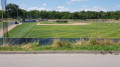
(10) Just past a car park, turn right onto the cycle path, following signs for ‘Sportgelände’ along Rheinwaldstrasse. Ride past numerous sports facilities. After the baseball ground, leave the tarmac path and take the dirt track, continuing straight on. Then take the first path that turns left.
(1) At the end of this path, at the T-junction, turn left. Continue along this path for several hundred metres, passing a horse riding arena, until you reach a wooden kiosk. Just past this kiosk, at the T-junction with a cobbled staircase, head down to the right towards the river.
(12) At the bottom of the path, at the T-junction, turn left. Walk past an open-air amphitheatre, ignore the steps leading up to the left and continue along the path, following the signs for Altrheinhafen. Pass underneath a terrace (Rheinterrasse). Ignore another flight of steps on the left and carry on straight ahead, where you’ll see a sign warning of a risk of flooding. At the end of the path, go up the steps on your left. At the top, on a dirt track, turn right to reach another wooden kiosk. Ignore the paths leading down to the right and turn left to join the tarmac road. Once you’ve joined it, turn right until you reach the junction you passed on the way there.
(5) Then turn right to cross the bridge over the Rhine. Cross the border again and return to your starting point (S/E)

 Visorando Member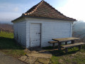
 Moderate
 Association / Club / Walk leader