Country:
 City:


Parking is available at the car park of the Baldersheim community hall, 12 Rue de Lorraine.
(S/E) From the car park, head south (away from the cemetery) along Rue de Lorraine, crossing Rue de Bourgogne, Rue de Provence, Rue de Franche-Comté and Rue du Doubs in turn. The road then bends to the right at the ‘Les Nymphéas’ residential block. Another 5–6 houses on and you’ll reach a roundabout at the junction with Rue de l’Église, where you turn left (towards the village exit).
(1) Cross the D55 (_take care__) at the pedestrian crossing, then follow the lane towards “VV12-Sausheim Nord vélo” to enter Sausheim (towards the houses).
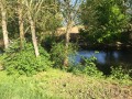
Carry on straight ahead, heading due south, passing along Rue des Merles for about 300 metres. After a few rows of houses, a few metres past the junction with Rue Roger Hoffarth (on your left), the Sausheim green corridor along the Quatelbach (river) stretches out to your right.
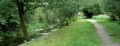
(2) Just before the Quatelbach, turn right onto the path marked with a Red Ring. It leads into the green corridor, where you can enjoy this haven of tranquillity whilst discovering a variety of tree species (information boards).
After a few minutes, you’ll come to a small bridge on your left (marked with a Red Ring sign) which crosses the Quatelbach. Cross it to reach Rue Verte at the entrance to the Sausheim recycling centre. Continue straight on towards the D420.
You are now on the outskirts of Sausheim. Cross the road to reach the Vosges side and walk towards the roundabout, then follow the cycle path due west, running alongside the D55 towards Kingersheim.
Leave the paths and roads leading into Sausheim on your left. You will soon see, also on your left, a building on a promontory behind a high fence just before the banks of the Ill. This is where the cycle path splits. Do not head towards the road. Do not cross the Ill.
(3) Continue to follow the Red Ring markers towards the Chemin de la Digue, which runs alongside the River Ill.
Stay on this path for quite a while. On your left, you’ll see the ‘colline des jeux’, a large playground for young children, and a little further on, just below the path, a fitness trail. Next come pastures and orchards, a key conservation area for the little owl. On your right, a ford crosses the Ill (do not use it). Continue until you reach a busy road linking Sausheim to Illzach.
(4) Turn left (do not cross the Ill), and re-enter Sausheim along a cycle path, crossing the Quatelbach. You’ll arrive at the Hansi roundabout.
Leave the Red Ring signposting and turn left onto Rue de Mulhouse towards the centre of Sausheim. Cross this street at the first pedestrian crossing and continue along the pavement on the right. Pass the entrance to the former Dolffuss and Noack (Eden) industrial site, cross the Quatelbach again, and head up Rue de Mulhouse to the chemist’s.
(5) At the chemist’s, turn right onto the parking lane that separates the chemist’s from the Crédit Mutuel branch. It then passes a medical centre and the fire station. Leave the care home on your right and carry straight on, following the Red Ring (a small footpath behind a school) for a short while until you reach the media library.
At the media library, head left up Rue du Petit Prince. You’ll come out onto Rue de l’Île Napoléon. Turn right, cross the Quatelbach again via a wooden bridge and walk several hundred metres up Rue de l’Île Napoléon until you reach the edge of the village (roundabout – end of the houses). Pass the high wire-mesh fence around the Sausheim fishing pond (water source) and the retirement home on your left.
(6) At the roundabout, turn left onto the aptly named Rue de l’Étang. Pass the headquarters of the Île Napoléon inter-municipal association, then follow the eastern fence of the fishing pond, which you can make out on your left, particularly in winter.
You will then cross Rue des Bains (no signpost) and continue straight on along a farm track.
You’ll emerge onto a busier road, Rue de la Hardt. Turn right onto it towards the D201 and the petrol station. Cross the busy D201 using the pedestrian crossing opposite the petrol station, then turn left towards the roundabout.
You have a choice here: turn left for a short round trip of a few metres along the D201 as far as the geodetic marker. Caution! The road is dangerous. There is a hard shoulder but no pavement. Take particular care with children.
(7) From the roundabout, continue along the extension of Rue de la Hardt, taking the less-travelled route – the ‘track-road’ that leads into the fields. Just before the electricity pylon, a few metres further on, turn left and follow a grassy track that passes behind the geodetic marker.
Two pylons further on, the path turns 90° and takes you to the fence surrounding a gravel pit (another water source).
On this new track, follow the fence to the left. The track leads you to the D55.
(8) Cross the D55 with care to reach, slightly to the left on the other side, a path that begins at a former entrance to the gravel pit, now a private fishing pond. The path starts on the left, running alongside the gravel pit’s fence. Follow the fence on the western side of the gravel pit to the end (about 300 m).
(9) At the end, let the path continue between the fields and turn left at the 5G relay mast. Pass under the high-voltage power line; you’ll reach a walnut tree and the D201. Cross it – again, taking great care – to return to Baldersheim. On the other side, take a small tarmac footpath between the conifers.
(10) At the end of this path, turn right onto Rue de Bourgogne, which soon curves to the left and takes you back to the Baldersheim community hall (S/E).

 Visorando Member

 Moderate
 Tourist office