


Refine your search for walks in Cervières
Cervières walks


 The sheepfold of Peyre Moute
 Visorando Member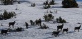
 4.66 mi
 +1,896 ft
 -1,946 ft
 6 hrs
6 hrs
 Moderate
 Departure from Cervières (Hautes-Alpes)
Circuit opposite the magnificent peak of Rochebrune with an exceptional view of the road of the Col d'Izoard. And besides, there are chamois here!
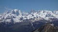
 Ancient Fort of Gondran or Sommet des Anges via Lac des Sarailles
 6.01 mi
+2,730 ft
-2,726 ft
5h 10
6.01 mi
+2,730 ft
-2,726 ft
5h 10
 Difficult
Departure from Cervières (Hautes-Alpes)
Difficult
Departure from Cervières (Hautes-Alpes)
A historic hike with a visit to two Maginot forts, a ridge walk with views of a multitude of peaks in the Écrins, Cerces, Italy and Queyras ranges, a descent to two pretty lakes and a return through a landscape of chimneys with another view of the Écrins. These are the ingredients of one of the most beautiful routes in the Briançonnais.
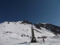
The Col d'Izoard
 6.00 mi
+2,087 ft
-2,087 ft
7 hrs
Moderate
Departure from Cervières (Hautes-Alpes)
6.00 mi
+2,087 ft
-2,087 ft
7 hrs
Moderate
Departure from Cervières (Hautes-Alpes)
The Izoard, a legendary pass on the Tour de France, makes for a truly beautiful snowshoe hike.
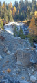
The Oules Waterfall
 5.43 mi
+1,289 ft
-1,260 ft
4 hrs
5.43 mi
+1,289 ft
-1,260 ft
4 hrs
 Easy
Departure from Cervières (Hautes-Alpes)
Easy
Departure from Cervières (Hautes-Alpes)
Discover the Oules waterfall at the bottom of the Blétonnet valley, starting from Laus de Cervières.
Col d'Izoard via the Sentier des Mules
 7.72 mi
+2,028 ft
-2,028 ft
3 hrs
Moderate
Departure from Cervières (Hautes-Alpes)
7.72 mi
+2,028 ft
-2,028 ft
3 hrs
Moderate
Departure from Cervières (Hautes-Alpes)
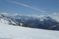
Reaching the Col d'Izoard via the Sentier des Mules is a magnificent snowshoe hike through the forest, far from the crowds climbing the pass by road.
Lake circuit via Lac Gignoux
 6.36 mi
+1,686 ft
-1,667 ft
4h 25
Moderate
Departure from Cervières (Hautes-Alpes)
6.36 mi
+1,686 ft
-1,667 ft
4h 25
Moderate
Departure from Cervières (Hautes-Alpes)
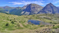
This beautiful loop allows you to see Lac des Sarailles, the customs officers' hut, Lac Gignoux and Lac Noir in succession, ending at the ruined hamlet of Les Fraches. The summit of Le Chenaillet, particularly popular for its geological features, can be seen throughout this loop.
Le Grand Charvia
 5.96 mi
+2,484 ft
-2,477 ft
4h 55
Difficult
Departure from Cervières (Hautes-Alpes)
5.96 mi
+2,484 ft
-2,477 ft
4h 55
Difficult
Departure from Cervières (Hautes-Alpes)
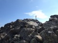
A lovely hike in the Fonts de Cervières near Briançon, featuring a summit climb and the discovery of three lakes, including the magnificent turquoise-blue Lac Gignoux.360-degree panoramic views of the surrounding peaks: Izoard, Ecrins and Cerces.I recommend supplementing the description by using the Visorando app.
⚠️ GPS tracking recommended.
Mont Chenaillet
 6.22 mi
+2,507 ft
-2,516 ft
5h 05
Moderate
Departure from Cervières (Hautes-Alpes)
6.22 mi
+2,507 ft
-2,516 ft
5h 05
Moderate
Departure from Cervières (Hautes-Alpes)
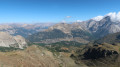
Le Chenaillet, an ancient volcano located under the ocean, is of exceptional geological interest. It is an easy hike with two lakes to discover and a 360° panoramic view of Italy, the Écrins, the Briançonnais and some of the peaks of the Queyras.
Fort de La Lausette from Le Laus
 3.91 mi
+1,857 ft
-1,847 ft
3h 25
Moderate
Departure from Cervières (Hautes-Alpes)
3.91 mi
+1,857 ft
-1,847 ft
3h 25
Moderate
Departure from Cervières (Hautes-Alpes)
A short hike to discover the fortified heritage of the Briançon region.
The Mule - Loubatières circular
6.41 mi
+2,011 ft
-2,011 ft
4h 40
Moderate
Departure from Cervières (Hautes-Alpes)
This circular starting from Laus de Cervières leads through two very pleasant woods: Péméant and Loubatières. It is a very interesting route in hot weather as it mainly passes under the large larch trees of these two forests.
Fort de la Lausette on the route
 7.86 mi
+3,281 ft
-3,281 ft
6h 30
Difficult
Departure from Cervières (Hautes-Alpes)
7.86 mi
+3,281 ft
-3,281 ft
6h 30
Difficult
Departure from Cervières (Hautes-Alpes)
A visit to one of the many military forts defending the border, Briançon and its valleys.
The Cime de Saurel via the lakes
 7.77 mi
+2,090 ft
-2,103 ft
5h 25
Moderate
Departure from Cervières (Hautes-Alpes)
7.77 mi
+2,090 ft
-2,103 ft
5h 25
Moderate
Departure from Cervières (Hautes-Alpes)
A Franco-Italian hike to a summit offering a stunning panorama of the peaks of the Fontsof Cervières and Piedmont, enhanced by the discovery of numerous lakes. As this route has several junctions, I recommend supplementing the description with the Visorando app.See also the video where I show the various junctions.
Part of the Aigalans path
2.73 mi
+230 ft
-253 ft
1h 25
Easy
Departure from Cervières (Hautes-Alpes)
A simple, unpretentious loop offering a chance to get some fresh air without tiring yourself out in the beautiful Fonts de Cervières plain.
Sommet des Anges
 6.64 mi
+1,873 ft
-1,870 ft
4h 40
Moderate
Departure from Cervières (Hautes-Alpes)
6.64 mi
+1,873 ft
-1,870 ft
4h 40
Moderate
Departure from Cervières (Hautes-Alpes)
An easy ridge walk with stunning views over the Écrins, the Cerces, the Briançonnais and Italy.
Cime Saurel from Montgenèvre
 9.61 mi
+784 ft
-2,766 ft
5h 05
Moderate
Departure from Montgenèvre (Hautes-Alpes)
9.61 mi
+784 ft
-2,766 ft
5h 05
Moderate
Departure from Montgenèvre (Hautes-Alpes)
This high-altitude walk, accessible from the Télémix des Chalmettes and the Gondrans chairlift, will allow you to discover several magnificent spots such as Lake Gignoux and the Cime Saurel, all whilst enjoying stunning views of the surrounding peaks.
The Fort de l'Infernet from the Sommet des Anges
 5.58 mi
+997 ft
-1,007 ft
3h 25
Moderate
Departure from Montgenèvre (Hautes-Alpes)
5.58 mi
+997 ft
-1,007 ft
3h 25
Moderate
Departure from Montgenèvre (Hautes-Alpes)
In summer, when the Montgenèvre ski lifts are open, there is an easy walk to the Fort de l'Infernet, which offers exceptional views of the Briançon valleys from the top station of the Gondrans chairlift.
The Small Pass via Lac Gignoux
 6.08 mi
+1,014 ft
-1,811 ft
3h 40
Moderate
Departure from Montgenèvre (Hautes-Alpes)
6.08 mi
+1,014 ft
-1,811 ft
3h 40
Moderate
Departure from Montgenèvre (Hautes-Alpes)
This route, starting from the Sommet des Anges and accessible via the Télémix des Chalmettes followed by the Télésiège des Gondrans, will allow you to discover several magnificent viewpoints as you pass through the Col du Gondran and its small lake, Lac Gignoux, the Col de Gimont and the small pass of Collet Vert.
The Chenaillet Geological Trail via the lakes
 4.33 mi
+1,286 ft
-2,080 ft
3h 05
Moderate
Departure from Montgenèvre (Hautes-Alpes)
4.33 mi
+1,286 ft
-2,080 ft
3h 05
Moderate
Departure from Montgenèvre (Hautes-Alpes)
This high-altitude route will allow you to explore the famous Chenaillet Geological Trail, as well as Lac de Chaussé and the source of the Doire. This walk is accessible via the Chalmettes Télémix and the Gondrans chairlift.
Fort Janus
 4.44 mi
+922 ft
-945 ft
2h 50
Moderate
Departure from Montgenèvre (Hautes-Alpes)
4.44 mi
+922 ft
-945 ft
2h 50
Moderate
Departure from Montgenèvre (Hautes-Alpes)
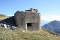
A magnificent walk discovering the forts that once protected Briançon from Italian invasion.
Breathtaking 360° panorama.
Le Lasseron
 4.09 mi
+2,726 ft
-2,726 ft
4h 15
Moderate
Departure from Cervières (Hautes-Alpes)
4.09 mi
+2,726 ft
-2,726 ft
4h 15
Moderate
Departure from Cervières (Hautes-Alpes)
A route away from the crowds, towards a summit located on the border between the Fonts de Cervières and Izoard valleys. Magnificent panoramic views of the surrounding peaks, as well as the Ecrins, Cerces and Italy.
Colle Bercia loop, between France and Italy
9.77 mi
+2,077 ft
-2,051 ft
6h 20
Moderate
Departure from Cervières (Hautes-Alpes)
This route straddles two countries, offering lakes, military heritage, pastoralism and views of the high peaks of Pic de Rochebrune on the French side and Mont Chaberton on the Italian side. It is ideal for walking or running.
The Cime Fournier
 7.51 mi
+1,827 ft
-1,814 ft
5h 05
Moderate
Departure from Cervières (Hautes-Alpes)
7.51 mi
+1,827 ft
-1,814 ft
5h 05
Moderate
Departure from Cervières (Hautes-Alpes)
A visit to a border peak, which will be reached via a detour into Italy to enjoy a particularly pleasant route.
Cima Dorlier
 7.63 mi
+2,802 ft
-2,802 ft
5h 55
Difficult
Departure from Cervières (Hautes-Alpes)
7.63 mi
+2,802 ft
-2,802 ft
5h 55
Difficult
Departure from Cervières (Hautes-Alpes)
A hike away from the crowds towards a pass where lovely meadows stretch out and towards a pretty Italian summit offering panoramic views of the Écrins, the Cerces, Piedmont and some of the Queyras peaks.
The route includes a few off-trail sections where I recommend using the Visorando app.
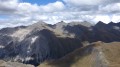
Dormillouse Ridge
 6.74 mi
+3,356 ft
-3,337 ft
6h 00
Difficult
Departure from Cervières (Hautes-Alpes)
6.74 mi
+3,356 ft
-3,337 ft
6h 00
Difficult
Departure from Cervières (Hautes-Alpes)
A hike off the beaten track towards a border ridge offering exceptional panoramic views of Italy, the Queyras, the Cerces and the Vanoise.Use of the Visorando app is recommended.
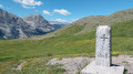
The Col Chabaud and Bousson Circular
 4.98 mi
+1,112 ft
-1,112 ft
3h 15
Moderate
Departure from Cervières (Hautes-Alpes)
4.98 mi
+1,112 ft
-1,112 ft
3h 15
Moderate
Departure from Cervières (Hautes-Alpes)
A very easy circular route via two mountain passes on the border between France and Italy.
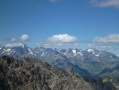
Le Grand Peygu
 2.83 mi
+2,159 ft
-2,159 ft
3h 10
Difficult
Departure from Cervières (Hautes-Alpes)
2.83 mi
+2,159 ft
-2,159 ft
3h 10
Difficult
Departure from Cervières (Hautes-Alpes)
This is a very striking pyramid that irresistibly catches the eye as you climb the Col d’Izoard. Yet this small, cramped summit reveals an extraordinary panorama of the Ecrins, the Vanoise, the Cerces and the Queyras, and even Mont Blanc. Its short but very challenging ascent is well worth the detour.
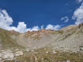
The Crête des Granges
 4.47 mi
+2,428 ft
-2,421 ft
4h 10
Difficult
Departure from Cervières (Hautes-Alpes)
4.47 mi
+2,428 ft
-2,421 ft
4h 10
Difficult
Departure from Cervières (Hautes-Alpes)
Access to a bare ridge between Queyras and Briançonnais.
The Cols des Ourdeis and Peygus
 4.94 mi
+1,883 ft
-1,870 ft
3h 55
Moderate
Departure from Cervières (Hautes-Alpes)
4.94 mi
+1,883 ft
-1,870 ft
3h 55
Moderate
Departure from Cervières (Hautes-Alpes)
The pretty cirque located after the Izoard chalets serves both passes and a beautiful little lake.
The Cime de la Charvie
 6.45 mi
+3,379 ft
-3,386 ft
5h 55
Difficult
Departure from Cervières (Hautes-Alpes)
6.45 mi
+3,379 ft
-3,386 ft
5h 55
Difficult
Departure from Cervières (Hautes-Alpes)
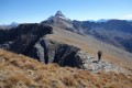
This is one of the mountain guides' favourite hikes to a summit with a ridge trail offering exceptional views of the Alps and returning to a valley that is very popular with chamois.
I recommend using the Visorando app.
The Lakes Circuit starting from Montgenèvre
 8.78 mi
+1,959 ft
-3,120 ft
5h 45
Moderate
Departure from Montgenèvre (Hautes-Alpes)
8.78 mi
+1,959 ft
-3,120 ft
5h 45
Moderate
Departure from Montgenèvre (Hautes-Alpes)
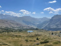
This walk, starting from the Télémix des Chalmettes, will allow you to enjoy several magnificent viewpoints, such as the Grand Charvia or Lake Gignoux, and to discover the eight lakes near the route, all whilst taking in a magnificent view of the Clarée Valley.
Circular route via the Col des Ourdeis via the Chalets d'Izoard
 3.85 mi
+1,283 ft
-1,283 ft
2h 55
Moderate
Departure from Cervières (Hautes-Alpes)
3.85 mi
+1,283 ft
-1,283 ft
2h 55
Moderate
Departure from Cervières (Hautes-Alpes)
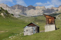
A short walk from the Auberge Napoléon towards the Izoard chalets and the Col d’Ourdeis.
The grand circuit of Les Ayes
9.18 mi
+2,910 ft
-2,910 ft
6h 45
Difficult
Departure from Villar-Saint-Pancrace (Hautes-Alpes)
A fine walk with two passes and some very beautiful scenery. Swimming available.
The Sioux trail in Cervières
3.59 mi
+381 ft
-361 ft
2h 00
Easy
Departure from Cervières (Hautes-Alpes)
For a multi-faceted walk in the Vallée des Fonts de Cervières:- a wide path along the edge of the Cerveyrette,- an arrival point featuring not teepees, but remarkable chalets,- an impressive view of the Pic du Lombard summit,- and above all, a delicious meal at the Refuge des Fonts,this is an interesting idea for a pleasant day out.
Pic de Rochebrune circular walk
 8.57 mi
+4,386 ft
-4,403 ft
8 hrs
8.57 mi
+4,386 ft
-4,403 ft
8 hrs
 Very difficult
Departure from Cervières (Hautes-Alpes)
Very difficult
Departure from Cervières (Hautes-Alpes)
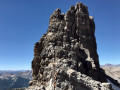
A spectacular alternative route up the Pic de Rochebrune, which explores the wild Casse des Clausins – home to golden eagles and edelweiss – and returns to the Col de l’Izoard via the Casse Déserte and the monoliths of l’Agnel.
The peak, the highest in the Briançonnais region, offers panoramic views of the French, Swiss and Italian peaks.
A good quarter of the walk takes place off the marked trail, and reaching the summit requires a single grade 3 climbing move on very good rock.
Moderator’s note: access to the Pic de Rochebrune has been authorised again since 22 July 2024 following the rockfalls of 2023. However, it is advisable to consult the guidelines provided via this link
Pic de Rochebrune
 6.21 mi
+3,707 ft
-3,707 ft
8 hrs
Very difficult
Departure from Cervières (Hautes-Alpes)
6.21 mi
+3,707 ft
-3,707 ft
8 hrs
Very difficult
Departure from Cervières (Hautes-Alpes)
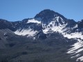
This legendary summit in the Briançonnais region offers exceptional views of the Écrins, Cerces, Queyras and Italy. Please note: this is a challenging route, partly off-trail in scree, with steep slopes and exposed sections.
Clot la Cime via the Col d'Izoard
 3.03 mi
+1,237 ft
-1,237 ft
2h 30
Moderate
Departure from Cervières (Hautes-Alpes)
3.03 mi
+1,237 ft
-1,237 ft
2h 30
Moderate
Departure from Cervières (Hautes-Alpes)
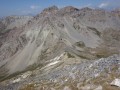
A low-altitude hike offering a 360° panorama of Queyras, Cerces and Briançonnais. This well-ventilated high-altitude route is ideal in hot weather.
From Val des Prés to La Chalp
 15.95 mi
+4,905 ft
-3,868 ft
11h 35
Difficult
Departure from Val-des-Prés (Hautes-Alpes)
15.95 mi
+4,905 ft
-3,868 ft
11h 35
Difficult
Departure from Val-des-Prés (Hautes-Alpes)
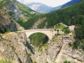
This thirteenth stage marks the start of the crossing of the Queyras Massif. From La Vachette, the previous day’s trail joins the GR®5. After a flat start, the forest path winds its way along the banks of the Durance as it descends towards the hamlet of L’Envers du Fontenil, before climbing up to a fortification at the foot of the Fort des Trois Têtes and then crossing the remarkable Pont d’Asfeld. The GR®5 climbs to the Cité Vauban in Briançon, one of France’s finest fortified towns, and descends via the Portes d’Embrun to the Parc de la Schappe. It heads south towards Villar-Saint-Pancrace, then veers off towards Les Ayes via the hamlets of La Mourande, Sachas and Soubeyran, from where it climbs to the Chapelle Saint-Laurent, then on to Le Lauzin, before reaching the Chalets des Ayes. It reaches the Col des Ayes, descends the opposite slope, joins a track at L’Eychaillon and turns left onto it, running alongside the Torrent de la Rivière as far as Brunissard and then La Chalp.
Lac des Cordes circuit
 5.46 mi
+2,100 ft
-2,096 ft
4h 20
Moderate
Departure from Cervières (Hautes-Alpes)
5.46 mi
+2,100 ft
-2,096 ft
4h 20
Moderate
Departure from Cervières (Hautes-Alpes)
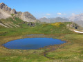
A remarkable circuit in the famous Fonts de Cervières valley, with a magnificent lake at the foot of the Pic de Rochebrune cirque.
L’Escalinade
9.80 mi
+4,551 ft
-4,551 ft
8h 30
Difficult
Departure from Cervières (Hautes-Alpes)
From this summit, you can (almost) touch the Pic de Rochebrune, the second-highest peak in the Queyras.
Le Petit Rochebrune
7.20 mi
+3,458 ft
-3,432 ft
6h 20
Difficult
Departure from Cervières (Hautes-Alpes)
On the ridge separating the Briançonnais from the Queyras, between the Grand Glaiza and the Pic de Rochebrune, this 3,078m peak offers a remarkable 360° view.
Summit of the Grand Vallon
 6.06 mi
+2,684 ft
-2,684 ft
5h 10
Moderate
Departure from Cervières (Hautes-Alpes)
6.06 mi
+2,684 ft
-2,684 ft
5h 10
Moderate
Departure from Cervières (Hautes-Alpes)
A hike to a summit situated on the border between Queyras and Briançonnais, offering a stunning panoramic view of the Italian Piedmont, the Queyras, the Ubaye, as well as the Cerces and the Vanoise.
Pic de Fond Queyras
7.30 mi
+3,097 ft
-3,071 ft
6h 05
Difficult
Departure from Cervières (Hautes-Alpes)
From Les Fonts de Cervières, dozens of hikes set off. This one, similar to the Petit Rochebrune route, allows you to traverse part of the ridge linking the Col des Péas to the summit of the Petit Rochebrune.
The Grand Glaiza
9.43 mi
+4,222 ft
-4,196 ft
8h 00
Difficult
Departure from Cervières (Hautes-Alpes)
Located at the bottom of the Fonts de Cervières valley, this 3,293-metre peak marks the border with Italy. It is very easy to access and offers remarkable views of the peaks of Queyras and Ubaye and, when not hidden by the nebia, the nearby Mont Viso.
Refuge des Fonts de Cervières – Andrea Tornior Bivouac
 9.76 mi
+4,888 ft
-3,291 ft
8h 45
Difficult
Departure from Cervières (Hautes-Alpes)
9.76 mi
+4,888 ft
-3,291 ft
8h 45
Difficult
Departure from Cervières (Hautes-Alpes)
A fairly alpine stage of the Queyras Transfrontière, featuring the ascent of a magnificent 3,000-metre peak: Le Grand Glaiza.
The start of this stage is accessible by car via Cervières on the D902 from Briançon, then the D89T through Cervières.
Grand Glaiza and the Malrif Lakes from Les Fonts de Cervières
11.75 mi
+5,056 ft
-5,020 ft
9h 50
Very difficult
Departure from Cervières (Hautes-Alpes)
A long walk through the Pierre Rouge valley to reach the Grand Glaiza via the Crête aux Eaux Pendantes and its rocky landscape, with the return route passing through the Lacs du Malrif to return to greenery.
More walks in Cervières
Select a point of interest below: