Country:

 City:
City:


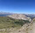
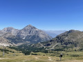
Park in the car park at the lower station of the Chalmettes Télémix. Take the Télémix to reach the upper station. Then follow a downhill track to the lower station of the Gondrans chairlift. Take the chairlift to reach the Sommet des Anges.
(S) Take the wide path leading down to your left, towards the east, towards the Col des Gondrans.
(1) Take the path veering slightly to the right, then continue straight on along the track leading up to the summit of Chenaillet.
(2) Take the fairly steep path leading down to the right, marked by a sign for Collet Vert. You’ll reach a junction of paths.
(3) Turn left onto the descending path and join the Piste des Souréous.
(4) Follow it uphill to the right for about fifty metres, then take the path leading uphill to the left towards a flat area.
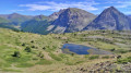
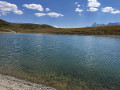
(5) Take the path on the left towards another flat area and walk alongside a small lake. Follow a fairly steep path passing beneath the Rocher de l’Aigle chairlift to reach the path leading to the small pass of Collet Vert.
(6) Turn left onto this path and head towards Lac de Chaussé. Continue downhill beneath the Rocher de l’Aigle chairlift. Then turn left to reach a path junction.
(7) Take the path on the left to reach the upper station of the Chalmettes Télémix.
(E) Take the Chalmettes Télémix down the slope to return to the Lower Station car park.

 Visorando Member
 Difficult