The Col des Ayes circular walk

This pass, particularly popular with GR®5 walkers, forms part of the Briançon–La Chalp stage described here; however, it can also be tackled as a day walk:
- either approaching from the hamlet of Les Ayes on the Briançon side,
- or from the hamlet of Clapeyto on the Queyras side.
This circular route, starting from Les Ayes, is sure to delight many walkers.

Details

n°2461807
Creation:
Last update:
Last review:
  • Walking
    Activity: Walking
  • ↔
    Distance: 6.44 mi
  • ◔
    Average duration: 5h 05 
  • ▲
    Difficulty: Average

  • ⚐
    Back to start: Yes
  • ↗
    Ascent: + 2,457 ft
  • ↘
    Descent: - 2,448 ft

  • ▲
    Highest point: 8,127 ft
  • ▼
    Lowest point: 5,669 ft

Description of the walk

Park in the Les Ayes car park, making sure to drive up via the middle road.

(S/E) Very soon after, turn left onto theGR®5– signposted and marked with red and white signs – via the wide track which quickly turns into a footpath. Follow the left bank of the Torrent des Ayes through some remarkable woodland. Cross a wider track to then reach the track leading to the chalets near the Col.

(1) Take this track, cutting across it to avoid the numerous hairpin bends, and emerge at the chalets.

(2) Continue south-east along the well-marked path and walk on to reach the Col des Ayes without difficulty.

(3) Follow the same route back to the track junction.

(1) Keep left on the track and descend very gently to Plan du Peyron (Plan Peyron on the map).

(4) Here you have two options: either the right bank or the left bank of the Torrent de l’Orceyrette. Join the tarmac road at the bridge over the torrent. Keep to the right on this road to return to the Ayes car park (S/E).

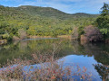
Waypoints

  1. S/E : mi 0 - alt. 5,669 ft - Les Ayes car park
  2. 1 : mi 1.35 - alt. 6,860 ft - Trail junction
  3. 2 : mi 1.95 - alt. 7,274 ft - Chalets de Vers le Col
  4. 3 : mi 2.67 - alt. 8,127 ft - Col des Ayes (2477m)
  5. 4 : mi 5.72 - alt. 6,102 ft - Map of Le Peyron
  6. S/E : mi 6.44 - alt. 5,679 ft - Les Ayes car park

Notes

It’s worth cutting across the hairpin bends between (1) and (2); the route isn’t signposted but it’s obvious.
In summer, before (1), a cluster of yurts offers a pleasant place to stop for seasoned hikers on theGR®5.

Worth a visit

Briançon and its surroundings.

Always be cautious and plan ahead when you're outdoors. Visorando and the author of this route cannot be held responsible for any accidents occurring on this route.

The GR® and PR® markings are the intellectual property of the Fédération Française de Randonnée Pédestre.

Reviews and comments

4.3 / 5
Based on 2 reviews

Reliability of the description
4 / 5
Ease of following the route
4 / 5
Route interest
5 / 5
Gomez Carlos
Gomez Carlos

Overall rating : 4.3 / 5

Date of your route : Jun 09, 2023
Reliability of the description : ★★★★☆ Good
Ease of following the route : ★★★★☆ Good
Route interest : ★★★★★ Very good
Very busy route : No

Thanks for this guide,
I followed it on the way there, but on the way back I took the route via the Col de la Taure and the Chalet de la Taure, then the nature trail. Then a short round trip to the Orceyrette ski lift. The path isn’t easy to find for the climb up to the Col de la Taure and the descent. This route adds 300 metres of elevation gain.

Machine-translated

beaber
beaber

Overall rating : 5 / 5

Date of your route : Aug 11, 2020
Reliability of the description : Not used / Not applicable
Ease of following the route : Not used / Not applicable
Route interest : ★★★★★ Very good
Very busy route : No

A lovely walk. The way back along the path is pretty, through the woods, but a bit long.

Machine-translated

Other walks in the area

For more walks, use our search engine .

The GPS track and description are the property of this route's author. Please do not copy them without permission.