Country:

 City:
City:


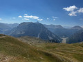
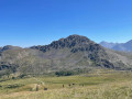
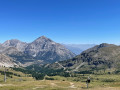
Take the Chalmettes Télémix lift uphill.
(S) Take the path on your left leading up a small hill. Once at the top, follow the path down to the left into the forest. You’ll soon reach a wider track.
(1) Turn right onto it and, after an easy climb, you’ll reach the point directly below the Rocher de l’Aigle chairlift; continue on to the Lac de Chaussé crossroads.
(2) Leave the lake on your right and you’ll soon reach a flat area via the fairly steep path.
(3) Turn right onto the ascending path. Then walk alongside an unnamed lake, and you’ll soon reach a wider track.
(4) Follow it to the right, then leave it to turn left onto a path; you will then emerge at the unnamed pass separating Le Chenaillet from Le Grand Charvia.
(5) Continue left to reach the highest point of the walk: the summit of Grand Charvia.
(6) Turn right onto an easy descent and head down to Lac Gignoux.
(7) Turn almost 180° to the right; you’ll soon come to a Y-junction.
(8) Take the path sloping gently down to the left; at the multi-way junction, turn right then left to reach Lac Noir.
(9) Carry on straight ahead, first down a gentle slope and then up a short climb, until you reach the picturesque Lac des Sarrailles.
(10) Walk round the lake on the left and continue along the same path, climbing gently to reach Lac de Sagne Peatland.
(11) Head back down via the small path on the right. Pass in front of the Lac des Anges hill reservoir. Continue down to the lower station of the Gondrans chairlift.
(12) Cross the track and continue straight ahead along the narrow path running alongside the Durance; you’ll soon come to a junction.
(13) Turn left, cross the wide track again, enter the forest and, following the Durance from a distance, emerge at the lower station of the Chalmettes Télémix.
(14) Cross the ski lift track and continue along the same path. Go round the residential complex on the right, then head back down towards Montgenèvre. (E)
 Visorando Member
 Difficult
 Easy
Easy