Refuge des Fonts de Cervières – Andrea Tornior Bivouac

A fairly alpine stage of the Queyras Transfrontière, featuring the ascent of a magnificent 3,000-metre peak: Le Grand Glaiza.
The start of this stage is accessible by car via Cervières on the D902 from Briançon, then the D89T through Cervières.

This walk is part of a multi-day hike: Queyras Transfrontière

Details

78219
Creation:
Last update:
Last review:
  • Walking
    Activity: Walking
  • ↔
    Distance: 9.76 mi
  • ◔
    Average duration: 8h 45 
  • ▲
    Difficulty: Difficult

  • ⚐
    Back to start: No
  • ↗
    Ascent: + 4,888 ft
  • ↘
    Descent: - 3,291 ft

  • ▲
    Highest point: 10,728 ft
  • ▼
    Lowest point: 6,703 ft

Photos

Description of the walk

(S) From the refuge, follow theGR®58eastwards towards the Col du Petit Malrif above Lac du Malrif.

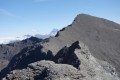
(1) At the pass, turn left (north/north-east) onto the ridge (follow the trail) towards Les Eaux Pendantes.

(2) Please note: the Pic du Malrif can be very tricky in strong winds or wet weather.
The rest of the ridge presents no real difficulty as far as the Grand Glaiza.

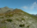
(3) The Grand Glaiza, at nearly 3,300 metres, is a stunning viewpoint that is not too difficult to reach.
Retrace your steps back to the Col du Malrif.

(4) At the pass, follow theGR®58Dalternative route which leads to the Col de Rasis.

(5) After crossing a scree slope, you reach the Col des Thures.

(6) From the Col de Thures, it’s possible to continue along the ridge to the foot of the Bric Froid, or even attempt the ascent… but that’ll add another 500m of ascent and descent!
Alternatively, head down to the left into the beautiful Italian valley of Thuras, to the Andrea Tornior Bivouac (E), which is clearly visible from the pass.


Waypoints

  1. S : mi 0 - alt. 6,703 ft - Refuge des Fonts de Cervières
  2. 1 : mi 3.05 - alt. 9,278 ft - Petit col du Malrif
  3. 2 : mi 3.18 - alt. 9,531 ft - Pic du Malrif
  4. 3 : mi 4.68 - alt. 10,728 ft - (3,293 m) - Grand Glaiza (le)
  5. 4 : mi 6 - alt. 9,396 ft - Col du Malrif
  6. 5 : mi 7.97 - alt. 9,593 ft - Col de Rasis
  7. 6 : mi 8.73 - alt. 9,199 ft - Col des Thures
  8. E : mi 9.76 - alt. 8,301 ft - Bivouac Andrea Tornior

Notes

In the event of adverse weather conditions (fog, rain, etc.), it’s best not to venture onto the Grand Glaiza. The section over the Pic du Malrif can be problematic with poor visibility and wet ground (slippery schist).
In this case, it’s better to follow theGR®58to Abriès or the Roux d’Abries.

The Andrea Tornior bivouac (E) is clearly visible from the Col des Thures and is practically right by the path. It shouldn’t be too difficult to find in bad weather.
A lovely hut with just the bare essentials. Please note, there is no water and the surrounding area consists of pastureland.
I collected water from the stream that rises in the valley below the Col de Rasis… Had no problems, without using water purification tablets or boiling the water.

Plan B:
In the event of bad weather, if you feel, for example, that the ridge walk to the Pic du Malrif is risky, or if the conditions are set to remain poor for some time, it’s best to head down to Abriès and try to hitch a lift to the hamlet of Le Roux d’Abries to spend the night at the Lodge Le Cassu.
You’ll be ready to set off as soon as possible to climb to the Col des Thures and reach the Andrea Tornior bivouac. And you’ll have plenty of time to make the most of it by heading via the summit of Bric Froid… it’s well worth the detour!
That’s the option I chose, given the conditions.
I’m familiar with the route described here, though. It’s well worth a visit!

Worth a visit

Always be cautious and plan ahead when you're outdoors. Visorando and the author of this route cannot be held responsible for any accidents occurring on this route.

The GR® and PR® markings are the intellectual property of the Fédération Française de Randonnée Pédestre.

Reviews and comments

4.8 / 5
Based on 2 reviews

Reliability of the description
4.5 / 5
Ease of following the route
5 / 5
Route interest
5 / 5
Marino de Marcy
Marino de Marcy
• Edited:

Overall rating : 5 / 5

Date of your route : Apr 11, 2025
Reliability of the description : ★★★★★ Very good
Ease of following the route : ★★★★★ Very good
Route interest : ★★★★★ Very good
Very busy route : Yes

We followed this route from the Col du Petit Malrif to the Col de Thures.
The round trip to the Grand Glaiza is well worth it; there’s a beautiful panorama in lovely surroundings (large tufts of golden benoites amidst the dark minerals) along a fairly easy route.

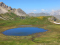
There were quite a few people coming and going from the Fonts de Cervières and around the Laus lakes, and then, after that, hardly anyone until the Col de Thures. We camped alone by the small lake below the Col de Rasis.

Machine-translated

c_moi_yves
c_moi_yves

Hello,
Yes, I walked past the foot of the Bric Froid, where we came across about twenty chamois… at least —it was magnificent!
Have a lovely day.

Machine-translated

6beryeti
6beryeti

Hello,

Yes, indeed, the water flows… or not, depending on the season or whether there’s a drought.
But the problem isn’t so much the water as what’s trampling around it. There were cows there when I stayed overnight.
I might be a bit wary, but I prefer a spring whenever possible. And don’t worry, I didn’t go to the French side, but to the Italian side of the Col de Rasis… and not very high up.

I hope you enjoyed the area !
Have you been to Bric Froid?

Machine-translated

c_moi_yves
c_moi_yves

Overall rating : 4.7 / 5

Date of your route : Aug 13, 2017
Reliability of the description : ★★★★☆ Good
Ease of following the route : ★★★★★ Very good
Route interest : ★★★★★ Very good

Hello,
Regarding the water around this Italian campsite: This campsite is situated between two streams (one 10 metres away with a gentle flow, the other 30 metres away with a much stronger flow); furthermore, water flows from all over this Italian valley. In two places, we saw water gushing out of the ground (as at 4 August 2017). So don’t bother trying to find water on the French side.
Enjoy your hike.

Machine-translated

Other walks in the area

For more walks, use our search engine .

The GPS track and description are the property of this route's author. Please do not copy them without permission.