Country:

 City:
City:


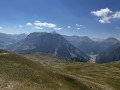
Park in the Télémix des Chalmettes car park, then head to the Sommet des Anges via the Télémix des Chalmettes and the Gondrans chairlift.
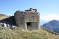
(S) Take the path branching off to your left towards the Col des Gondrans; the descent is easy and pleasant. Make your way to the Cabane des Douaniers.
(1) Take the path veering slightly to the right towards Lac Gignoux. Continue on to reach the crossroads near the Lacs du Rouséou via a relatively flat and easy route.
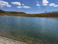
(2) Carry on, either straight ahead or to the left, then follow the almost flat path to reach Lac Gignoux.
(3) Take the path on the left and follow a circular route via the Col de Gimont, then turn right to reach the Cime Saurel.
(4) Then head down to the right to return to the previous junction at Lac Gignoux.
(3) Opposite, retrace your steps along the route you took on the way there until you reach the Cabane des Douaniers.
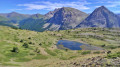
(1) Turn sharply right (90°), heading north, and walk alongside Lac de Sagne Enfonza, then descend gently to reach the hilltop lake known as Lac des Anges.
(5) After a quick left-right turn, continue straight ahead to reach the large open area housing the lower station of the Gondrans chairlift.
(6) Take the path opposite, heading north towards Montgenèvre parallel to the ski run, then turn left to join the ski run descending in front of you after crossing the run.
(7) Cross the piste and then take the path on the right leading down into the forest. Follow this pleasant descent, running parallel to the River Durance, to reach the Durance ski lift.
(8) Turn right to quickly reach the car park for the Télémix des Chalmettes (S/E).
 Visorando Member
 Difficult