Country:

 City:
City:


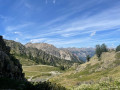
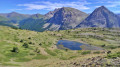
Park in the Télémix des Chalmettes car park and take the lift. Once at the top station, head right to follow the track towards the departure point of the Gondrans chairlift. Take this to reach the Sommet des Anges, the starting point of the hike.
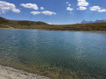
(S) Take the path leading down to the left towards the Col du Gondran. The descent, which is very easy, quickly leads to a small lake.
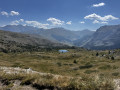
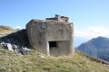
(1) Head off to the right towards Lac Gignoux. Pass the hut on your right and carry on straight ahead for about 200 m. Ignore the path on the left leading to Le Chenaillet; keep going in the same direction until you reach a junction north of Lac Noir.
(2) Turn left to follow the path, which passes close to a small lake on your left before veering sharply to the right and heading east. Keep heading in this direction to reach Lac Gignoux.
(3) Take the path on your left heading up towards the Col de Gimont. The climb is quite steep but you’ll reach the pass – which marks the French-Italian border – very quickly.
(4) Follow the path branching off to your left towards the Collet Vert. The ascent on the Italian side, which is fairly easy and pleasant, takes you to a junction of paths.
(5) Take the path on your left leading up towards the Collet Vert and follow it to the small pass, which is also situated on the French-Italian border.
(6) Cross back into France and follow the path descending to your left towards Lac de Chaussé, ignoring the wide track also on the left.
(7) At the flat stretch, take the path straight ahead towards Lac de Chaussé. The path becomes quite steep as you approach the lake.
(8) Leave Lac de Chaussé on your left and take the wide path leading down to the right.
(9) Take the path leading uphill on your left to reach the top station of the Télémix des Chalmettes (E).
 Visorando Member
 Difficult