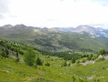
Part of the Aigalans path

A simple, unpretentious loop offering a chance to get some fresh air without tiring yourself out in the beautiful Fonts de Cervières plain.

Details

1551157
Creation:
Last update:
Last review:
  • Walking
    Activity: Walking
  • ↔
    Distance: 2.73 mi
  • ◔
    Average duration: 1h 25 
  • ▲
    Difficulty: Easy

  • ⚐
    Back to start: Yes
  • ↗
    Ascent: + 230 ft
  • ↘
    Descent: - 253 ft

  • ▲
    Highest point: 6,266 ft
  • ▼
    Lowest point: 6,089 ft

Description of the walk

Park at the side of the Route des Fonts near the hamlet of La Chau.

(S/E) Set off along the unpaved track leading to the chalets in the hamlet of La Chau. Cross the hamlet, leaving the path to Lacs Noir and Lacs Gignoux on your left, and take the yellow-marked path on your right. Descend slightly to reach the junction with the Chemin de l’Aigalans (signposted).

(1) Turn left here and walk along a flat path clearly marked by small stone walls running alongside it. You’ll reach the junction for the hamlets of Rif Tord and Les Hugues.

(2) Continue to the right, crossing the peat bog via wooden walkways to reach the hamlet of Les Hugues.

(3) Take the track leading to the Rif Tord chalets, then continue down a gentle slope to return to the crossroads you passed on the way out.

(2) Retrace your steps along the previous route to reach the first junction.

(1) Carry on to the left along the wide track. Cross the tarmac D89T road and, opposite, you’ll find the path running alongside the Cerveyrette.

(4) Follow this path as it winds its way alongside the stream. You’ll reach a crossroads near an old guard post. Turn right and you’ll easily reach the car park where you started (S/E).

Waypoints

  1. S/E : mi 0 - alt. 6,188 ft - Car park in the hamlet of La Chau
  2. 1 : mi 0.45 - alt. 6,129 ft - Crossroads on the Chemin de l’Aigalans
  3. 2 : mi 0.8 - alt. 6,129 ft - Crossroads between the hamlets
  4. 3 : mi 1.28 - alt. 6,155 ft - Les Hugues
  5. 4 : mi 2.29 - alt. 6,106 ft - Crossroads on the tarmac road
  6. S/E : mi 2.73 - alt. 6,188 ft - Car park in the hamlet of La Chau

Notes

Water points in the three hamlets.

Worth a visit

Crossing the Bourget Plain peat bog.

Reviews and comments

4.7 / 5
Based on 2 reviews

Reliability of the description
5 / 5
Ease of following the route
5 / 5
Route interest
4 / 5
isabelle5891
isabelle5891

Overall rating : 4.7 / 5

Date of your route : Nov 04, 2024
Reliability of the description : ★★★★★ Very good
Ease of following the route : ★★★★★ Very good
Route interest : ★★★★☆ Good
Very busy route : No

A very pleasant route through this beautiful high valley, which can really be enjoyed even by untrained walkers. It’s almost flat, yet varied. Magnificent, with the colourful trees in the distance during this lovely autumn.

Machine-translated

desacetdecorde
desacetdecorde

Overall rating : 4.7 / 5

Date of your route : Sep 07, 2019
Reliability of the description : ★★★★★ Very good
Ease of following the route : ★★★★★ Very good
Route interest : ★★★★☆ Good

This short and very easy walk follows a path that runs alongside an area of wet meadows and takes you past small hamlets featuring the typical architecture of the Fonds de Cervières valley: little chapels and half-timbered chalets. Best done at the end of the day, when the shadows are long and the softer light illuminates the marshes and brings out the contours of the houses. There’s a lovely view to the west over the Tenailles de Montbrison and the Pelvoux.
However, the section of the route between the hamlet of La Chau and Rif Tord can be linked to the Chabaud and Bousson Passes circular route (points 1-2-3 N0 56), making it a very comprehensive yet easy hike to explore this part of the valley.

Machine-translated

Other walks in the area

For more walks, use our search engine .

The GPS track and description are the property of this route's author. Please do not copy them without permission.