


mantix

 Visorando Member
 Premium user
 - Location: Aix-en-Provence (13100|13090|13540)
- Gender: man
Sign up:
Published route(s)
 Circular Sainte-Victoire and bottom of Lake Bimont
 8.76 mi
 +2,073 ft
 -2,073 ft
 5h 50
5h 50
 Difficult
 Departure from Beaurecueil (Bouches-du-Rhône)
An exceptional walk at the far end of Lac du Bimont, to be done before the dam is filled in 2019. Views of the most beautiful side of Sainte-Victoire, a lovely climb, a magnificent panorama of the region, a walk at the far end of the lake, and old stones bearing witness to times gone by.Important: The final section of this route – part of which is marked on the map as being in the lake – was accessible until May 2019, before the lake was filled. Please read the practical information below.
11/09/2024: The Imoucha path will be closed for three months, from 1 October to 31 December (2024 and 2025). The walk cannot be undertaken during these periods. See practical information.
Circular through the pine forest at Le Tholonet
 2.90 mi
+413 ft
-387 ft
1h 40
2.90 mi
+413 ft
-387 ft
1h 40
 Easy
Departure from Le Tholonet (Bouches-du-Rhône)
Easy
Departure from Le Tholonet (Bouches-du-Rhône)
Whether you want a leisurely family outing or a brisk run, this circular allows you to escape Le Tholonet on tracks and paths with little traffic, offering views of Montagne Sainte-Victoire.
 Sardière Monolith Circular Trail and Sculpture Trail
 5.44 mi
+1,184 ft
-1,201 ft
4 hrs
5.44 mi
+1,184 ft
-1,201 ft
4 hrs
 Average
Departure from Aussois (Savoie)
Average
Departure from Aussois (Savoie)
A snowshoe hike through the forest offering two points of interest: the spectacular Sardière monolith and the Sculpture Trail. Beautiful views of the peaks of the Mont Cenis massif to the south and surprising sculptures amongst the pine trees.
From Valbone to Theth and back – the Albanian Alps
 12.07 mi
+6,217 ft
-6,217 ft
8 hrs
12.07 mi
+6,217 ft
-6,217 ft
8 hrs
 Very difficult
Departure from Albania
Very difficult
Departure from Albania
Discover two very different slopes: mountain pastures and beech woodland. At the pass, there’s a 360° view with the option of an additional ascent. You can use this route to walk just one way from Valbone to Theth or vice versa, as hikers usually do; they sometimes hire horses to carry their rucksacks. The hike is challenging if you do the round trip due to the distance, but presents no technical or route-related difficulties.
Sardinia – Towards Monte Tinnari, amidst pink granite and shades of blue
 6.42 mi
+1,138 ft
-1,142 ft
3h 55
Average
Departure from La Trinitai e Vignola/Trinità d'Agultu e Vignola (Gallura Nord-Est Sardegna)
6.42 mi
+1,138 ft
-1,142 ft
3h 55
Average
Departure from La Trinitai e Vignola/Trinità d'Agultu e Vignola (Gallura Nord-Est Sardegna)
A magnificent palette of pinks and blues, a coastal route that takes you up to higher ground to admire the Sardinian coast and, in the distance, the Corsican cliffs of Bonifacio, not to mention two beautiful beaches where you can cool off.
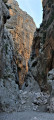
The Gorropu Canyon in Sardinia
 6.43 mi
+3,737 ft
-3,763 ft
6h 15
Difficult
Departure from Orthullè/Urzulei (Ogliastra)
6.43 mi
+3,737 ft
-3,763 ft
6h 15
Difficult
Departure from Orthullè/Urzulei (Ogliastra)
The narrow canyon, cluttered with boulders that are fun to climb over, is spectacular in its depth. The approach trail offers a beautiful view of the wide Flumineddu valley and the hilltop village of Dorgali. Above the Mediterranean vegetation, you will encounter impressive holm oaks, immense and several hundred years old, remnants of an ancient forest.
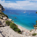
Cala Goloritze beach in Sardinia
 4.33 mi
+1,673 ft
-1,667 ft
3h 25
Average
Departure from Baunei (Ogliastra)
4.33 mi
+1,673 ft
-1,667 ft
3h 25
Average
Departure from Baunei (Ogliastra)
This is the quickest route to the famous Sardinian beach, a valley that opens out onto a picture-postcard sea.
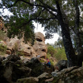
Circular walk taking in the sights on the Golgo plateau
 2.81 mi
+135 ft
-135 ft
1h 25
Easy
Departure from Baunei (Ogliastra)
2.81 mi
+135 ft
-135 ft
1h 25
Easy
Departure from Baunei (Ogliastra)
A nuraghe, natural pools, chasms, a church and a striking face carved into a cliff – these are the sights to discover on an easy walk through unspoilt countryside, amongst free-roaming pigs and donkeys. A little-visited and peaceful route, following the return from Cala Goritze, which attracts most hikers.
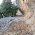
The hidden village of Tiscali
 5.98 mi
+1,939 ft
-1,942 ft
4h 25
Average
Departure from Durgali/Dorgali (Nuoro)
5.98 mi
+1,939 ft
-1,942 ft
4h 25
Average
Departure from Durgali/Dorgali (Nuoro)
A ruined village sheltered by a rock arch, made all the more impressive by the approach walk through unspoilt countryside – this is the discovery you’ll make after crossing a pass, descending into a valley and climbing the next slope. As a bonus, there’s a magnificent view over a third valley.
Around Ulassai
 5.43 mi
+1,841 ft
-1,857 ft
4h 05
Average
Departure from Ulassa/Ulassai (Ogliastra)
5.43 mi
+1,841 ft
-1,857 ft
4h 05
Average
Departure from Ulassa/Ulassai (Ogliastra)
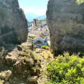
In this climber’s paradise, this walk takes you past a canyon, a summit, two caves and numerous cliffs offering magnificent views of the neighbouring villages and valleys.
Campo di Giove Bear Trail
 2.43 mi
+463 ft
-463 ft
1h 30
Easy
Departure from Campo di Giove (L'Aquila)
2.43 mi
+463 ft
-463 ft
1h 30
Easy
Departure from Campo di Giove (L'Aquila)
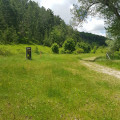
Set off to discover the Abruzzo bear on a trail that is accessible to young children and will also interest adults. Themed panels present different aspects of the animal and offer games and activities.
Saut and Péclet-Polset mountain huts from Les Prioux - Chavière Valley
 16.18 mi
+5,794 ft
-5,794 ft
More than 12 hrs
Very difficult
Departure from Pralognan-la-Vanoise (Savoie)
16.18 mi
+5,794 ft
-5,794 ft
More than 12 hrs
Very difficult
Departure from Pralognan-la-Vanoise (Savoie)
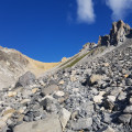
Two beautiful glacial valleys, two passes, two refuges, a lake... and views of glaciers and peaks rising to over 3,000 metres. The Alps as we love them, with vast panoramas and well-marked trails that allow you to rack up kilometres and elevation gain for a variety of views. Magnificent panoramas are guaranteed and, with a little luck, marmots and ibex will be there to greet you.
Carrubella-Cavagrande-Cassibile circular route
 3.35 mi
+771 ft
-771 ft
2h 15
Average
Departure from Noto (Siracusa)
3.35 mi
+771 ft
-771 ft
2h 15
Average
Departure from Noto (Siracusa)
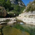
A refreshing dip in the Cassibile River gorges, where swimming is possible.
Snowshoeing to the Col de Longet
 4.71 mi
+2,211 ft
-2,211 ft
5 hrs
Easy
Departure from Molines-en-Queyras (Hautes-Alpes)
4.71 mi
+2,211 ft
-2,211 ft
5 hrs
Easy
Departure from Molines-en-Queyras (Hautes-Alpes)
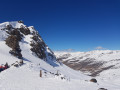
A snow-covered forest and white expanses surrounded by peaks await you. The view from the pass offers a high mountain panorama.
The covered bridge at Linguenau
 3.96 mi
+561 ft
-551 ft
2h 20
Easy
Departure from Gemeinde Lingenau (Bezirk Bregenz)
3.96 mi
+561 ft
-551 ft
2h 20
Easy
Departure from Gemeinde Lingenau (Bezirk Bregenz)
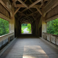
This short and easy hike will take you to a picturesque covered bridge. In June, you will be able to walk through lush green meadows. You will also be able to see two covered crosses.
Kaunertal Red Rock Loop
 3.68 mi
+1,043 ft
-1,037 ft
2h 35
Average
Departure from Kaunertal (Bezirk Landeck)
3.68 mi
+1,043 ft
-1,037 ft
2h 35
Average
Departure from Kaunertal (Bezirk Landeck)
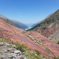
This loop takes you through red rocks eroded by glaciers and offers beautiful views of the Kaunertal valley and the snow-capped peaks. At the end of June, rhododendrons and alpine flowers are in full bloom.
In the green valley of the Horlachbach stream - Ötzal - Tyrol
 9.54 mi
+3,291 ft
-3,274 ft
7h 15
Difficult
Departure from Umhausen (Bezirk Imst)
9.54 mi
+3,291 ft
-3,274 ft
7h 15
Difficult
Departure from Umhausen (Bezirk Imst)
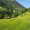
Starting from Niederthai, on easy tracks, you will pass through a green valley between meadows and forests, perpendicular to the Ötzal Valley. This hike can easily be shortened: the steep section at the end (about 3 km) can be skipped, but it allows you to admire the landscape from higher up.
Similarly, the hike can be extended if you wish to go as far as the Finstertaler Scharte pass. The cattle tracks are popular with cyclists in summer and skiers in winter.
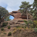
Circular of the arch and hermitage in Prades, Spain
 2.93 mi
+305 ft
-279 ft
1h 35
Easy
Departure from Prades (Tarragona)
2.93 mi
+305 ft
-279 ft
1h 35
Easy
Departure from Prades (Tarragona)
Starting from Prades, the red sandstone town, you will walk through the undergrowth on easy trails and discover a red stone arch, a small lake and three chapels, including a hermitage perched on a cliff.
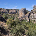
Circular Pelegrina: gorges and viewpoint of the Gallorío waterfall
 4.17 mi
+748 ft
-755 ft
2h 35
Easy
Departure from Sigüenza (Guadalajara)
4.17 mi
+748 ft
-755 ft
2h 35
Easy
Departure from Sigüenza (Guadalajara)
This route will take you to a village ranked among the most beautiful in Spain, then down into a gorge where the vegetation will provide shade. You will walk at the foot of the cliffs before climbing to their summits. You will certainly see vultures there, and perhaps a waterfall in spring if there is water.
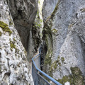
La Yecla Gorge in Santo Domingo de Silos
 0.82 mi
+341 ft
-325 ft
1h 15
Easy
Departure from Santo Domingo de Silos (Burgos)
0.82 mi
+341 ft
-325 ft
1h 15
Easy
Departure from Santo Domingo de Silos (Burgos)
This very short round trip hike takes you through an extremely narrow gorge. A small stream has cut through the mountain at an impressive height (100 metres), carving out a very narrow passage: you have to bend down to get through in some places. You will see vultures on the cliffs and a metal sculpture of a vulture by the side of the path.
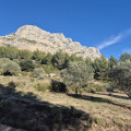
From the Refuge Cézanne to the Deux Aiguilles car park via the Trou
 1.80 mi
+387 ft
-407 ft
1h 10
Easy
Departure from Saint-Antonin-sur-Bayon (Bouches-du-Rhône)
1.80 mi
+387 ft
-407 ft
1h 10
Easy
Departure from Saint-Antonin-sur-Bayon (Bouches-du-Rhône)
This trail is an alternative known to local hikers for reaching the Saint-Antonin car parks when they have just completed a circular in Sainte-Victoire: it avoids following the brown-marked route, passing through the Col de l'Oppidum (alt. 580 m), then descending a very steep and rugged path. There is a 40-metre less elevation gain, and when you are in a hurry to get to the car park or tired, taking this Trou trail is a good option, especially in bad weather.
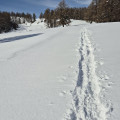
Circular snowshoe loop around the Ancelle resort.
 4.92 mi
+1,217 ft
-1,247 ft
5 hrs
Average
Departure from Ancelle (Hautes-Alpes)
4.92 mi
+1,217 ft
-1,247 ft
5 hrs
Average
Departure from Ancelle (Hautes-Alpes)
A gentle walk along a narrow path beside a torrent, then the view opens up onto snowfields. Once on the ridges, you can admire the Gap and Champsaur valleys dominated by beautiful peaks and, further away, the Écrins.
On the slopes of La Om in Piatra Craiului National Park
 6.45 mi
+3,698 ft
-3,684 ft
6h 10
Very difficult
Departure from Romania
6.45 mi
+3,698 ft
-3,684 ft
6h 10
Very difficult
Departure from Romania
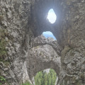
Magnificent karst formations await you after you’ve crossed a dense forest: arches, faults, gullies and caves. The climb is steep through the forest and becomes even steeper once you emerge, to the extent that cables have been fixed into the rock face. This challenging route, known as La Zaplaz, was first opened in 1886. From the top, the view stretches across the entireZărneştivalley. See the practical information below regarding access rights and safety.
Round trip to the Șaua Padinii Închise pass
 1.70 mi
+1,673 ft
-1,667 ft
2h 15
Average
Departure from Romania
1.70 mi
+1,673 ft
-1,667 ft
2h 15
Average
Departure from Romania
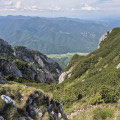
These 500 metres of elevation gain will take you up to the Carpathian sky, offering impressive panoramic views. The route starts in the forest and ends on rocky terrain – very steep limestone with a few sections where you may need to use your hands. Once at the pass, you’ll discover the green Barsa valley.
Gaining altitude in Piatra Craiului National Park
 7.04 mi
+2,720 ft
-2,723 ft
5h 35
Average
Departure from Romania
7.04 mi
+2,720 ft
-2,723 ft
5h 35
Average
Departure from Romania
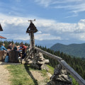
This circular walk to the Curmătura hut from Fântâna lui Botorog offers a lush, green setting. The route begins with picturesque gorges before climbing through woodland and meadows. At the end of the trail is a viewpoint from which the view stretches from the valley up to the cliffs and limestone ridges above. Information boards explain the distinctive features of the environment in several languages. The descent takes place through pastures before returning to the woodland.
From the viewpoint, you can reach a pass and the ridges via a walk described here and named ‘Round trip to the Șaua Padinii Închise Pass’.
The ladders leading to Inelet: a circular route through the forest
 4.78 mi
+1,827 ft
-1,801 ft
3h 45
Average
Departure from Romania
4.78 mi
+1,827 ft
-1,801 ft
3h 45
Average
Departure from Romania
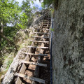
Climb the ladders to reach a tiny hamlet on the steep slope of a valley. Woodland and meadows alternate. After crossing the River Cerna via a suspension bridge and climbing ladders to get over a rocky outcrop, you’ll head up through the forest and reach the meadows where you’ll come across horses. Then, along a balcony path, you’ll pass a church and some farmhouses. The descent is through the forest and the return journey is via the road.
Viewpoint overlooking the Danube in the Iron Gates
 2.80 mi
+807 ft
-810 ft
2h 00
Easy
Departure from Romania
2.80 mi
+807 ft
-810 ft
2h 00
Easy
Departure from Romania
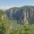
A balcony trail 180 metres above the Danube. Almost directly above the river, you’ll see the boats plying its waters and the cliffs on the Serbian bank. After a short climb and a walk across a plateau, several vantage points offer ever-changing views as you continue your hike.