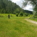
Orfento Gorges to Ponte del Vallone

This route allows you to explore the Orfento Gorges from the top of the cliffs and then deep within them: cliffs, precipices, shade, water, footbridges and waterfalls.

Details

n°36532683
Creation:
Last update:
Last review:
  • Walking
    Activity: Walking
  • ↔
    Distance: 5.24 mi
  • ◔
    Average duration: 3h 25 
  • ▲
    Difficulty: Moderate

  • ⚐
    Back to start: Yes
  • ↗
    Ascent: + 1,201 ft
  • ↘
    Descent: - 1,198 ft

  • ▲
    Highest point: 2,293 ft
  • ▼
    Lowest point: 1,660 ft

Photos

Description of the walk

The starting car park is the “Centro Visita della Valle dell’Orfento” car park in Caramanico Terme, at the top of the village. To reach this car park by car, drive about 50 metres past the entrance to the Centre, then turn left. From the bottom of the car park, walk through a pedestrian gate to the Centre to complete a compulsory administrative formality: you must register your hike online via your mobile phone using the QR code on display; paper registration is not possible, but during opening hours (to be checked depending on the date) the reception staff can assist you.

(S/E) At the top left of the starting car park, a red-and-white marker on the steps leads to the path, which you should follow eastwards. At the junction, follow the signs for “B2 Ponte del Vallone”. Pass a distinctive rock formation on the cliff face. The path then winds its way into the gorge. At another junction, continue down the B2 route to reach the Orfento river.

(1) A sign points to “Ponte del Vallone”. Cross the bridge and, after about twenty metres, turn left onto the north-westerly path to descend into the valley. The route is marked with an ‘S’ on the signs; head towards “Ponte di Caramanico”. The path follows the river as closely as possible. Ignore a fork to the right and continue until you reach the San Cataldo Bridge

(2) Cross the bridge. Further on, do not head left up towards Caramanico Terme via route B6 (30 mins), as the most spectacular part of the gorges begins at this point. Continue towards “Ponte di Caramanico”, signposted as 30 mins away. Follow the path as close as possible to the river. This path crosses five bridges from which you can admire the waterfalls and cliffs. It passes close to a stream with a sulphurous smell.

(3) Cross the last bridge to the right bank and follow the path, which climbs steeply up to the SS487 road.

(4) Turn left onto this road and cross the bridge towards Caramanico Terme. Continue to the roundabout.

(5) Turn left and head up to the next roundabout.

(6) Go round it on the left. Take the right-hand bend onto Via della Libertà.

(7) When you reach the Hotel Cercone, cut left to join Vialle Roma. Continue to the left, turn left at the bend, then immediately right to follow Contrada Santa Croce Ponte. This will take you to the car park (S/E).

Waypoints

  1. S/E : mi 0 - alt. 2,031 ft - Santa Croce car park (starting point)
  2. 1 : mi 1.76 - alt. 1,982 ft - Ponte del Vallone
  3. 2 : mi 3.32 - alt. 1,690 ft - Ponte San Cataldo
  4. 3 : mi 3.89 - alt. 1,680 ft - Last bridge to the right bank
  5. 4 : mi 4 - alt. 1,706 ft - SS487
  6. 5 : mi 4.18 - alt. 1,755 ft - Roundabout
  7. 6 : mi 4.36 - alt. 1,834 ft - Roundabout
  8. 7 : mi 4.77 - alt. 1,942 ft - Hotel Cercone
  9. S/E : mi 5.25 - alt. 2,034 ft - Santa Croce car park (starting point)

Notes

The walk was undertaken in June 2023, at which time I noted that there were no shelters or drinking water along the route.
You should bring the same kit as for a mid-mountain hike. The route can be muddy in places and slippery in others.
Wear long-sleeved clothing due to the possible presence of ticks.
The regulations are very strict: check with the “Centro Visita della Valle dell’Orfento”, on Via del Vivaio in Caramanico Terme, regarding dogs, any restrictions and swimming…
At this centre, you can also enquire about the possibility of taking a bus from the viewpoint (4) back up to the start car park (S/E).
The depth of the gorges means it is not possible to obtain an accurate GPS track, but the path is signposted and it seems unlikely that you would get lost.
This description of the walk follows the route indicated by the official signposts at the junctions, but the paths shown on the maps differ: apparently the route was re-marked in June 2023, but the maps have not been updated to reflect this.

Worth a visit

The walk can be extended by continuing eastwards to the Ponte de la Pietra.
If you only wish to see the most spectacular part of the gorges, from the car park (S/E), walk past the pedestrian entrance to the “Centro Visita della Valle dell’Orfento” and head straight down towards (2) then continue towards (3): this is the “Sentiero delle Scalelle”.
Caramanico Terme is a village where you can stock up on supplies, find accommodation and get information about the park.
The route follows part of the “Cammino Grande di Celestino”, a route comprising 13 stages.

Reviews and comments

4.7 / 5
Based on 1 review

Reliability of the description
5 / 5
Ease of following the route
5 / 5
Route interest
4 / 5
mantix
mantix

Glad you enjoyed the walk. How did you manage to get back up? We found that was the weak point of the walk, which is otherwise lovely.

Machine-translated

Philthebike
Philthebike

Overall rating : 4.7 / 5

Date of your route : Oct 01, 2023
Reliability of the description : ★★★★★ Very good
Ease of following the route : ★★★★★ Very good
Route interest : ★★★★☆ Good
Very busy route : No

A lovely walk – not at all difficult, but thoroughly enjoyable from start to finish

Machine-translated

Other walks in the area

For more walks, use our search engine .

The GPS track and description are the property of this route's author. Please do not copy them without permission.