
Lago del Valle – Cabaña de Cobrana

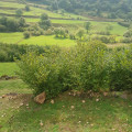
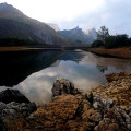
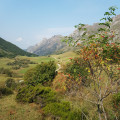
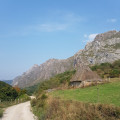
This walk will take you to a mountain lake via a gentle climb through a wide, verdant valley used for livestock farming. Thatched cottages are dotted amongst the meadows all along the route, right up to the cirque that holds the lake.

Details

n°67783850
Creation:
Last update:
Last review:
  • Walking
    Activity: Walking
  • ↔
    Distance: 8.13 mi
  • ◔
    Average duration: 4h 40 
  • ▲
    Difficulty: Moderate

  • ⚐
    Back to start: Yes
  • ↗
    Ascent: + 1,102 ft
  • ↘
    Descent: - 1,102 ft

  • ▲
    Highest point: 5,197 ft
  • ▼
    Lowest point: 4,081 ft

Photos

Description of the walk

To reach the car park at the start of the walk from Pola de Somiedo, follow signs for “8 km Valle de Lago”. Pass the turn-off for the campsite and the small village of Valle de Lago. The car park is 8.5 km from the “Centro de Interpretación del Parque Natural de Somiedo”. Parking is available on both sides of the road in marked spaces.

(S/E) Continue on foot along the same road, passing through a hamlet until you reach a sign on the right indicating “Lago del Valle Por el camino de sombra”, meaning “via the path in the shade”.

(1) Ignore the direction indicated by the sign and carry on along the road until you reach a fountain. After the fountain, continue along the track reserved for livestock farmers. Signposts indicate thePR® AS 15.1 route. Carry on until you reach a Fork in the road and an ascending path.

(2) Ignore this path which climbs to the left and carry on straight ahead until you reach a junction on the right with a sign indicating “Pueblo de El Valle – Camino de Sombra”.

(3) Carry on to the left along the main track until you reach another sign indicating ‘Lago del Valle Por el camino de sombra’, which is the upper section of the shaded path. This junction marks the turning point of the circular route.

(4) Turn left again and carry on until you can see the crest of the dam and the lake. Head towards its eastern shore until you reach a small sandy beach.

(5) Continue southwards along the lake’s shores for a round trip to the Cabaña Cobrana, two thatched barns.

(6) Turn back towards the spillway.

(5) For the return journey, head towards the dam and walk along its base. At the end of the first concrete section, climb up the embankment and then descend again to rejoin the second concrete section of the dam until you reach its end.

(7) Turn right to follow the narrow path known as the Camino de sombra, upper section. Head down through the meadows until you come to a fork on the left and an uphill path.

(8) Keep to the right and continue the descent to the junction of the circular route.

(4) Take the path you followed on the way up in the opposite direction to return to the starting point (S/E).

Waypoints

  1. S/E : mi 0 - alt. 4,094 ft - Car park
  2. 1 : mi 0.41 - alt. 4,154 ft - Sign: Camino de sombra
  3. 2 : mi 1.38 - alt. 4,288 ft - Fork
  4. 3 : mi 1.56 - alt. 4,308 ft - Sign for the “Camino de sombra” on the return journey
  5. 4 : mi 1.92 - alt. 4,393 ft - Crossroads of the circular loop
  6. 5 : mi 3.65 - alt. 5,148 ft - Lago del Valle, a sandy beach
  7. 6 : mi 3.82 - alt. 5,190 ft - Cabaña Cobrana
  8. 7 : mi 4.36 - alt. 5,128 ft - Path on the right
  9. 8 : mi 5.11 - alt. 4,918 ft - Fork in the road and ascending track
  10. S/E : mi 8.13 - alt. 4,094 ft - Car park

Notes

No shelter; bar-restaurant (“Sidrería”) and drinking fountain at the start.
Hiking kit.
The green valleys of Asturias owe their colour to the rain: bear this in mind when choosing your clothes!

Worth a visit

  • Note the apiary and its electric fence to keep out bears, between (1) and (2), to the left of the path as you climb.
  • The “Camino de sombra” comprises two sections. The suggested route takes the upper section on the way down for the return journey between (7) and (4). You can also take the other section on the way down between (3) and (1). You can also use this “Path in the Shade” on the way up.
  • In Pola de Somiedo, the “Centro de Interpretación del Parque Natural de Somiedo” offers a wealth of information on the region and its inhabitants, as well as leaflets on possible walking routes.
  • Just before the dam, a path branches off northwards and climbs (200 m elevation gain) up the valley side. It leads to the Lagos de Saliencia.

Always be cautious and plan ahead when you're outdoors. Visorando and the author of this route cannot be held responsible for any accidents occurring on this route.

The GR® and PR® markings are the intellectual property of the Fédération Française de Randonnée Pédestre.

Reviews and comments

5 / 5
Based on 1 review

Reliability of the description
5 / 5
Ease of following the route
5 / 5
Route interest
5 / 5
craco.35
craco.35

Overall rating : 5 / 5

Date of your route : Nov 17, 2025
Reliability of the description : ★★★★★ Very good
Ease of following the route : ★★★★★ Very good
Route interest : ★★★★★ Very good
Very busy route : No

Thank you to the author for this magnificent autumn hike.

Machine-translated

For more walks, use our search engine .

The GPS track and description are the property of this route's author. Please do not copy them without permission.

