
The ladders leading to Inelet: a circular route through the forest

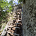
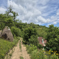
Climb the ladders to reach a tiny hamlet on the steep slope of a valley. Woodland and meadows alternate. After crossing the River Cerna via a suspension bridge and climbing ladders to get over a rocky outcrop, you’ll head up through the forest and reach the meadows where you’ll come across horses. Then, along a balcony path, you’ll pass a church and some farmhouses. The descent is through the forest and the return journey is via the road.

Details

101781128
Creation:
Last update:
Last review:
  • Walking
    Activity: Walking
  • ↔
    Distance: 4.78 mi
  • ◔
    Average duration: 3h 45 
  • ▲
    Difficulty: Moderate

  • ⚐
    Back to start: Yes
  • ↗
    Ascent: + 1,827 ft
  • ↘
    Descent: - 1,801 ft

  • ▲
    Highest point: 2,516 ft
  • ▼
    Lowest point: 938 ft

Photos

Description of the walk

To reach the start of the hike, head north on road 67D from Baile Herculane, pass the Domogled-Valea Cernei National Park Tourist Information Centre (where you can buy your park entry ticket), and drive 17.7 km until you reach a bus stop on the left-hand side of the road. A sign warns that the route is not recommended for those with a fear of heights. There are two or three places to park your car.

(S/E) Head down towards the river, cross the suspension bridge and walk up into the forest. You’ll pass a picnic table and an information board. Continue until you reach the bottom of the ladders.

(1) The climb up the ladders (a vertical climb of about 10 m) is made easier by a rope. Reach the top of the ladders.

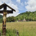
(2) Navigate a few bends, pass a table and a sign reading “Cătun inelet 50’ Punte Stoian 2h45”, and reach a cross in a meadow.

(3) Continue along the ridge to a church and its cemetery.

(4) Information and directional signs indicate the new route: take the path on the left heading south-east along the Via Transilvanica until you reach the first house in the hamlet of Inelet.

(5) Continue along the path, passing close to a stopover lodge, until you reach a junction near a picnic table and a cross, set amongst a meadow and another lodge.

(6) Leave the Via Transilvanica and take a path that descends steeply. Pass at the foot of a cliff.

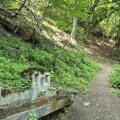
(7) Continue the descent to a fountain.

(8) Complete the descent, cross a bridge (Inelet or Stoian, depending on the map) and join the 67D road, which leads back to the starting point (S/E).


Waypoints

  1. S/E : mi 0 - alt. 1,033 ft - Bus stop
  2. 1 : mi 0.22 - alt. 1,414 ft - At the bottom of the ladders
  3. 2 : mi 0.24 - alt. 1,467 ft - Top of the ladders
  4. 3 : mi 0.61 - alt. 1,932 ft - Cross
  5. 4 : mi 0.89 - alt. 2,306 ft - Church
  6. 5 : mi 1.29 - alt. 2,395 ft - First house in the hamlet of Inelet
  7. 6 : mi 1.9 - alt. 2,464 ft - Junction towards Ponte Stoian. Cross and signpost.
  8. 7 : mi 2.51 - alt. 1,814 ft - At the foot of the cliff
  9. 8 : mi 2.82 - alt. 1,375 ft - Drinking fountain
  10. 9 : mi 3.22 - alt. 942 ft - Path/road junction and information board
  11. S/E : mi 4.78 - alt. 1,030 ft - Bus stop

Notes

There is a drinking fountain on the descent on the way back (8). You can take shelter under the church porch (4) in case of rain. There are stopover lodges along the Via Transilvanica, between (5) and (6). The route follows good paths, first along a track and then on a tarmac road. Signposts (Red Triangle) are marked along the route.

You will need to purchase a park entry ticket at the Domogled-Valea Cernei National Park Visitor Centre, 300 metres north of the junction of roads 67D and 608D. Payment can be made at the centre’s ticket machines or by text message: approximately 2 euros for 7 days in 2026.

Worth a visit

The park offers a wide range of activities. You can download a map of the park from this address: https://domogled.ro/ro/turism/harta-turistica/

The visitor centre (Centrul de vizitare) has exhibition rooms detailing the park’s unique features and its surroundings.

The Baile Herculane spa town, though rather old-fashioned, has a certain charm if you’re fond of derelict buildings. Its sulphurous waters and drinking water are renowned.

For more walks, use our search engine .

The GPS track and description are the property of this route's author. Please do not copy them without permission.