Gaining altitude in Piatra Craiului National Park

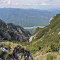
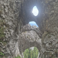
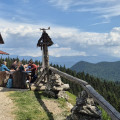
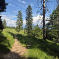
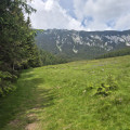
This circular walk to the Curmătura hut from Fântâna lui Botorog offers a lush, green setting. The route begins with picturesque gorges before climbing through woodland and meadows. At the end of the trail is a viewpoint from which the view stretches from the valley up to the cliffs and limestone ridges above. Information boards explain the distinctive features of the environment in several languages. The descent takes place through pastures before returning to the woodland.

From the viewpoint, you can reach a pass and the ridges via a walk described here and named ‘Round trip to the Șaua Padinii Închise Pass’.

Details

101569895
Creation:
Last update:
Last review:
  • Walking
    Activity: Walking
  • ↔
    Distance: 7.04 mi
  • ◔
    Average duration: 5h 35 
  • ▲
    Difficulty: Moderate

  • ⚐
    Back to start: Yes
  • ↗
    Ascent: + 2,720 ft
  • ↘
    Descent: - 2,723 ft

  • ▲
    Highest point: 4,757 ft
  • ▼
    Lowest point: 2,779 ft

Photos

Description of the walk

To reach the start of the walk, leave Zărnești via Road 112G. The final section of the route follows an unpaved track for 1.5 km. Drive as far as the Botorog fountain, which is situated on the embankment to the right of the track. Park near the bridge over the Zărnești stream.

(S/E) Set off along the track heading south-west, which runs alongside the river. The route is marked with blue lines. After entering the park – where you may be asked to show your entry fee receipt – you’ll soon reach the entrance to the narrow gorges

(1) Walk through the gorge to the mountain rescue hut.

(2) Follow the track heading north-west, passing beneath some climbing routes, until you reach a shelter.

(3) Ignore the path heading west and continue through the gorge. About a hundred metres after a right-angle bend, look out for the junction with the path on the right, marked by a sign indicating Cabana Curmatura is 2 h 30 mins away.

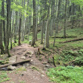
(4) Take the path, now marked with yellow dots, which climbs steeply up the slope through dense woodland. You’ll reach a ford.

(5) Continue the ascent through the forest until you reach a meadow.

(6) Follow the stream, first across the meadow and then through the undergrowth, until you reach the track.

(7) Turn right towards the viewpoint. Reach its southern terrace.

(8) Continue eastwards on level ground for about forty metres until you reach a junction of paths.

(9) The route is now marked with yellow lines. Ignore the path on the left which goes uphill and take the roughly level path until you leave the forest.

(10) Head down through the meadow until you re-enter the forest.

(11) Take the very steep path to a drinking water spring.

(12) Continue the descent, following the winding path as it makes the steep slope easier to navigate and is more comfortable than the many shortcuts. Return to the starting point via the fountain by the ski run (S/E).

Waypoints

  1. S/E : mi 0 - alt. 2,782 ft - Botorog Spring
  2. 1 : mi 0.92 - alt. 3,045 ft - Entrance to the national park and start of the gorges
  3. 2 : mi 1.36 - alt. 3,287 ft - Mountain rescue chalet
  4. 3 : mi 1.93 - alt. 3,448 ft - Shelter and trailhead
  5. 4 : mi 2.32 - alt. 3,619 ft - Trail/Path junction
  6. 5 : mi 2.71 - alt. 3,947 ft - Ford
  7. 6 : mi 3.42 - alt. 4,216 ft - Start of the meadow
  8. 7 : mi 4.12 - alt. 4,734 ft - Trail/Track junction
  9. 8 : mi 4.17 - alt. 4,705 ft - South terrace of the high-altitude viewpoint
  10. 9 : mi 4.19 - alt. 4,721 ft - Trail junction
  11. 10 : mi 5.22 - alt. 4,488 ft - Exit from the forest
  12. 11 : mi 5.8 - alt. 4,170 ft - New entrance to the forest
  13. 12 : mi 6.01 - alt. 4,006 ft - Source
  14. S/E : mi 7.04 - alt. 2,782 ft - Botorog Spring

Notes

You must pay an entry fee to hike in this national park; this can be done online (https://www.pcrai.ro/bilete) or at a machine that accepts cash only at the Visitor Centre: Centrul de Vizitare al Parcului National Piatra Craiului, 1 km from Zarnesti. 10 lei, or approximately 2 euros, for 7 days in 2026. At this centre, you can buy a map of the entire park for 25 lei in 2026, ona scale of 1:30,000, which includes, in addition to the marked footpaths, mountain bike trails and information on the environment.

Drinking water is available at the fountain at the start, at the viewpoint (8), and there is a drinking water source at the point (12).

As for bears, advice is provided by the park rangers: speak loudly, make noise, and use a whistle or a horn. Signs recommend pepper spray, but no shop had any in stock during our visits. On public holidays, this area attracts large numbers of walkers, whose presence deters the bears.

The trail markings consist of a white background with, in the centre, a blue line running from (S/E) to (4), followed by a yellow dot up to (7) and finally a yellow line from (9) to the finish. The markings are very clearly visible.

Worth a visit

Numerous trails criss-cross the park, offering a variety of hiking options.

For more walks, use our search engine .

The GPS track and description are the property of this route's author. Please do not copy them without permission.