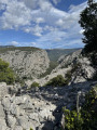
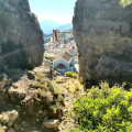
Circular walk taking in the sights on the Golgo plateau

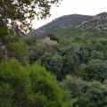
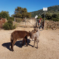
A nuraghe, natural pools, chasms, a church and a striking face carved into a cliff – these are the sights to discover on an easy walk through unspoilt countryside, amongst free-roaming pigs and donkeys. A little-visited and peaceful route, following the return from Cala Goritze, which attracts most hikers.

Details

17479105
Creation:
Last update:
Last review:
  • Walking
    Activity: Walking
  • ↔
    Distance: 2.81 mi
  • ◔
    Average duration: 1h 25 
  • ▲
    Difficulty: Easy

  • ⚐
    Back to start: Yes
  • ↗
    Ascent: + 135 ft
  • ↘
    Descent: - 135 ft

  • ▲
    Highest point: 1,329 ft
  • ▼
    Lowest point: 1,217 ft

Photos

Description of the walk

To reach the car park at the start of the hike:
- if you’re coming from the north, leave the SS 125 just before Baunei, heading towards Ristorante Golgo and Il rifugio (the road branches off to the left).
- if you are coming from the south, you will find signs for Golgo and Goloritze in the centre of Baunei (the road branches off to the right). After driving for about 8 km, leave the tarmac road at a wooden sign indicating Sas Piscinas, Voragine and Goloritze. Follow this track for about 400 m until you reach a crossroads, then park.

(S/E) Look out for large, round boulders at the edge of the track that block vehicles from passing. Go past this line of boulders, cross an open area and, under the trees, you’ll find the first pool of the “As Piscinas” complex.
Go round it on the left and, keeping to the left, rejoin a path heading north-east. On your left, you’ll pass another pool. Follow this path, which is bordered by a low wall on the left-hand side and which, further on, turns left at a right angle. Continue along it for 100 m to reach the Su Sterru chasm.

(1) This is on the left, protected by a guardrail. Continue along the path north-west and then west until you come to a track.

(2) Cross this track at right angles, then carry on in the same direction across a meadow. At the end of the meadow, take the track heading due west to the Il Rifugio car park. Exit the car park by opening the single pedestrian gate and head uphill towards this hotel, restaurant and campsite.

Walk past it on the left-hand side, climb the steps, and follow a path that leads to another set of wooden steps, this time going downhill. Walk beneath the stone face.

(3) The best vantage point for the stone face is directly beneath it. Continue downhill, passing a chasm. From the chasm, head towards the dry riverbed. After this low point, the path climbs towards information boards about the Alvo nuraghe and then on to the nuraghe itself, at the top of the hill, clearly visible. From the nuraghe, a path about fifty metres long leads to a viewpoint overlooking the pebbly riverbed below.

(4) Turn back, following the same path as on the way there, back to Il Rifugio. Walk round Il Rifugio and head towards its northern exit. Take the track leading to the Church of San Pietro.

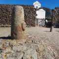
Ignore a path on the left and, at the next junction, turn left. Then head straight on towards the church. At the low wall, open the small gate on the right (close it again afterwards), and walk past a small column bearing a carved face. Go through a second gate and enter the church courtyard.

(5) From the church, retrace your steps, go through the two gates, then turn left (towards the east) and walk along the low wall. Follow this track, which is suitable for vehicles. At the next crossroads, head towards Baunei, due south.

(2) Continue straight ahead along the track. The ‘Su Sterru’ sign is high up in the foliage on the left. It points to a path that branches off to the left and leads directly back to the car park where you started (S/E).

Waypoints

  1. S/E : mi 0 - alt. 1,329 ft - Car park at the crossroads
  2. 1 : mi 0.2 - alt. 1,286 ft - Chasm
  3. 2 : mi 0.68 - alt. 1,253 ft - Path/track junction
  4. 3 : mi 1.09 - alt. 1,227 ft - Viewpoint overlooking the ‘stone face’
  5. 4 : mi 1.19 - alt. 1,247 ft - Viewpoint overlooking the river
  6. 5 : mi 1.84 - alt. 1,260 ft - Church of San Pietro
  7. S/E : mi 2.81 - alt. 1,329 ft - Car park at the crossroads

Notes

- No water sources apart from the Il Rifugio restaurant and campsite.
- Shelter in the churchyard.
- Low-cut walking shoes are sufficient.
- The road leading to the start of the walk begins in the village of Baunei. The first two kilometres of this road are very steep and feature a series of hairpin bends; long vehicles cannot access this section.

(2) Alternative route: you can turn left to rejoin the path leading to point (1).

Worth a visit

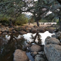
- As Piscinas are four pools of murky water where swimming is not permitted. They serve as drinking troughs for the pigs, donkeys and cattle that inhabit the plateau.
- Leaving the Church of San Pietro, at the car park, walk along the boundary wall towards the east; after about 100 metres you will find a junction signposted Cala Sisine (about fifteen kilometres away).
- Nuraghi are round towers dating from the Bronze Age. You can enter the Nuraghe d’Alvo (or Nuraghe Alvu di Genna’e Sarmentu): be aware of the risk of rockfalls. There is another nuraghe one kilometre north of the Church of San Pietro; you can reach it by taking the track leading to Cala Sisine, then following a footpath.
- Juniper wood was used to build the shepherds’ huts near the restaurant and the spectacular staircases leading up to the stone face, which is about ten metres high (Maschera di Pietra or Faccia Litica).
- The Church of San Pietro is closed to the public, but you can access its courtyard and a shelter by passing through two gates in succession; please ensure you close them behind you to keep animals out.
- To get to Cala Goritze, park at the Su Porteddu car park/campsite/restaurant, 500 metres east of the start of this walk, at the end of the track.

Reviews and comments

4.3 / 5
Based on 4 reviews

Reliability of the description
4.5 / 5
Ease of following the route
4.3 / 5
Route interest
4 / 5
JT
JT

Overall rating : 4 / 5

Date of your route : Apr 24, 2026
Reliability of the description : ★★★★☆ Good
Ease of following the route : ★★★★☆ Good
Route interest : ★★★★☆ Good
Very busy route : No

a short, easy walk off the beaten track, without the huge crowds of tourists that flock to the nearby Cala Goloritze beach in April

Machine-translated

mantix
mantix

I’m glad you enjoyed this walk. I see you managed to get past the agritourism centre – sometimes you have to go round it. Don’t miss Goloritze beach and other walks in Sardinia. Enjoy exploring.

Machine-translated

michel tout court
michel tout court

Overall rating : 4.7 / 5

Date of your route : Sep 30, 2024
Reliability of the description : ★★★★★ Very good
Ease of following the route : ★★★★★ Very good
Route interest : ★★★★☆ Good
Very busy route : No

A lovely little walk with a bit of a ‘safari’ feel to it… (donkeys, goats and cattle roaming free) which allowed us to discover lots of interesting little things.
Highly recommended

Machine-translated

Bob2a
Bob2a

We did indeed get to see the ‘human side’ of things. It’s important to follow your instructions carefully. It’s a lovely walk in spring and autumn. In summer, the heat must be intense.

Machine-translated

mantix
mantix
• Edited:

Thank you for this information: if the campsite restaurant is closed, it does make the journey a bit longer – you’ll need to take the road for cars. That wasn’t the case when we took this route. I hope you were able to see the human face on the cliff.
For children, you’ll need to hold their hands on the dangerous sections. The steps are spectacular.

Machine-translated

Bob2a
Bob2a

Overall rating : 4 / 5

Date of your route : May 02, 2024
Reliability of the description : ★★★★☆ Good
Ease of following the route : ★★★★☆ Good
Route interest : ★★★★☆ Good
Very busy route : Yes

The final section of the route needs to be altered as it passes through private property (a bar-restaurant; the exit gate via the car park is closed out of season).
Not suitable for children => the edge of the chasms is very dangerous).

Machine-translated

AGUIRRE Louise
AGUIRRE Louise

Overall rating : 4.3 / 5

Date of your route : May 08, 2022
Reliability of the description : ★★★★★ Very good
Ease of following the route : ★★★★☆ Good
Route interest : ★★★★☆ Good
Very busy route : Yes

An easy walk. Lush, pleasant vegetation. Animals roaming freely

Machine-translated

Other walks in the area

For more walks, use our search engine .

The GPS track and description are the property of this route's author. Please do not copy them without permission.