Around Ulassai

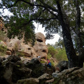
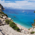
In this climber’s paradise, this walk takes you past a canyon, a summit, two caves and numerous cliffs offering magnificent views of the neighbouring villages and valleys.

Details

28550610
Creation:
Last update:
Last review:
  • Walking
    Activity: Walking
  • ↔
    Distance: 5.43 mi
  • ◔
    Average duration: 4h 05 
  • ▲
    Difficulty: Moderate

  • ⚐
    Back to start: Yes
  • ↗
    Ascent: + 1,841 ft
  • ↘
    Descent: - 1,857 ft

  • ▲
    Highest point: 3,074 ft
  • ▼
    Lowest point: 2,244 ft

Photos

Description of the walk

Once in Ulassai (SP 11 road), to reach the start of the trail, follow the signs for “Campo sportivo” or “Camping”. Park near the stadium, past the campsite.

(S/E) Take a path between the stadium and the campsite fence. At the first path after the corner of the stadium, turn left, heading north-east, until you reach a junction with a signpost for ‘Gedili’.

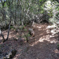
(1) Turn right towards Ulassai. Enter the Sa Tappara gorge and follow the main path, avoiding the tracks leading to the climbing routes. Head downhill and look out for the vertical sign on the cliff to your right pointing towards Ulassai. Pass underneath it and exit the gorge. Reach the town, pass by the wash house, continue downhill along Via Santa Croce and Via Chiesa, and leave the old town through an archway leading onto Piazza Barigau. Walk along the lawn, turning left then right until you reach the first road leading uphill to the left, called Via Dante Alighieri.

(2) Head towards Cagliari and go up the hill. Pass the Tourist Office, then take the first street on the right towards the Tessile cooperative. Just past this weaving workshop, a sign points to S’Arenargiu.

(3) Take the path on the right, which climbs steeply in hairpin bends towards the mountain. Further up, follow the sign for Tisiddu. The path reaches the plateau, where you’ll find a fork in the path and signposts.

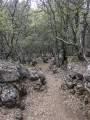
(4) Take the first path on the left, heading towards Punta Matzeu. From this fork, the path is shaded all the way to Scala 'e Predi. Continue the climb to the summit of Punta Matzeu.

(5) After enjoying the viewpoint, which offers views of the villages of Ulassai, Osini and Gairo, continue southwards along the descending path. Walk to a fork in the path.

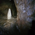
(6) Take the path on the left and walk to the Matzeu cave and back. Once you’ve passed the cave, turn back.

(6) Continue downhill. Ignore a path branching off to the left towards Jerzu. The path then turns northwards. Leave the marked path after passing some boulders to take a shortcut.

(7) Take a path on the left at a marker. It is clearly signposted but not marked with trail markers. This is a shortcut that descends westwards and avoids having to return to point 4. When it rejoins the marked trail, follow the latter to the left, heading south-west and then south. Ignore a path to the left and continue down until it turns westwards. At this point, leave the path at the next fork.

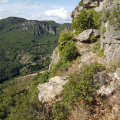
(8) Take a round trip to the cave; the main attraction is the walk along a narrow ledge overlooking the valley. Go past the cave to enjoy the view a little further on, at the end of the ledge, then turn back.

(8) Return to the signposted path, which heads south, descending steeply to a treeless terrace where you’ll find a fork (Scala 'e Predi).

(9) Turn sharply right on the steep descent, towards Barigau. Pass the sign for “Sa Genobida – Alt. 755 m” and continue northwards. The path leads to the road. Shortly afterwards, pass a spring and continue to the junction at Barigau Square.

(2) Turn left, then right. Turn left again onto Via Dante Alighieri, continue along Via Santa Croce, then turn right to return to the starting point at the sports ground (S/E).

Waypoints

  1. S/E : mi 0 - alt. 2,602 ft - Stadium and campsite
  2. 1 : mi 0.17 - alt. 2,598 ft - Gedili signpost
  3. 2 : mi 0.84 - alt. 2,329 ft - Junction: Cagliari / Campsite / Old Town
  4. 3 : mi 1.39 - alt. 2,270 ft - S’Arenargiu sign
  5. 4 : mi 1.86 - alt. 2,776 ft - Junction towards Punta Matzeu
  6. 5 : mi 2.09 - alt. 3,074 ft - Punta Matzeu summit
  7. 6 : mi 2.19 - alt. 2,946 ft - Junction towards Matzeu Cave
  8. 7 : mi 2.56 - alt. 2,890 ft - Start of the shortcut
  9. 8 : mi 3.22 - alt. 2,762 ft - Junction towards the Is Janas cave
  10. 9 : mi 3.73 - alt. 2,549 ft - Junction at Scala 'e Predi towards Barigau
  11. S/E : mi 5.43 - alt. 2,602 ft - Stadium and campsite

Notes

The route includes sections of tarmac road and very rocky, steep paths.
There is a fountain at the end of Rue Chiesa on Place Barigau and a spring on the way back.
Bring a torch if you wish to explore the caves.
You can simply set off on the walk from this point (2).
There are red-and-white markings on all the trails in the area, and signposts are often in place at junctions.

Worth a visit

- Alternative route: For the return journey, from point (2), you can cross back through the old town to the northern end of Via Regina Margherita and follow the markings for trail no. 503, known as “Sa Tappara”, which lead to point (1) Gedili and then back to the car park where you started. The ascent then takes you through a shaded woodland with views of the village of Gairo.
Numerous works of art are on display in the town.
Guided tours of the Su Marmuri cave are available.

Reviews and comments

4.8 / 5
Based on 3 reviews

Reliability of the description
5 / 5
Ease of following the route
4.3 / 5
Route interest
5 / 5
User 23774474

Overall rating : 5 / 5

Date of your route : Sep 29, 2025
Reliability of the description : ★★★★★ Very good
Ease of following the route : ★★★★★ Very good
Route interest : ★★★★★ Very good
Very busy route : No

Very beautiful hike. Thank you for the description

Machine-translated

mantix
mantix

Well done to the children if they managed the whole circular route! I suggested this route for adults as it’s long and there are some steep climbs in places. Enjoy the rest of your time in Sardinia.

Machine-translated

Foto.phil67
Foto.phil67

Overall rating : 4.7 / 5

Date of your route : Sep 16, 2024
Reliability of the description : ★★★★★ Very good
Ease of following the route : ★★★★☆ Good
Route interest : ★★★★★ Very good
Very busy route : No

A superb route with varied and magnificent scenery.
Some sections may be difficult for young children.

Machine-translated

mantix
mantix

I’m really glad you enjoyed this route. If you set off from behind the campsite, you must have made good time! I hope you found the shortcut back down via point 7 useful. Make the most of Sardinia – there are plenty of walks to enjoy.

Machine-translated

Mickael Nazca
Mickael Nazca
• Edited:

Overall rating : 4.7 / 5

Date of your route : Jun 16, 2024
Reliability of the description : ★★★★★ Very good
Ease of following the route : ★★★★☆ Good
Route interest : ★★★★★ Very good
Very busy route : No

Hello,

Thank you for sharing this walk. The instructions were very clear; I followed my GPS location on the map as I went along, and that helped me a great deal.
Breathtaking scenery and caves just waiting to be explored.
We didn’t come across a single person on this route.
It took us 4½ hours, including a 30-minute break.

Machine-translated

For more walks, use our search engine .

The GPS track and description are the property of this route's author. Please do not copy them without permission.