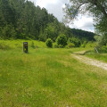
San Bartolomeo di Legio Hermitage

This is the most beautiful route for exploring the hermitage hidden within the cliff.

Details

n°36418425
Creation:
Last update:
Last review:
  • Walking
    Activity: Walking
  • ↔
    Distance: 3.98 mi
  • ◔
    Average duration: 2h 35 
  • ▲
    Difficulty: Easy

  • ⚐
    Back to start: Yes
  • ↗
    Ascent: + 837 ft
  • ↘
    Descent: - 840 ft

  • ▲
    Highest point: 2,874 ft
  • ▼
    Lowest point: 2,224 ft

Photos

Description of the walk

To reach the car park at the start of the route in the hamlet of Decontra when coming from Caramanico Terme, leave the SS487 by turning right 450 m after the bridge over the Orfento. A sign indicates Decontra is 6 km away. The car park is at the entrance to the hamlet.

(S/E) Take a dirt track that climbs north-westwards to the first junction, at a small round stone structure.

(1) Head up to the right onto a track in the direction of the path marked ‘CP’ on a sign, heading north-east. Keep heading in this direction; leave this track when it turns north and join the signposted path that cuts across the bend. Rejoin the track a little further up; it passes through a woodland and then descends into meadows where you can see piles of stones, known as ‘clapiers’. Continue to the junction with the track leading to the San Spirito hermitage.

(2) Turn left, heading north-west, and continue along the CP route (Anello di Valle Giumentina). After about 700 m, you’ll reach a crossroads marked by a post with directional signs.

(3) Leave the CP path and turn right onto the S trail (Cammino Grande di Celestino), through the meadow. As the path descends, you can see the hermitage clinging to the cliff face on the other side of the canyon. After a steep descent, cross the stream and head back up towards the hermitage; there are steps in place.

(4) The hermitage consists of a balcony and several rooms which are open to visitors. There are frescoes.
From the far end of the balcony, a path leads towards the SP22 road to Roccamorice after a curious passage carved into the rock. Turn back to rejoin the track marked CP.

(3) Turn right onto it, heading west, to complete the “Anello di Valle Giumentina” circular path. Pass an eco-museum on your right. A dirt track begins. Cross a bridge and follow the straight path ahead, which leads to a junction about 150 m further on.

(5) Turn left onto the dirt track which crosses fields heading south. It reaches a junction marked by numerous signposts.

(6) Turn left onto the road which climbs up to the junction of several paths and the round stone structure seen earlier.

(1) Head back down the path opposite, following the route in the opposite direction to the way you came, towards the Decontra car park (S/E).

Waypoints

  1. S/E : mi 0 - alt. 2,661 ft - Decontra car park
  2. 1 : mi 0.11 - alt. 2,684 ft - Round stone structure – Carrf. de la circular structure
  3. 2 : mi 0.88 - alt. 2,792 ft - Junction towards San Spirito
  4. 3 : mi 1.32 - alt. 2,621 ft - Junction leading to the S. Bartolomeo di Legio hermitage
  5. 4 : mi 1.75 - alt. 2,231 ft - Ermitage San Bartolomeo in Legio
  6. 5 : mi 2.83 - alt. 2,411 ft - Junction towards Decontra
  7. 6 : mi 3.14 - alt. 2,418 ft - Junction leading to the finish
  8. S/E : mi 3.98 - alt. 2,661 ft - Decontra car park

Notes

Notes from June 2023.
Shelter at the hermitage, no drinking water.
The route is partially shaded up to the point (2).
Equipment suitable for mid-mountain hiking.
The steps at the hermitage may be slippery; the paths may be muddy.
Covering clothing recommended due to the possible presence of ticks.

Worth a visit

  • The eco-museum (admission fee applies) on the route, between (3) and (5), is not always open.
  • You may spot deer at the edge of the woods (early in the morning) and wild boar in the fields.
  • Look out for the piles of stones (clapiers) built to clear the meadows of unwanted stones.
  • The trail follows part of the “Cammino Grande di Celestino”, a route comprising 13 stages.
  • Several hermitages can be visited in the Maiella massif.
  • The village of Caramanico Terme offers the chance to stock up on supplies, find accommodation and get information at the park visitor centre, at the top of the village. It is also the starting point for another shaded walk through the Orfento Gorges.

Reviews and comments

4.7 / 5
Based on 1 review

Reliability of the description
5 / 5
Ease of following the route
5 / 5
Route interest
4 / 5
mantix
mantix

Thank you for your comment. It’s true that in May we saw six people at the hermitage and no one else on our route… But you can’t always choose your dates… All the best!

Machine-translated

57452
57452
• Edited:

Overall rating : 4.7 / 5

Date of your route : Aug 16, 2023
Reliability of the description : ★★★★★ Very good
Ease of following the route : ★★★★★ Very good
Route interest : ★★★★☆ Good
Very busy route : Yes

A lovely walk; there were lots of people at the hermitage – I think it’s best to avoid August.

Machine-translated

Other walks in the area

For more walks, use our search engine .

The GPS track and description are the property of this route's author. Please do not copy them without permission.