
Corno Grande – Western Summit

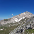
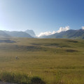
It is the highest point in Abruzzo and indeed on the Italian peninsula: a hike with a ‘high-mountain’ feel where you’ll need to use your hands to make your way along the Via delle Creste. A magnificent view of Campo Imperatore and the Gran Sasso massif in all directions.
Please note: be sure to take note of the comments in the ‘Practical Information’ section.

Details

n°37456146
Creation:
Last update:
Last review:
  • Walking
    Activity: Walking
  • ↔
    Distance: 6.38 mi
  • ◔
    Average duration: 5h 35 
  • ▲
    Difficulty: Difficult

  • ⚐
    Back to start: Yes
  • ↗
    Ascent: + 3,009 ft
  • ↘
    Descent: - 2,999 ft

  • ▲
    Highest point: 9,436 ft
  • ▼
    Lowest point: 6,975 ft

Photos

Description of the walk

To reach the car park where the walk starts from Fonte Cerreto, head towards Castel del Monte via the SS17bis road; after 17 km, turn left onto the SR17bis/C road and continue to Campo Imperatore, 10 km away.

(S/E) From the car park, head north-west along a well-marked path signposted with white and red rectangles. Pass above the astronomical observatory and arrive at a junction.

(1) Ignore path no. 101, which branches off to the right, and follow path no. 100D, climbing up a series of hairpin bends until you reach the Duca degli Abruzzi mountain hut.

(2) Leave the refuge on your left and head north-east, following the ridge along a small, unmarked path to the summit of Picco Confalonieri.

(3) Descend to a pass, then follow the ridge towards the next summit. Descend to the Sella di Monte Aquila pass.

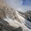
(4) At the signpost for Corno Grande Vetta Occidentale, follow the marked route no. 103 for approximately 150 m. Turn left at the signposts, staying on route no. 103. Walk along the mountainside heading north, leaving the path leading to the Garibaldi Refuge on your left, and follow the path heading west through a large scree slope (or snowfield, depending on the season) until you reach a ridge.

(5) Climb northwards and then, when the track turns eastwards, look out for large white dots circled in red – which replace the rectangular markings – and follow them. Walk almost level along the ridge until you reach the start of a steep slope.

(6) From this point, follow the white and red markings that indicate the route (Via delle Creste) very closely, to the nearest metre. Go to the right or left of the ridge line as indicated by these two-coloured round markers, using your hands to help you climb the rocks. Use a metal bar fixed into the rock at a more tricky section. Cross any remaining snowfields. Continue to the summit, marked by a cross.

(7) Then descend back down the same route you took on the ascent to the Sella di Monte Aquila.

(4) At the signpost for Campo Imperatore, follow path no. 101: leave the ridge and head down a steep slope. Further down, continue along the mountainside to the next junction, which you have already passed on the way up.

(1) Continue down the path, following the route in the opposite direction to the ascent, to return to the car park (S/E).

Waypoints

  1. S/E : mi 0 - alt. 6,982 ft - Campo Imperatore car park
  2. 1 : mi 0.39 - alt. 7,221 ft - Junction of the circular path. Paths 101/100D
  3. 2 : mi 0.76 - alt. 7,822 ft - Refugio Duca degli Abruzzi
  4. 3 : mi 0.95 - alt. 7,884 ft - Picco Confalonieri
  5. 4 : mi 1.38 - alt. 7,657 ft - Sella di Monte Aquila
  6. 5 : mi 2.55 - alt. 8,120 ft - Sella del Brecciaio
  7. 6 : mi 2.94 - alt. 8,619 ft - Start of the climbing hike
  8. 7 : mi 3.34 - alt. 9,409 ft - Corno Grande Vetta Occidentale summit, 2,912 metres
  9. S/E : mi 6.38 - alt. 6,982 ft - Campo Imperatore car park

Notes

Observations from the day of the ascent, late June 2023:

  • Along the route, the staffed Duca degli Abruzzi mountain hut offers accommodation, meals and drinks.
  • There is no mobile signal: it is advisable to download the map and the route track.
  • The hike takes place in the mountains: rocky paths, snow or ice, and sections where you’ll need to use your hands to make progress. You should therefore bring appropriate kit, and a helmet is even recommended due to rockfalls caused by melting snow or by hikers further up the slope. Depending on the temperature, crampons may be necessary.
  • Clouds are common on this peak, even in the absence of strong winds.
  • This route is known for being very busy.
  • You can avoid a few slopes on the way up by going directly from (1) to (4).
  • In Italy, the Via delle Creste is graded EE, i.e. for experienced hikers, or EEA, i.e. for experienced hikers with equipment, depending on conditions.

Worth a visit

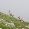
  • Between (4) and (1), chamois can be spotted at the end of the day.
  • Restaurants and bars are open in season at Campo Imperatore, a ski and mountain resort.
  • The Directissime route (very littered with loose rocks) and the Normale route (which remains snow-covered late into the season) lead to the summit.

Reviews and comments

4.7 / 5
Based on 1 review

Reliability of the description
5 / 5
Ease of following the route
4 / 5
Route interest
5 / 5
mantix
mantix

Thanks for the feedback.
I imagine you’ve had plenty of snow this season, and the ice axe and crampons must have come in handy, didn’t they?

Machine-translated

PETITJULES41
PETITJULES41

Overall rating : 4.7 / 5

Date of your route : Apr 28, 2025
Reliability of the description : ★★★★★ Very good
Ease of following the route : ★★★★☆ Good
Route interest : ★★★★★ Very good
Very busy route : Yes

to do

Machine-translated

For more walks, use our search engine .

The GPS track and description are the property of this route's author. Please do not copy them without permission.

