From Valbone to Theth and back – the Albanian Alps

Discover two very different slopes: mountain pastures and beech woodland. At the pass, there’s a 360° view with the option of an additional ascent. You can use this route to walk just one way from Valbone to Theth or vice versa, as hikers usually do; they sometimes hire horses to carry their rucksacks. The hike is challenging if you do the round trip due to the distance, but presents no technical or route-related difficulties.

Details

2388282
Creation:
Last update:
Last review:
  • Walking
    Activity: Walking
  • ↔
    Distance: 12.07 mi
  • ◔
    Duration according to the author: 8 hrs 
  • ▲
    Difficulty: Very difficult

  • ⚐
    Back to start: Yes
  • ↗
    Ascent: + 6,217 ft
  • ↘
    Descent: - 6,217 ft

  • ▲
    Highest point: 6,070 ft
  • ▼
    Lowest point: 2,552 ft

Photos

Description of the walk

To reach the starting point, walk past the Fusha e Gjesë hotel at the end of the tarmac road in the Valbone valley, continue along the gravel track for 2.8 km and park in a meadow between Llomi and Rragam.

(S/E) The start of the path is marked by a signpost. It is signposted with small red-and-white markings. It sets off to the right of the signpost, up the slope, and winds its way through fields and past a few scattered houses. The slope is gentle as far as Café Emanueli.

(1) Immediately after this café, turn right at a right angle along the fence at the steepest part of the slope. Blue and red arrows indicate the direction. From here, follow the large white-red-white markers all the way to Theth. The climb is steep.

(2) Cross the bed of a torrent, the Përroo Valit.

(3) Pass under a majestic beech tree and, a few dozen metres further on, above Café Simoni. Continue west-north-west until you reach a fork in the path.

(4) A signpost indicates Theth (Thethi) to the left. From here on, the trees are very low and, after crossing the small valley, the path zigzags up a steep slope before turning south.

(5) The path runs horizontally beneath a cliff face and leads easily to the Valbone Pass, ‘Qafa Valbonës’.

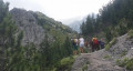
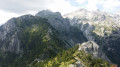
(6) From the pass, enjoy the view over the Valbone and Theth valleys, as well as all the surrounding peaks.
Leave the path leading to two peaks on your left – we’ll see them on the way back. The descent to the right heads west; there is no other track. The path passes through a magnificent beech forest and reaches the Krojnat bar, a hut offering drinks and camping facilities.

(7) Three hundred metres further down, the river also provides a source of drinking water. From this point, the path winds through woods and meadows.
If you do not wish to visit Theth, you can turn back and return to Valbone, as the landscape remains largely the same and the temperature rises as you descend, which can make the return journey arduous in summer.
The route heads south-west, then, after a junction, north-west until you approach Theth.

(8) Water tower. This marks the start of the village of Theth, which is quite sprawling. Take the track that descends steeply and you’ll arrive near a guesthouse, Bujtina Lek Shkafja.

(9) From here, follow the 4x4 track to the right. After several bends, you’ll reach a torrent.

(10) After the bridge over the stream, follow the widest track to reach the centre of Theth, where the outbound trail ends.

(11) If you wish to spend some time in Theth, see tips and information under ‘During the hike or nearby’. The campsite is less than 1 km further south on Rruga Fushë. The return journey follows the same route.

(6) Once back at the Valbone Pass, head right towards two small peaks to the south-west. The path leading to them is very steep, so caution is advised.

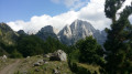
(12) Two small peaks to the south-west of the pass offer stunning views.

(3) Return to the pass.

(6) Turn right onto the return path to the car park (S/E)

Waypoints

  1. S/E : mi 0 - alt. 3,599 ft - Llomi/Rragam
  2. 1 : mi 0.62 - alt. 3,812 ft - Café Emanueli
  3. 2 : mi 0.9 - alt. 4,012 ft - Torrent
  4. 3 : mi 1.36 - alt. 4,760 ft - Hêtre then Simoni kafe
  5. 4 : mi 1.77 - alt. 5,066 ft - Thethi–Zerka junction
  6. 5 : mi 2.15 - alt. 5,699 ft - Cliff
  7. 6 : mi 2.47 - alt. 5,892 ft - Valbone Pass (Qafa Valbonës)
  8. 7 : mi 3.37 - alt. 4,921 ft - River (water source)
  9. 8 : mi 4.86 - alt. 3,281 ft - Water tower
  10. 9 : mi 4.96 - alt. 3,159 ft - Bujtina "Lek Shkafja"
  11. 10 : mi 5.31 - alt. 2,927 ft - Bridge
  12. 11 : mi 5.81 - alt. 2,556 ft - Rruega Nikgjuonaj - Theth (Thethi)
  13. 12 : mi 9.25 - alt. 5,932 ft - Small peak
  14. 13 : mi 9.41 - alt. 6,053 ft - Highest point of the hike
  15. S/E : mi 12.07 - alt. 3,599 ft - Llomi/Rragam

Notes

In good weather, standard hiking kit is sufficient.
Three bars and a stream provide opportunities to top up your drinks. There is no shelter between the Simoni and Krojnat bars.

For points (12) and (13), the route runs along the edge of precipices. As the reliability of GPS cannot be guaranteed, you should rely on the actual terrain rather than on technology.

Worth a visit

To explore Theth without public transport: As the SH 21 road is unpaved as far as Theth, you can only reach the village by 4x4 vehicle or by special buses departing from Shkodra.
You can also catch these buses en route (at Qafa Buni i Thores or Qafë e T’Thores). However, Valbone is very easy to reach by car, which is the appeal of this hike: it allows you to get to Theth without public transport, starting from Valbone.

A day’s stop in Theth gives you the chance to enjoy hiking and swimming: the Blue Eye, waterfalls, rivers, the church, the tower and the mill. A festival is held there in early August.

There are plenty of places to stay in Theth. Near the main bridge (which can be considered the start of the village centre, stretching as far as the cloistered tower), you’ll also find a small grocery shop and a restaurant, which means you don’t have to overload your rucksack.

Houses are scattered throughout the valley, at the bottom and on the slopes; some accommodation is situated at high altitudes or some distance from the centre. You should bear this in mind if booking in advance, which is advisable during the high season.

Reviews and comments

4.3 / 5
Based on 3 reviews

Reliability of the description
4 / 5
Ease of following the route
4 / 5
Route interest
5 / 5
mantix
mantix
• Edited:

Yes, the Teth Valley is stunning. What’s more, back in 2019 you could only get there by 4x4 or on foot, so it felt like you were at the end of the world… (except for the Blue Eye…) It’s also worth taking the road to Lotaj or walking to Vermosh. In short, there’s plenty to do in the Cursed Mountains!

Machine-translated

plebuse
plebuse

Yes, I agree – the Valbona side is more beautiful and the trail more interesting! The last 2 km on the Theth side were a bit of a slog for us, with a constant stream of walkers. No pigs in sight!
The two days in Theth were well worth it to do the short hike listed on Visorando, as the views are superb and the scenery is very varied (walking through the mountain pastures in particular).

Machine-translated

mantix
mantix

Thanks for those details. It’s true that I had a 4x4 to take me part of the way at the start; that avoids a flat, boring beginning. I jogged almost the whole way and ran whenever I could. It’s a demanding hike because you normally do it in two stages… The mule caravans also slow you down. I preferred the Valbona side for its more alpine character. On the Teth side, the track is tedious and long, and the views are less spectacular. I wonder if there are still pigs roaming free after the start…

Machine-translated

plebuse
plebuse

Overall rating : 4.3 / 5

Date of your route : Aug 04, 2026
Reliability of the description : ★★★★☆ Good
Ease of following the route : ★★★★☆ Good
Route interest : ★★★★★ Very good
Very busy route : Yes

A two-day hike (Valbona – Teth, two days in Teth with a superb circular route through the mountain pastures, then back on the third day). It seems quite a challenge to do the round trip in one go, bearing in mind that on the Valbona side it actually starts 1.5 km before the signposted starting point. In any case, we wouldn’t have managed it given the elevation gain (at least 1,800 metres in total, with steep climbs on both sides of the valley and virtually no flat sections). But it’s by no means impossible; in fact, we were with our two teenagers, who are keen walkers and completed the hikes without any trouble. We set off at 6 am on both occasions (and arrived around midday, having taken quite a few breaks), and I’d recommend doing so to avoid the crowds of tourists – it is a bit of a ‘mass hike’ after all, even if the scenery is splendid.
There are quite a few descents over loose stones, which aren’t particularly pleasant, especially on the Teth side.

Machine-translated

mantix
mantix

Thank you for this information.
As is often the case in Albania, the villages aren’t like those in Tuscany – you’re quite right. You’re also right about the risk of cold weather: the pass is at a high altitude. If you’re only doing the outward journey, you’ll need to find accommodation in Teth or catch a bus straight back to Shkodër. There are other ways to enjoy these ‘cursed’ mountains, as they’re known, apart from this route, as there are plenty of walks through landscapes that are still very unspoilt.

Machine-translated

Philou6231
Philou6231

Overall rating : 4.3 / 5

Date of your route : Jul 31, 2022
Reliability of the description : ★★★★☆ Good
Ease of following the route : ★★★★☆ Good
Route interest : ★★★★★ Very good
Very busy route : Yes

Hike completed at the end of July, following only the Valbone to Theth route (stages 1 to 10), but taking a short detour to see the peaks (stages 12 and 13).
Duration: 6 hours, including breaks, and without rushing too much (but at a relatively ‘steady’ pace).
Some of the climbs are quite challenging, particularly if you’re carrying a heavy rucksack (though nothing too daunting for experienced hikers).
As it’s a very dry time of year, there are few places to top up your water supplies, so make sure you take enough to avoid dehydration.
Despite the heatwave, we were unlucky enough to be caught in a downpour upon reaching the summit (to the point of feeling cold). So, a windbreaker and a light fleece might be necessary.
As is the case elsewhere in Albania, stray dogs are sometimes present. They’re very calm and can make for friendly travelling companions (but always remain cautious).
A challenging hike with some stunning views, which I’d highly recommend. That said, I found the two villages rather dull (though they’ll probably become more interesting in a few years’ time...).
On a side note: the boat journey from Koman didn’t go well for us; the ferry was overcrowded and there was quite a lot of rubbish in the water – what a shame…

Machine-translated

JODIDO
JODIDO
• Edited:

I did indeed stick to this Teeth/Valbona circular route, as I was determined to return to Shkodër via Lake Koman. And I didn’t regret my decision. The two and a quarter hours spent on the ferry travelling down through the magnificent gorges will remain a wonderful memory!
I intend to return to this region with my car, using Valbona as a base, so I can explore the surrounding mountains...

Machine-translated

mantix
mantix
• Edited:

Well done, great performance on the climb! I hope you enjoyed the beech forest and the peaks to the right of the pass! There’s another one to the left, but it takes longer to climb.
It’s quite common to just do the one-way route from one village to the other. The downside is the stony track and the road leading to the accommodation in Valbona. Using your car from Valbona lets you avoid this uninteresting bit: my suggestion allows you to see both villages in a single day, which is hardly possible from Theth without a 4x4. To really appreciate Theth, you need to stay there for two days and go for a wander; the valley is long and well worth a visit...
I noticed that there were just as many walkers heading in one direction as in the other, but they’d set off early (risk of thunderstorms, right?) and they passed each other around midday at the pass, not at 2 pm – that’s why I think you didn’t see them.
Don’t hesitate to spend several days in these valleys: you can pop over to Montenegro and Kosovo – it’s very unspoilt.
To add some tourist information, I saw lots of tourists doing the following circular route: Shkodër – bus – Theth – hike – Valbona – bus – Fierze – ferry across Lake Koman – Koman – bus – Shkodër. And the reverse route is also possible.

Machine-translated

JODIDO
JODIDO
• Edited:

Overall rating : 5 / 5

Date of your route : Aug 14, 2019
Reliability of the description : Not used / Not applicable
Ease of following the route : Not used / Not applicable
Route interest : ★★★★★ Very good

I didn’t use the information provided by Visorando about this hike, as I only discovered today, 9 November 2019, that it is listed on the website.
I only did the Theth–Valbona section, and found myself caught in a terrible storm whilst descending into the Valbona valley. I was soaked from head to toe, and the clothes in my rucksack got wet too…! And it wasn’t exactly warm either!
I took a minibus at 7.30 am from Shkodër (1,200 leks, or €10), because even though I’d come to Albania in my car, there was no way I was going to drive it given the state of the track beyond the pass. It took us an hour and a half to cover about 30 km. As the little village of Theth didn’t really inspire me, I set off straight away on the hike at around 11.30 am. The climb up to the pass isn’t steep, and I reached the top in 2 hours 30 minutes. There were few hikers heading in this direction; most seemed to be coming from Valbona, and some had hired donkeys to carry their rucksacks. The scenery is somewhat reminiscent of the mountains in the Champsaur, the Écrins or the Queyras at an altitude of 1,000–1,200 metres.
At the bottom of the Valbona valley, you have to tackle a long cobbled track, as well as a stretch of road, before reaching the mountain-style village, where I found a room for €13, breakfast included. There were few shops, just a sort of small grocery store and a few restaurants in guesthouses…So it took me about 6 hours to get to Valbona from Theth.
It’s possible to climb a peak at 2,700 metres (one of the highest in the country) from Valbona, but I didn’t have time to do that hike.

Machine-translated

Other walks in the area

For more walks, use our search engine .

The GPS track and description are the property of this route's author. Please do not copy them without permission.