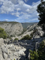
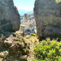
Cala Goloritze beach in Sardinia

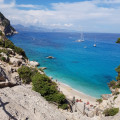
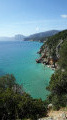
This is the quickest route to the famous Sardinian beach, a valley that opens out onto a picture-postcard sea.

Details

17106205
Creation:
Last update:
Last review:
  • Walking
    Activity: Walking
  • ↔
    Distance: 4.33 mi
  • ◔
    Average duration: 3h 25 
  • ▲
    Difficulty: Moderate

  • ⚐
    Back to start: Yes
  • ↗
    Ascent: + 1,673 ft
  • ↘
    Descent: - 1,667 ft

  • ▲
    Highest point: 1,542 ft
  • ▼
    Lowest point: 39 ft

Photos

Description of the walk

To reach the car park at the start of the walk:
- if you’re coming from the north, leave the SS 125 just before Baunei, heading towards Ristorante Golgo and Il rifugio (the road branches off to the left),
- if you are coming from the south, you will see signs for Golgo and Goloritze in the centre of the village (the road branches off to the right). After driving for about 8 kilometres, leave the tarmac road at a wooden signpost indicating Sas Piscinas, Voragine and Goloritze. The track ends after about one kilometre and leads to the Su Porteddu car park, which is also a campsite and a bar-restaurant.

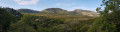
(S/E) Head towards the nature warden’s kiosk, then go through the gate on the right and follow the well-marked path. Climb through the scrubland, then descend slightly to reach a viewpoint overlooking the coast.

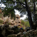
(1) Begin the descent through sparse heath. Note a cave on the right which can serve as a shelter. Reach the lowest point of the valley. Old oak trees line the path. You’ll come to another cave on the right.

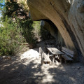
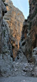
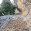
(2) Continue the descent, alternating between sections under the trees and open stretches. You’ll occasionally pass at the foot of cliffs and even under an arch. Ignore a path that climbs steeply to the left; carry on down to reach the picnic area beneath the cliff and the rock shelter.
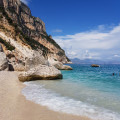
Take the steps with wooden handrails to reach Cala Goloritze beach.

(3) Follow the same route in the opposite direction to return to the Su Porteddu car park (S/E).

Waypoints

  1. S/E : mi 0 - alt. 1,309 ft - Su Porteddu car park and campsite
  2. 1 : mi 0.59 - alt. 1,493 ft - Viewpoint overlooking the coast
  3. 2 : mi 0.89 - alt. 1,161 ft - Caves converted into shelters
  4. 3 : mi 2.17 - alt. 39 ft - Cala Goloritze Beach
  5. S/E : mi 4.33 - alt. 1,309 ft - Su Porteddu car park and campsite

Notes

- Bring suitable footwear for rocky terrain and plenty of water. A snorkel and mask are recommended.
- There’s no water, but caves can provide shelter.
- The number of people allowed access to the beach is limited to 250 per day (October 2021), which is a lot for such a small beach. In summer, it’s best to book and pay for access online (€6) via the Heart of Sardinia app a few days before your hike.
- The entrance kiosk opens at 7.30 am. You can buy your ticket there or have your e-booking checked. The rangers will check your footwear and give you advice on the walk.
- It’s essential to set off as soon as the barrier opens if you want to enjoy the beach for a while before it gets crowded.
- The road leading to the start of the walk begins in the village of Baunei. The first two kilometres of this road are very steep and feature a series of hairpin bends; long vehicles cannot access it. Near the start of the walk, the road is unpaved.

Worth a visit

- This beach (unsupervised for swimming, but a nature warden is present) can be reached via the described path or by boat. However, boats do not moor there; they must remain 300 metres from the shore.
- The route described crosses a path that links Santa Maria Navarrese to Cala Gonone over several days.
- There are two campsites and a lodge near the start. The Su Porteddu campsite, bar and restaurant also serves as a car park for the start of the walk.
- At the start of the walk, the Golgo plateau offers some interesting sights.
(3) View of the Aguglia peak and its vertiginous climbing routes.

Reviews and comments

4.2 / 5
Based on 4 reviews

Reliability of the description
3.8 / 5
Ease of following the route
4.3 / 5
Route interest
4.5 / 5
Sand84
Sand84

Overall rating : 5 / 5

Date of your route : Aug 31, 2026
Reliability of the description : ★★★★★ Very good
Ease of following the route : ★★★★★ Very good
Route interest : ★★★★★ Very good
Very busy route : Yes

This walk requires a lot of effort on the way back, as there is a 450-metre climb over 2 km.

Machine-translated

User 4286033

Overall rating : 4.3 / 5

Date of your route : Feb 26, 2026
Reliability of the description : ★★★★☆ Good
Ease of following the route : ★★★★☆ Good
Route interest : ★★★★★ Very good
Very busy route : No

Out of season, in February, in the sunshine, it’s magical (and almost deserted, and free). The climb is steep, and given the exposure and the terrain, you should try to arrive early (before 1 pm, say, in February) to make the most of the sunshine.

Machine-translated

mantix
mantix
• Edited:

Hello, as I wrote , there is an admission charge. At the moment it will cost you 7 euros, or 14 euros for two, if you book via the website I mentioned. It’s definitely best to book in advance, especially in the summer. For example, for tomorrow, Sunday 27 April, there are 199 places left out of a total of 250... So you can turn up at reception tomorrow – there’ll be places available, unless you arrive late… Please note that the site closes at 5 pm…

Machine-translated

veroxx
veroxx

Overall rating : 2.3 / 5

Date of your route : Apr 25, 2025
Reliability of the description : ★☆☆☆☆ Very disappointing
Ease of following the route : ★★★☆☆ Average
Route interest : ★★★☆☆ Average
Very busy route : Yes

There’s a €14 charge to access the path! And you have to book in advance!

Machine-translated

mantix
mantix

The climb back up… take it easy and make sure you’ve still got plenty of water! Carry on exploring the area by visiting the sights on the Golgo plateau, but do so when it’s cooler…

Machine-translated

Laurent Lapedra
Laurent Lapedra

Overall rating : 5 / 5

Date of your route : Jul 17, 2023
Reliability of the description : ★★★★★ Very good
Ease of following the route : ★★★★★ Very good
Route interest : ★★★★★ Very good
Very busy route : Yes

A lovely walk and a fantastic cove.
But beauty comes at a price – the walk back uphill is a bit of a struggle after a day at the beach.

Machine-translated

Other walks in the area

For more walks, use our search engine .

The GPS track and description are the property of this route's author. Please do not copy them without permission.