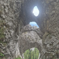
On the slopes of La Om in Piatra Craiului National Park

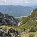
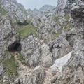
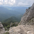
Magnificent karst formations await you after you’ve crossed a dense forest: arches, faults, gullies and caves. The climb is steep through the forest and becomes even steeper once you emerge, to the extent that cables have been fixed into the rock face. This challenging route, known as La Zaplaz, was first opened in 1886. From the top, the view stretches across the entireZărneştivalley. See the practical information below regarding access rights and safety.

Details

100983488
Creation:
Last update:
Last review:
  • Walking
    Activity: Walking
  • ↔
    Distance: 6.45 mi
  • ◔
    Average duration: 6h 10 
  • ▲
    Difficulty: Very difficult

  • ⚐
    Back to start: Yes
  • ↗
    Ascent: + 3,698 ft
  • ↘
    Descent: - 3,684 ft

  • ▲
    Highest point: 6,453 ft
  • ▼
    Lowest point: 2,805 ft

Photos

Description of the walk

To reach the start of the hike, leaveZărneştivia the west on Road 50A, passing the Visitor Centre (Centrul de Vizitare Parcul Național Piatra Craiului), from where you should drive for about 9.4 km to the end of the road, where you can park on the hard shoulder.

(S/E) Head south along the main track for about 300 metres, then go through the barrier marking the boundary of the national park (toll applies). Walk a short distance alongside the river until you reach a trailhead on the left.

(1) Take this path. After leaving the track, cross the ford and head uphill through the forest to a second ford.

(2) After the second ford, the path turns south-east, continuing through the forest until you reach the third ford.

(3) Continue in the same direction until you reach a sign at a bend heading west.

(4) Take the bend in the direction signposted ‘Refuge Spirla’ (15 minutes’ walk) and follow the path through the beech trees, which becomes steep, up to the refuge.

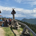
(5) Walk past the very basic, unstaffed refuge and take the path through the coniferous trees, heading south-east, until you reach another sign marking a junction towards La Om.

(6) Follow the sign for “La Om 3 hours, difficult route” heading east, to the left, then head south up a steep scree slope. At the top of this scree slope, take a ledge where there is an old sign indicating “La Zaplaz 1640 m” and “La Om 2–2.5 hours”.

(7) Continue along the ledge eastwards and look up at the four limestone arches in the cliff face. At the end of the ledge, veer to the right and proceed to the foot of a chimney equipped with a cable.

(8) Once you have climbed the fifteen metres of the chimney, look down at the four natural arches from above. Continue climbing the rock face, which is equipped with cables at the tricky sections. At the top of a slope, the path heads towards a ravine.

(9) Head towards the top of the ravine and memorise the route for the descent; this will prevent you from descending straight down into the ravine instead of heading to the right. Continue eastwards along the couloir to a ridge passage between two ravines, which forms a small pass.

(10) Descend a few metres opposite a cave and head into the rock face to its right. The route continues up a chimney to the edge of a meadow where the slope levels out.

(11) Turn round and follow the route in the opposite direction to return to the starting point (S/E).

Waypoints

  1. S/E : mi 0 - alt. 2,815 ft - Roadside car park
  2. 1 : mi 0.68 - alt. 2,953 ft - Junction of track and footpath, and ford
  3. 2 : mi 1.05 - alt. 3,123 ft - Second ford
  4. 3 : mi 1.44 - alt. 3,422 ft - Third ford
  5. 4 : mi 2.13 - alt. 4,278 ft - Sign at a bend indicating the Spirla Refuge
  6. 5 : mi 2.36 - alt. 4,659 ft - Spirla Mountain Hut
  7. 6 : mi 2.71 - alt. 5,135 ft - Junction towards La Om
  8. 7 : mi 2.95 - alt. 5,574 ft - Old sign on the ledge
  9. 8 : mi 2.99 - alt. 5,702 ft - Chimney with cable
  10. 9 : mi 3.03 - alt. 5,814 ft - Gorge
  11. 10 : mi 3.15 - alt. 6,345 ft - Small pass
  12. 11 : mi 3.23 - alt. 6,424 ft - High-altitude meadow
  13. S/E : mi 6.45 - alt. 2,815 ft - Roadside car park

Notes

You must pay an entry fee to hike in this national park; this can be done online or at a machine that only accepts cash at the Visitor Centre: Centrul de Vizitare al Parcului National Piatra Craiului, 1 km from Zarnesti. 10 Lei, or approximately 2 euros, for 7 days in 2026. At this centre, you can buy a map of the entire park for 25 lei in 2026, at a scale of 1:30,000, which includes not only marked footpaths but also mountain bike trails and information on the environment.

There is no drinking water along the route. A shelter called Refugiul Spirla – a red and white, dome-shaped structure made of fibreglass – provides a place of refuge but offers no other facilities.

From the point (6), walkers will need to be accustomed to using cables to help them make their way.

There are sheepdogs at the start of the route, and there is a chance of encountering bears: you may notice scratch marks, fur at the base of trees and droppings, particularly near the cave at point (10). On this subject, advice is provided by nature rangers: speak loudly, make noise, and use a whistle or a horn. Signs recommend pepper spray, but no shop had any in stock during our visits.

The route described was walked in late June 2026 and was free of snow, apart from a few snowfields that were easy to avoid. The trail does not go all the way to the summit of La Om, as the geological features are less spectacular higher up.

The route is marked by a white square crossed by a red line. Apart from at the junction (1), the markings are very clearly visible.

There is little mobile coverage on this route, so you should download the map and the route file before setting off. As always in steep terrain, the GPX track should be followed with caution.

Worth a visit

Other, easier walks are available, notably a circular walk heading south from point (6).

Inside the Visitor Centre, there is a museum area showcasing the National Park’s ecosystems; admission is free for holders of the 7-day Park pass, otherwise it costs 5 Lei.

For more walks, use our search engine .

The GPS track and description are the property of this route's author. Please do not copy them without permission.