


alsaco2

 Visorando Member
 Premium user
 - Gender: man
Sign up:
Published route(s)
 Beautiful vineyards in Itterswiller, Bernardvillé and Reichsfeld
 7.02 mi
 +686 ft
 -663 ft
 3h 50
3h 50
 Moderate
 Departure from Epfig (Bas-Rhin)
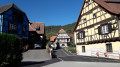
A 360° view of one of the most beautiful vineyards in the Bas-Rhin, with views of the Vosges foothills.In good weather, you can see Strasbourg Cathedral, the Black Forest and even the Bernese Alps.An easy walk in the Schernetz valley, through the vineyards, including two famous localities: the "Sohlenberg" (pink Vosges sandstone) and the "Shiefferberg" (schist soil).The route passes through three authentic villages and the Chapel of the 14 Saints, adjacent to Baumgarten Abbey.
La Grande Bellevue from Le Hohwald village
 7.76 mi
+1,083 ft
-1,096 ft
4h 30
Moderate
Departure from Le Hohwald (Bas-Rhin)
7.76 mi
+1,083 ft
-1,096 ft
4h 30
Moderate
Departure from Le Hohwald (Bas-Rhin)
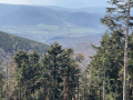
Hohwald is a bit like our own “Little Switzerland of Alsace”. A distinctly Swiss calm and a sense of tranquillity. The hike takes place mainly on forest roads, paths and trails (around 4 hours, excluding breaks), suitable for families, with lovely views of the village and some nearby peaks such as the Neuntelstein (970 m) and the Ungersberg (901 m). On a clear day, you can see the Haut-Koenigsbourg (757 m) and the Rocher du Coucou (856 m).
Kreutzweg and Charbonnière passes, Tannhütte refuge
 7.55 mi
+1,913 ft
-1,909 ft
5h 10
Moderate
Departure from Bas-Rhin
7.55 mi
+1,913 ft
-1,909 ft
5h 10
Moderate
Departure from Bas-Rhin
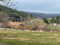
Below the Champ du Feu, this pleasant route descends almost to the entrance of the village of Breitenbach. It is of moderate difficulty with some steep climbs nonetheless, especially the challenging one that ends the hike, but also some lovely descents.Forest tracks and narrow paths, beautiful trees and stunning views, plus a lovely shelter for a mid-route lunch break, feature throughout this route.
Le Voyemont and the Roche des Fées viewpoint via the Hang shelter
 9.68 mi
+1,450 ft
-1,447 ft
5h 45
Moderate
Departure from Ranrupt (Bas-Rhin)
9.68 mi
+1,450 ft
-1,447 ft
5h 45
Moderate
Departure from Ranrupt (Bas-Rhin)
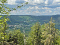
A mix of magnificent cow pastures and beautiful coniferous forests with stunning views. A preserved valley with a few farms and the odd holiday home, at the foot of one of the valley’s legendary peaks, the Climont (966 m). A haven of peace – picture-postcard perfect!The route is suitable for beginner hikers, though the climb to the Refuge du Hang and on to the Belvédère de la Roche des Fées may seem challenging for those less accustomed to hiking and requires a reasonable level of fitness.
Lac Noir, Col du Calvaire and Lac Blanc circular
 6.10 mi
+1,102 ft
-1,099 ft
3h 45
6.10 mi
+1,102 ft
-1,099 ft
3h 45
 Difficult
Departure from Orbey (Haut-Rhin)
Difficult
Departure from Orbey (Haut-Rhin)
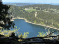
10 km with stunning views of two glacial lakes. The largest and highest, Lac Blanc (depth 72 m) covers 29 ha at an altitude of 1,055 m; Lac Noir (depth 45 m) covers 14 ha at 955 m. Breathtaking views from the Belmont Observatory. Don’t forget your camera.
 Snowshoe tour in the Mauselaine ski area
6.06 mi
+1,198 ft
-1,204 ft
4 hrs
Moderate
Departure from Gérardmer (Vosges)
A lovely winter snowshoe hike, a circular route around the Mauselaine ski area, above Gérardmer. Perfectly signposted with numbers (in our case, follow No. 1), with yellow signs and arrows to indicate the direction.
Lac des Perches or Sternsee from Rimbach-près-Masevaux
9.42 mi
+2,372 ft
-2,372 ft
6h 25
Difficult
Departure from Rimbach-près-Masevaux (Haut-Rhin)
Starting in Rimbach, a charming mountain village in the Masevaux Valley, this circular route takes us to one of the highest lakes in the Vosges, Lac des Perches. (alt. 984 m)A relatively strenuous hike with a fair bit of elevation gain, certainly, but the reward is well worth it; the view over the valley is magnificent and the lake is one of the most beautiful in the massif, and as it is only accessible on foot, it is also well preserved.About half of this lovely route takes you through the shade of the forest; the valley floors, lower slopes and certain ridges carpeted with grass are a delight for the cows from mid-May to September.We have classified this route as difficult; it will be so for occasional walkers and young children, but is of moderate difficulty for seasoned hikers.
Circular Heidenkopf and climb to the Mündel Tower
 7.14 mi
+1,430 ft
-1,430 ft
4h 30
Moderate
Departure from Rosheim (Bas-Rhin)
7.14 mi
+1,430 ft
-1,430 ft
4h 30
Moderate
Departure from Rosheim (Bas-Rhin)
Near Boersch, Mollkirch, Grendelbruch and Ottrott, in the Bischoffsheim Forest.Through magnificent pine, fir, oak and beech forests, the paths and trails climb towards the Heidenkopf, where the 20-metre-high Mündel Tower stands, built in 1909 by the Vosgien Club, offering a 360° panoramic view of the Alsace plain, the Black Forest, the Vosges foothills, the Champ du Feu massif and the Bruche valley.Numerous signposts put up by the Rosheim Vosges Club, particularly in the car park, outline the various hiking options in the area; this route is one of them.
Grendelbruch-Purpurkopf-Hoderbusch-Verlorene Eck-Col du Jaegertaennel.
 8.42 mi
+1,453 ft
-1,483 ft
5h 10
Moderate
Departure from Grendelbruch (Bas-Rhin)
8.42 mi
+1,453 ft
-1,483 ft
5h 10
Moderate
Departure from Grendelbruch (Bas-Rhin)
This circular route on the slopes above the Magel Valley follows mainly paths and beautiful forest trails.Views of Guirbaden Castle in the distance, the climb to the Purpurkopf, a break at the Verlorene Eck shelter, small wooden bridges crossing little streams, and more lovely views – particularly of the western side of Mont Sainte-Odile – are the highlights of this very pleasant walk in all weathers.
 The summit of the Noll, starting from Oberhaslach
20.00 mi
+2,421 ft
-2,398 ft
2.5 hrs
Moderate
Departure from Oberhaslach (Bas-Rhin)
Circular mountain bike route through the beautiful Bois d’Urmatt and Lutzelhouse State Forest.
The route starts at the edge of the village of Oberhaslach (large car park next to the village hall) and climbs to the summit of the Noll, mainly along forest tracks.
There are some lovely views along the route, including the section passing above the Soultzbach Waterfall, the Giant Sequoia, the magnificent Lutzelhouse Club Vosgien chalet, the shelter at the Col du Narion (‘La Baraque aux juifs’) and the section skirting the Rocher de Mutzig. There are also some beautiful sculptures dotted along the route.
Russ – Col du Teufelsloch – Rocher de la Marbrière
 7.41 mi
+1,512 ft
-1,529 ft
4h 45
Moderate
Departure from Russ (Bas-Rhin)
7.41 mi
+1,512 ft
-1,529 ft
4h 45
Moderate
Departure from Russ (Bas-Rhin)
A circular walk exploring the ancient geological riches of the Bruche Valley, the Rocher de la Marbrière, which takes its name from a marble deposit once quarried here, then filled in around the 1970s, and which is no longer visible today. Towards the end of the route, a return trip via this lovely, secure promontory offers a view of the Schirmeck Valley as far as Urmatt. It is situated about a hundred metres behind a pleasant shelter of the same name, an ideal spot for a lunch break. Along the route, there are some very beautiful views of the Struthof Memorial, the town of Schirmeck, the Donon, the Hersbach quarry, the villages of Russ and Wisches, as well as the many surrounding peaks.
Champ du Feu circular loop
5.44 mi
+712 ft
-682 ft
4 hrs
 Easy
Departure from Belmont (Bas-Rhin) (Bas-Rhin)
Easy
Departure from Belmont (Bas-Rhin) (Bas-Rhin)
The Champ du Feu is one of the highest points in the Bas-Rhin at an altitude of 1,098 metres. As the only winter sports resort in the Bas-Rhin, the area is ideal for cross-country skiing, downhill skiing and snowshoeing, and is an icon for all generations of Alsatians.This beautiful circular route, 70% of which is in woodland, is designed for walkers and, in snowy weather, for snowshoe hikers. It mainly follows marked trails and a few forest paths on groomed snow.Two striking rock formations, beautiful trees and lovely views can be found throughout this fairly varied route.There is a lovely shelter almost at the end of the route, as well as refreshment facilities at both ends.
Above the Fecht Valley, from Gunsbach to Munster
 7.81 mi
+1,637 ft
-1,611 ft
5h 00
Moderate
Departure from Gunsbach (Haut-Rhin)
7.81 mi
+1,637 ft
-1,611 ft
5h 00
Moderate
Departure from Gunsbach (Haut-Rhin)
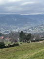
A few kilometres from the town of Munster, the village of Gunsbach is best known for one of its famous residents, Dr Albert Schweitzer, who had his house built here in 1928 in the village where he grew up. His house is now a museum open to visitors.
This circular route, following beautiful paths and trails, climbs up to the Heidenruckenkopf, descends via the Hexenplatz, and passes by the Narrenstein with its unique view of the town and the Fecht valley. It circles the town of Munster and its main attractions, then climbs back up via beautiful paths, notably the Heidenbach trail, and finally descends to Albert Schweitzer’s House.
Wildberg Pass from Oberhaslach
 6.88 mi
+1,417 ft
-1,394 ft
4h 25
Moderate
Departure from Oberhaslach (Bas-Rhin)
6.88 mi
+1,417 ft
-1,394 ft
4h 25
Moderate
Departure from Oberhaslach (Bas-Rhin)
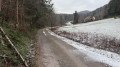
In the magnificent forest of Oberhaslach, a mecca for hiking, and amongst the multitude of trails, including the well-known “Sculpture Trail” and those of “Nideck Castle and Waterfall”, “Schneeberg”, “Ringelstein” and “Hohenstein”, or even the “Petit Katzenberg” trail, there is a pass, the Wildberg Pass, which is less well-known but certainly deserves to be better known.Starting from the large car park at the village hall at the end of the village of Oberhaslach, the route climbs steadily and gently, without difficulty, along paths and forest tracks lined with small streams to the Wildberg Pass, before descending with lovely views, particularly of the Schneeberg. A varied route, with almost 90% of the route through woodland; a short stretch of tarmac at the start and finish, otherwise forest roads, a few forest tracks (some not marked by the CV) and lovely paths.
Champ du Feu circular (long version)
6.60 mi
+781 ft
-778 ft
4 hrs
Moderate
Departure from Belmont (Bas-Rhin) (Bas-Rhin)
Le Champ du Feu, one of the highest points in the Bas-Rhin at an altitude of 1,098 m, a winter sports resort ideal for cross-country skiing, downhill skiing and snowshoeing, an icon for all generations of Alsatians.This lovely circular route is an extension of the Champ du Feu circular route (hike No. 43137315 of 11 Dec. 2023); the first 5 kilometres are similar to the original route, but the rest changes and extends the circular route by 2 km.Eighty per cent of the route is through woodland, intended for walkers and, in snowy weather, for snowshoe hikers, and mainly follows footpaths and a few forest tracks. It crosses a few marked cross-country ski trails on groomed snow; please walk alongside these so as not to disturb the skiers or damage the trails.Beautiful rocks and trees, with lovely views, can be found throughout this fairly varied route.There is a lovely shelter near the end of the route, with refreshments available in the first third and at the start/finish.
Around the Saint-Louis-Arzwiller Inclined Plane
 7.12 mi
+974 ft
-958 ft
4h 05
Moderate
Departure from Saint-Louis (Moselle)
7.12 mi
+974 ft
-958 ft
4h 05
Moderate
Departure from Saint-Louis (Moselle)
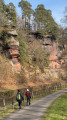
A beautiful circular route offering the chance to discover the Saint-Louis-Artzwiller Inclined Plane, the Rocher du Calice and the Vallée des Éclusiers. Part of the walk takes place in the forest along forest tracks and beautiful paths, where you’ll discover fantastic and unique rock formations, a magnificent rocky outcrop, a typical Moselle village, and a picturesque stretch of the old canal better known as the ‘Vallée des Éclusiers’ with its old locks, now out of service. The Saint-Louis-Arzviller inclined plane, a boat lift unique in Europe built in 1969, replaced the seventeen locks of the old Marne-Rhine Canal. It forms part of the Marne-Rhine Canal, enabling passage through the Vosges, and is one of the most visited river sites in France.
The "Schnakenpfad" starting from Ottenheim-Schwanau
 9.21 mi
+26 ft
-26 ft
4h 15
Moderate
Departure from Schwanau (Regierungsbezirk Freiburg)
9.21 mi
+26 ft
-26 ft
4h 15
Moderate
Departure from Schwanau (Regierungsbezirk Freiburg)
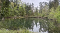
A circular route with virtually no elevation gain, through the shaded forest on the German side of the Rhine. Part of the route follows a signposted path known as the “Schnakenpfad” (the snail trail), which is approximately 7.5 km long. It is located near Lac de Gravier to the west, between the villages of Ottenheim-Schwanau and Meißenheim. This path is aptly named, as the locals also call it “Schnoogepfad” (the Mosquito Trail), because in summer it is teeming with them. The route alternates between small lakes, streams, charming little wooden bridges, footpaths, tracks of varying widths, tarmac roads and a few pavements at the start and finish in the streets of the village of Ottenheim-Schwanau. The whole route is easily accessible. There are several shelters with tables and benches along the way. Suitable walking shoes are nevertheless recommended. Dogs must be kept on a lead! The area is rich in wildlife and you’ll also come across beautiful wild geese.
The Ungersberg via Albéville
 9.24 mi
+2,195 ft
-2,192 ft
6h 10
Moderate
Departure from Albé (Bas-Rhin)
9.24 mi
+2,195 ft
-2,192 ft
6h 10
Moderate
Departure from Albé (Bas-Rhin)
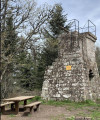
In Alsatian, Ungersberg means the ‘Mountain of the Hungarians’: the highest sandstone massif in the Val de Villé, situated between the mountains and the Alsatian plain. The ascent and descent of the Ungersberg, along rocky paths, is quite steep; walking poles and good footwear will be a great help. The Club Vosgien has erected the Héring Tower at its summit, offering a sweeping view of the Alsace plain and the neighbouring peaks.
Circular route from Gaschney to the lakes of Fischboedle and Schiessrothried
8.16 mi
+1,529 ft
-1,493 ft
5 hrs
 Very difficult
Departure from Muhlbach-sur-Munster (Haut-Rhin)
Very difficult
Departure from Muhlbach-sur-Munster (Haut-Rhin)
A route around the most beautiful sites in the Munster Valley. A variety of mountain landscapes: high-altitude pastures, twisted beech trees (high-altitude beech), cirques and glacial lakes, scree slopes, via ferrata, scree fields, glacial valleys: a real distillation of the Vosges in a single hike. A must.
This route is rated very difficult due to the section from (10) to (13). It is absolutely not suitable for beginners, children, occasional walkers, or people accompanied by dogs.(!) See also practical information regarding a section that is clearly off-limits.
Falkenstein, Hohbuhl, Col de la Franzur from Grendelbruch
 7.52 mi
+1,486 ft
-1,509 ft
4h 45
Moderate
Departure from Grendelbruch (Bas-Rhin)
7.52 mi
+1,486 ft
-1,509 ft
4h 45
Moderate
Departure from Grendelbruch (Bas-Rhin)
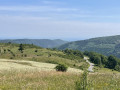
From the mountain village of Grendelbruch, this loop, mainly located south of this village of 1,250 inhabitants, sets off to explore the Piton du Falkenstein, a magnificent rocky outcrop offering a beautiful view of the Bruche Valley. This hike continues via the Col du Bruchberg, the climb through the stubble fields to the Signal de Grendelbruch and its 360° view, then follows the climb to Hohbuhl through the forest. Next, pleasant trails take you to the Col du Beyerlager and then to the Col de la Franzur. You will make some magnificent discoveries, alternating between village streets, forest, undergrowth, thatched roofs, forest roads and pretty little trails. And there are plenty of viewpoints!
Sentiers des Roches - Frankenthal
 5.38 mi
+1,512 ft
-1,512 ft
3h 45
Difficult
Departure from Le Valtin (Vosges)
5.38 mi
+1,512 ft
-1,512 ft
3h 45
Difficult
Departure from Le Valtin (Vosges)
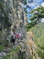
A legendary hike and probably – indeed, certainly – one of the most beautiful in the Vosges Mountains! Running along a ridge above the Munster Valley with breathtaking natural views. On part of the circular route, the path is carved into the rock face, with ladders and handrails along the route. Sure-footedness, good walking boots and walking poles are essential. This is a shorter version than the many others that exist, designed to favour the shade provided by the vegetation and which, on very hot days, avoids the exposed climb via the Col de Falimont. Another distinctive feature is that it takes the ‘rock trail’ on the ascent, but it can, of course, be walked in either direction.
The Champ de Roches from Corcieux
10.12 mi
+991 ft
-961 ft
5h 30
Moderate
Departure from Corcieux (Vosges)
The Champ de Roches is located in the municipality of Barbey-Seroux, near the Col des Arrentès between the Neuné and Vologne valleys. This "river" of rocks stretches between conifer plantations for 400 metres long and 40 metres wide. The existence of such chaos is surprising and has given rise to numerous legends in which the presence of the Devil is never far away.Although most of this hike takes place on forest trails and paths, the relatively long but easy loop includes a few stretches of road that allow you to discover the town of Corcieux at the start and finish, as well as the charming hamlets in the surrounding area. There are beautiful, idyllic landscapes throughout this circuit.
Portique des Géants and Château du Nideck circular from Luttenbach
8.38 mi
+2,005 ft
-1,995 ft
5h 35
Moderate
Departure from Oberhaslach (Bas-Rhin)
Landscapes of the Northern Vosges, combining unspoilt nature, medieval ruins and forgotten legends. Passing by Hohenstein Castle and its belvedere, the hike crosses the Petit Ringeslberg and offers a return trip to the Rocher du Pfaffenlapp, a spectacular rock formation. Then head for the Kasperlehepp Pond, nestled in a small clearing, a peaceful body of water surrounded by reeds and ferns. Continuing the climb, you reach the ruins of Nideck Castle, perched on a rocky promontory. Further on, below, a path accessible by steps allows you to approach the Nideck Waterfall, some twenty metres high, which cascades down a basalt wall, forming a circular loop rich in discoveries. Legend has it that a young giantess, while walking here, discovered a tiny man in a field. Intrigued, she took him back to her father, giving rise to the legend of the Giants of Nideck, immortalised by the Brothers Grimm.
From the Col de Sainte-Marie-aux-Mines to the Chaume de Lusse
8.51 mi
+1,526 ft
-1,526 ft
5h 15
Difficult
Departure from Wisembach (Vosges)
This circular hike links the Col de Sainte-Marie-aux-Mines to Chaume de Lusse, through typical Vosges forests of beech, fir, blueberry and high-altitude meadows. The forest paths and roads offer beautiful panoramic views of the Val d'Argent and Meurthe valleys. This is a fairly dynamic route that leads to Chaume de Lusse via a varied course, including sustained climbs (which is why we rate it as difficult), forest passages and open ridges. Part of the route runs between Alsace and Lorraine on paths and trails marked by the GR®531, the former border from 1871 to 1918, with boundary stones marked D (Deutschland), often hammered, and F, marking the historic border and named "Chemins de la Grande Guerre" (Paths of the Great War).
Lac Blanc - Tête des Faux circular loop
 6.96 mi
+968 ft
-961 ft
4 hrs
Moderate
Departure from Orbey (Haut-Rhin)
6.96 mi
+968 ft
-961 ft
4 hrs
Moderate
Departure from Orbey (Haut-Rhin)
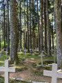
Five routes are marked out in the Lac Blanc 1200 ski resort, offering several levels of difficulty, with distances ranging from 3 to 14 km. This route is a compilation of sections from three of these routes, forming a circular route of approximately 11 km, taking into account the passages closed due to the marking of quiet zones. The route mainly follows forest paths through a forest of tall fir trees. It includes a beautiful but physically demanding climb on a path winding between the trees, a passage near a First World War necropolis, a short descent through the undergrowth, and then an arrival on a stubble field offering a superb view: first of the Alsace plain and the Black Forest in the distance, then of the Lac Blanc glacial cirque. The route continues through the Lac Blanc Adventure Park before returning to the car park.
Rocher de Dabo, Col de la Schleif and Rocher du Himbeerfels circular loop
6.15 mi
+1,056 ft
-1,053 ft
3h 45
Moderate
Departure from Dabo (Moselle)
A circular route in the heart of the Vosges mountains, in Moselle, on the trails of Rocherdu Dabo, a natural viewpoint offering superb panoramic views of the surrounding forest. Along the way, you will stop at Rutschfelsen, then at Col de la Schleif. Next, via Col du Himbeerfels, you will complete the circular route and climb up to the magnificent Rocher du Himbeerfels. The route continues to theZollstockRestaurant, with an optional but recommended stop before heading back. To conclude this circular route combining nature and heritage, a visit toSaint-Léon Chapel will add a cultural and spiritual touch to your wonderful getaway. An easy hike, accessible to all, with beautiful trails and varied paths, combining remarkable landscapes (in good weather) and local discoveries.
Circular route via the Treh farmhouse inn and Trehkopf from Markstein.
3.82 mi
+469 ft
-472 ft
3 hrs
Moderate
Departure from Ranspach (Haut-Rhin)
Starting from the first car park at the entrance to the Markstein resort, in the triangle formed by the D430, D731 and Route des Crêtes (closed in winter), the route follows forest trails and paths. Part of the route runs alongside ski slopes and crosses beautiful wooded areas.You will pass above the Markstein farmhouse inn, visible below. The trail then continues through a pleasant coniferous forest before reaching the Treh farmhouse inn, an iconic landmark in the area.From this inn, the climb becomes steeper towards Trehkopf. The ascent, short but dynamic, leads to an altitude of over 1,200 metres. At the summit, your efforts are richly rewarded with a generous panorama of the Vosges mountains. On a clear day, the view extends even further, revealing the Alps on the horizon.
Dreikirschenweg-kleine runde in Achern
 9.08 mi
+374 ft
-374 ft
4h 30
Moderate
Departure from Achern (Regierungsbezirk Freiburg)
9.08 mi
+374 ft
-374 ft
4h 30
Moderate
Departure from Achern (Regierungsbezirk Freiburg)
A circular route starting from Achern station, known and signposted as the ‘Dreikirschenweg – Kleine Runde’ (a short 14 km route, with a longer alternative, the 18 km ‘Grosse Runde’), is one of the great classics. Special feature: a route with almost no elevation gain, about half of which is on tarmac. It passes partly through the town of Achern, its suburb of Oberachern, and the village of Mösbach.
Suitable for a wide audience, this route presents no technical difficulties and is ideal for occasional walkers, cyclists and families alike. Throughout the route, you can enjoy a varied landscape alternating between urban areas, orchards, vineyards and the open countryside typical of the Black Forest foothills. It also offers several interesting views of the surrounding hills and, on a clear day, of the Rhine plain towards Alsace. Benches and rest areas are dotted along the route, providing pleasant spots to take a break.
Circular path along the banks of the Basse-Zorn
 8.63 mi
+69 ft
-66 ft
4h 00
Moderate
Departure from Weyersheim (Bas-Rhin)
8.63 mi
+69 ft
-66 ft
4h 00
Moderate
Departure from Weyersheim (Bas-Rhin)
A charming circular walk in the heart of the Basse-Zorn valley, a stone’s throw from Hoerdt, the famous Alsatian capital of asparagus. This peaceful walk takes you through a bucolic and romantic setting, following the water’s course along shaded paths and country lanes. Passing through three typically Alsatian villages with authentic heritage, the route offers a blend of tranquillity and discovery, with no major difficulty thanks to its gentle gradient.
The route takes in Bietlenheim, Geudertheim and Weyersheim, following the peaceful banks of the Zorn. Throughout the walk, you’ll discover Catholic and Protestant churches, old bathing spots, historic mills, wash houses and the picturesque atmosphere of these villages. A getaway combining nature and heritage.
Circular route from the Col du Wettstein for Les Basses-Huttes and Glasborn
7.75 mi
+1,568 ft
-1,545 ft
4h 55
Moderate
Departure from Orbey (Haut-Rhin)
An almost perfect circular route, worthy of a postcard. Along the entire route, points of interest follow one after another: military remains, historic sites, impressive rocks with remarkable shapes, magnificent panoramas and breathtaking scenery guaranteed. Between the Col du Wettstein, the Rain des Chênes, the village of Les Basses-Huttes, the small pass of Linge, the Schratzmaennele and the Glasborn, with trails and a few forest tracks, charming villages, authentic farm-inns and magnificent views of the Vosges ridges, every kilometre holds its own share of discoveries. A comprehensive hike that has it all: nature, history, heritage, gastronomy and exceptional scenery, for an experience as varied as it is unforgettable.
Auenwildnispfad nature trail and walk along the banks of the Old Rhine
7.86 mi
+46 ft
-46 ft
3h 40
Moderate
Departure from Neuried (Regierungsbezirk Freiburg)
Near the Pierre-Pflimlin Bridge, between Strasbourg (France) and Altenheim (Germany), the first part of the walk is a nature trail through the heart of the Rhine floodplain forest – the Auenwildnispfad – which allows you to explore one of the last remaining wild landscapes along the banks of the Rhine, where the river still shapes an environment rich in biodiversity. You’ll cross wooden footbridges, traverse small branches of the Rhine, walk over rustic bridges and discover viewing platforms offering beautiful views of the floodplain forest. Information boards explain how this unique ecosystem works and introduce the local wildlife: birds, amphibians, insects and beavers all find refuge here. The second part of the walk then alternates between forest paths, trails along the banks of the Rhine and the ‘Goldscheurer Baggersee’ gravel pit, all in a peaceful, shaded setting.