Country:
 City:
City:


The walk starts from the car park at the Forum Européen du Rhin. There are plenty of car parks around the forum; if the upper ones are full, you may need to use the lower ones, which are also very easy to access.
(S/E) Head south-east and, immediately, at the corner of a building, turn right and take the northern entrance to the Forum Européen du Rhin. Pass under the L98 bridge after 100 metres.
(1) Follow the Kinzingtaler Jakobsweg path to the left until you reach a climb on the left leading up to the road (be careful: some of the signs leading up to this point may lead you astray).
(2) Turn right, keeping one of the branches of the Dreibauergrund gravel pit on your right, to reach the start of the Auenwildnispfad trail with its information boards.
(3) Follow the Auenwildnispfadto the right (very clear signposting).
(4) Cross a stream in two stages.
(5) Carry on straight ahead with a stream on your right until you reach a barbecue area.
(6) Turn right. Further on, turn left. Follow the stream until you reach a bridge you crossed on the way there.
(5) Turn right and cross the stream in two stages.
(4) On the other side, turn right and follow the same stream on your right-hand side. Soon, the path moves away from the stream and then turns north-north-east.
(3) Turn slightly to the right and retrace your steps along the route you took on the way there.
(2) First turn right then left, and head north-north-east. Cross the L98 with care (there is heavy traffic in both directions). On the other side, turn right and follow a wide path running parallel to the road.
(7) Turn left, then right. Then follow a track suitable for vehicles, keeping a body of water (gravel pit) on your right.
(8) At the northern tip of the body of water, carry straight on and ignore two turn-offs on the right.
(9) At the Fork in the road, veer left and cross the Im Oberen path. Pass a car park on your left and turn right down the slope below the path. Walk for a long way north-north-east.
(10) At another fork in the road, follow the Rheinauweg to the left.
(11) Turn left, passing Marlen marina on your right.
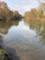
(12) You’ll come out onto the banks of the Rhine; turn right and walk along the river on your right.
(13) Take a path on the left that leads into the forest.
(14) There is the option of a short round trip to the banks of the Rhine.
(14) Head south-east (straight on if you’re returning from the banks of the Rhine, otherwise turn left).
(15) You can reach a picnic area by continuing straight on and then immediately taking the first path on the left.
(16) Retrace your steps.
(15) Head south (turn left if coming from the picnic area, otherwise turn right). Walk south-west.
(17) Turn right. You’ll soon reach the Rhine; follow it on your right-hand side until you reach the car park where you started (S/E).
 Visorando Member
 Easy
Easy 
 Association / Club / Walk leader