


Refine your search for walks in Rustrel
Rustrel walks


 On the way to the Grand Montagne
 Visorando Member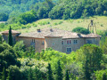
 6.43 mi
 +2,057 ft
 -2,057 ft
 4h 45
4h 45
 Moderate
 Departure from Rustrel (Vaucluse)
La Grand Montagne overlooks Rustrel from a height of around 650 m. The army built several tunnels there, which are now used as the Bas Bruit Underground Laboratory. This walk takes you on a grand tour of these hidden treasures, offering stunning views of the Luberon mountain range, the Apt plain, its vineyards, lavender and olive groves, and, of course, the many ochre quarries stretching from Gignac to Roussillon.
The Tour de la Grande Montagne
 9.56 mi
+2,244 ft
-2,244 ft
6h 20
Moderate
Departure from Rustrel (Vaucluse)
9.56 mi
+2,244 ft
-2,244 ft
6h 20
Moderate
Departure from Rustrel (Vaucluse)
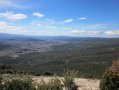
A beautiful walk in the hills above Rustrel offering magnificent views of the Colorado Provençal.
A colourful walk starting from the Rustrel Oil Mill
 7.36 mi
+1,076 ft
-1,086 ft
4h 20
Moderate
Departure from Rustrel (Vaucluse)
7.36 mi
+1,076 ft
-1,086 ft
4h 20
Moderate
Departure from Rustrel (Vaucluse)
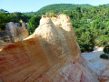
Start the walk with a visit to the unmissable Colorado Provençal, then take a stroll through the hills in the triangle formed by the villages of Rustrel, Gignac and Caseneuve to admire the lavender fields and enjoy a beautiful view of the imposing Château de Caseneuve and the Grand Lubéron.This walk is a less tarmac-heavy alternative to the ‘Visit and Tour of the Colorado Provençal via the Ridges’ (official route)Best done early in the morning, in summer and in fine weather to make the most of the colours of the ochre cliffs and the lavender.
Visit and tour of Colorado Provençal via the ridges (official route)
 7.57 mi
+997 ft
-1,017 ft
4h 20
Moderate
Departure from Rustrel (Vaucluse)
7.57 mi
+997 ft
-1,017 ft
4h 20
Moderate
Departure from Rustrel (Vaucluse)
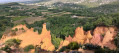
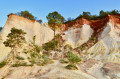
The hike begins with a visit to the Colorado Provençal Belvédères trail (pedestrian rate), a listed site managed by the Colorado de Rustrel Association, and continues with a tour of the Colorado via the ridges (GR®) to discover views of other ochre quarries. The hike reveals all the nuances of ochre colours in these former open-air quarries.Please note! The Mille Couleurs car park is reserved exclusively for visitors to the two marked trails managed by the Colorado de Rustrel Association for a limited period of approximately 3 hours. If you wish to hike the Tour du Colorado via the ridges, you must park in the village and pay the pedestrian entrance fee for the Belvédères trail.
Tour of the Provençal Colorado in Rustrel (official route)
 1.95 mi
+259 ft
-262 ft
1h 05
1.95 mi
+259 ft
-262 ft
1h 05
 Easy
Departure from Rustrel (Vaucluse)
Easy
Departure from Rustrel (Vaucluse)
The hike reveals all the nuances of ochre colours in these former open-air quarries. Paid parking, giving access to the trails to all occupants of the vehicle. There is a pedestrian rate, if you do not use the car park, which allows you to obtain the leaflet with the map, the history of the site and the code for the mobile discovery app. Please note that the Milles Couleurs car park (paid) is only accessible to visitors to the two marked trails managed by the Colorado Association of Rustrel.
Colorado Provençal via La Croix de Cristol
 Association / Club / Walk leader
 3.84 mi
+787 ft
-791 ft
2h 25
Moderate
Departure from Rustrel (Vaucluse)
3.84 mi
+787 ft
-791 ft
2h 25
Moderate
Departure from Rustrel (Vaucluse)
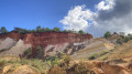
A beautiful hike that will allow you to discover the surroundings of Rustrel's Colorado.
Viens, hamlets and chapels
 9.36 mi
+1,467 ft
-1,463 ft
5h 35
Moderate
Departure from Viens (Vaucluse)
9.36 mi
+1,467 ft
-1,463 ft
5h 35
Moderate
Departure from Viens (Vaucluse)
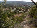
A walk in the Luberon that includes a visit to the beautiful village of Viens, some of its hamlets and chapels.
Views of the ochre cliffs of Rustrel and Gignac, beautiful trails and forest passages.
Geological curiosities (slab with footprints).
Circular towards Caseneuve
 6.87 mi
+1,375 ft
-1,378 ft
4h 20
Moderate
Departure from Caseneuve (Vaucluse)
6.87 mi
+1,375 ft
-1,378 ft
4h 20
Moderate
Departure from Caseneuve (Vaucluse)
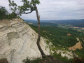
An easy circular offering beautiful panoramic views of the Luberon and the Provençal Colorado.
The fortress of Saignon
 4.55 mi
+866 ft
-850 ft
2h 50
Moderate
Departure from Saignon (Vaucluse)
4.55 mi
+866 ft
-850 ft
2h 50
Moderate
Departure from Saignon (Vaucluse)
A beautiful hike that takes you to the hilltop village of Saignon via old mule tracks through the woods and fields.
The Saignon rock offers an incredible panorama of the Apt valley, the Monts de Vaucluse and Mont Ventoux.
La Croix de la Lavande and the Vallon des Jardins
9.96 mi
+1,385 ft
-1,375 ft
5h 45
Moderate
Departure from Lagarde-d'Apt (Vaucluse)
A lovely, pleasant circular walk at the end of June as the lavender is in bloom and the temperature doesn’t get too high due to the altitude. Only the end of the walk is a little steeper in the Vallon des Jardins, up to Les Esfourniaux. The beauty of the vegetation (rowan, plum, dogwood, etc.) will quickly make you forget the effort involved.
Castor and Travignon
 10.24 mi
+2,457 ft
-2,467 ft
6h 50
10.24 mi
+2,457 ft
-2,467 ft
6h 50
 Difficult
Departure from Saint-Saturnin-lès-Apt (Vaucluse)
Difficult
Departure from Saint-Saturnin-lès-Apt (Vaucluse)
A superb hike combining magnificent views across the whole region with unmissable sights. Challenging sections are followed by pleasant, shaded paths or those running along ridges. One of the most beautiful yet little-known hikes around Saint-Saturnin-lès-Apt.
From Viens to the Col des Quatre Chemins
 3.65 mi
+377 ft
-377 ft
2h 00
Easy
Departure from Viens (Vaucluse)
3.65 mi
+377 ft
-377 ft
2h 00
Easy
Departure from Viens (Vaucluse)
A short, easy 2-hour walk starting from Viens in the Luberon. Beautiful views of the Luberon geological reserve.
Oppedette Gorges - Le Calavon
 3.26 mi
+863 ft
-833 ft
2h 15
Moderate
Departure from Oppedette (Alpes-de-Haute-Provence)
3.26 mi
+863 ft
-833 ft
2h 15
Moderate
Departure from Oppedette (Alpes-de-Haute-Provence)
Wild and difficult to access gorges, between 150 and 200m deep, very narrow in places, only a few metres wide. The descent of the Karstic Cave is very well equipped but tricky to navigate.
The Gorges of Oppedette
 3.80 mi
+627 ft
-630 ft
2h 20
Moderate
Departure from Oppedette (Alpes-de-Haute-Provence)
3.80 mi
+627 ft
-630 ft
2h 20
Moderate
Departure from Oppedette (Alpes-de-Haute-Provence)
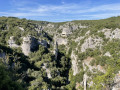
A beautiful loop around the Calavon Gorges from the village of Oppedette.
The ridges of Saint-Saturnin-lès-Apt
 11.59 mi
+2,405 ft
-2,431 ft
7h 25
Moderate
Departure from Saint-Saturnin-lès-Apt (Vaucluse)
11.59 mi
+2,405 ft
-2,431 ft
7h 25
Moderate
Departure from Saint-Saturnin-lès-Apt (Vaucluse)
A long and beautiful excursion over easy but varied countryside, with some steeper sections on the descent but on an excellent path.
The Claparèdes plateau via Saignon
 6.43 mi
+1,257 ft
-1,234 ft
4h 05
Moderate
Departure from Apt (Vaucluse)
6.43 mi
+1,257 ft
-1,234 ft
4h 05
Moderate
Departure from Apt (Vaucluse)
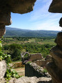
Starting from the centre of Apt, this is a very beautiful, easy circular, passing in front of Saignon and Rocsalière to reach the Claparèdes plateau before descending back to Apt via a beautiful paved slanting street.
From Apt to Saignon
 4.85 mi
+994 ft
-997 ft
3h 05
Moderate
Departure from Apt (Vaucluse)
4.85 mi
+994 ft
-997 ft
3h 05
Moderate
Departure from Apt (Vaucluse)
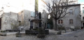
A pleasant little hike that has the advantage of starting practically in the centre of Apt, reaching the Saignon rock and returning along the hillside among fruit trees and lavender.
Oppedette - Vachères circular
 10.55 mi
+1,302 ft
-1,309 ft
6h 00
Moderate
Departure from Oppedette (Alpes-de-Haute-Provence)
10.55 mi
+1,302 ft
-1,309 ft
6h 00
Moderate
Departure from Oppedette (Alpes-de-Haute-Provence)
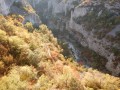
Discover the villages of Oppedette and Vachères, the Saut du Moine waterfall, and sweeping panoramic views of the Luberon, the Alps...
From Saint-Saturnin-lès-Apt to Gordes via the Gorges de la Véroncle
 16.68 mi
+2,257 ft
-1,690 ft
9h 40
Difficult
Departure from Saint-Saturnin-lès-Apt (Vaucluse)
16.68 mi
+2,257 ft
-1,690 ft
9h 40
Difficult
Departure from Saint-Saturnin-lès-Apt (Vaucluse)
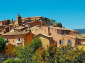
This sixth stage crosses the wooded slope of Perréal Hill before reaching the village of Gargas and winding through the farmland of the Urbane Valley, then climbing up to the pretty village of Roussillon, where you can allow an hour to visit the old ochre quarry, with its magnificently coloured landscapes of cliffs and fairy chimneys. The route returns to the cultivated fields and enters the narrow Gorges de la Véroncle – a little gem waiting to be discovered – before heading up the Ravin de Vézaule to reach Camping des Sources.
Saignon via Le Castellet
 11.48 mi
+2,887 ft
-2,913 ft
7h 50
Difficult
Departure from Saignon (Vaucluse)
11.48 mi
+2,887 ft
-2,913 ft
7h 50
Difficult
Departure from Saignon (Vaucluse)
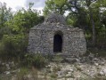
A very beautiful walk starting from the pretty little village of Saignon.
From Oppedette to Saint-Saturnin-lès-Apt
 18.17 mi
+2,146 ft
-2,838 ft
10h 15
Difficult
Departure from Oppedette (Alpes-de-Haute-Provence)
18.17 mi
+2,146 ft
-2,838 ft
10h 15
Difficult
Departure from Oppedette (Alpes-de-Haute-Provence)
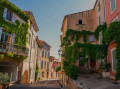
This fifth stage takes you on a journey of discovery through the splendid Gorges d’Oppedette and, once past the Chapelle Saint Ferréol, visits the remarkable medieval village of Viens with its maze of narrow streets marked by the passage of centuries, before crossing the gleaming ochre landscapes of the Colorado de Rustrel, notable for its canyon-like scenery and fairy chimneys reminiscent of John Ford’s Westerns. The route reaches the hilltop village of Villars before continuing on to Saint-Saturnin-lès-Apt.
Circular route through the wild side of Simiane-la-Rotonde
 4.95 mi
+1,099 ft
-1,073 ft
3h 15
Moderate
Departure from Simiane-la-Rotonde (Alpes-de-Haute-Provence)
4.95 mi
+1,099 ft
-1,073 ft
3h 15
Moderate
Departure from Simiane-la-Rotonde (Alpes-de-Haute-Provence)
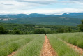
This short circular route, starting from the medieval village of Simiane-la-Rotonde, will take you through pretty holm oak forests and along lavender fields. You will pass by old dry stone sheepfolds (or jas) and the ruins of three mills. At the end of the hike, you can visit the Rotonde and lose yourself in the narrow streets of the old village. As a bonus, you will have beautiful, unobstructed views of the Albion plateau, the Lure Mountain and even the Alps.
Circular route south of Simiane-la-Rotonde and return via the summit of the Espéron
7.24 mi
+1,549 ft
-1,549 ft
4h 40
Moderate
Departure from Simiane-la-Rotonde (Alpes-de-Haute-Provence)
From the pretty hilltop village of Simiane-la-Rotonde, a route through coppiced woodland with lovely views to the east, south beyond the Grand Luberon, and north on the return journey from the summit of the Espéron.
The Rain Water Reservoirs Trail
 9.05 mi
+1,329 ft
-1,339 ft
5h 20
Moderate
Departure from Saint-Saturnin-lès-Apt (Vaucluse)
9.05 mi
+1,329 ft
-1,339 ft
5h 20
Moderate
Departure from Saint-Saturnin-lès-Apt (Vaucluse)
Discover rain water reservoirs carved into rock, which enabled rural life to continue in this waterless area.
Tour of the Grand Luberon
 42.22 mi
+6,713 ft
-6,696 ft
4 days
Difficult
Departure from Apt (Vaucluse)
42.22 mi
+6,713 ft
-6,696 ft
4 days
Difficult
Departure from Apt (Vaucluse)
A four-day circular route that takes you up to the highest point of the Grand Luberon massif and along its ridges, offering superb panoramic views. You pass through numerous villages and hamlets, each boasting a rich heritage. Halfway through, you can add a loop to extend this route to five stages.
From Apt to Sivergues via the Rocher des Druides
 6.27 mi
+2,106 ft
-630 ft
4h 45
Moderate
Departure from Apt (Vaucluse)
6.27 mi
+2,106 ft
-630 ft
4h 45
Moderate
Departure from Apt (Vaucluse)
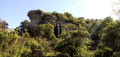
This first stage is mainly uphill, leading to the foot of the western part of the Grand Luberon ridges. Halfway through, there is a descent to pass by the foot of the Rocher des Druides and the hamlet of Roscalière, followed by a climb back up. It is possible to avoid this detour and thus shorten the stage.
Mourre Nègre circuit via the north
 8.33 mi
+2,047 ft
-2,034 ft
5h 35
Moderate
Departure from Auribeau (Vaucluse)
8.33 mi
+2,047 ft
-2,034 ft
5h 35
Moderate
Departure from Auribeau (Vaucluse)
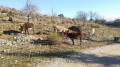
This circuit leads to the top of Mourre Nègre, the highest point in the Luberon (1,115 metres), from the north, via a series of detours. The climb is gradual. Beautiful view from the summit. The descent also offers beautiful panoramic views but requires good footwear on a stony path.
On the rain water reservoir trail towards Travignon
 6.12 mi
+489 ft
-459 ft
3h 15
Moderate
Departure from Saint-Saturnin-lès-Apt (Vaucluse)
6.12 mi
+489 ft
-459 ft
3h 15
Moderate
Departure from Saint-Saturnin-lès-Apt (Vaucluse)
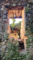
This is a beautiful, easy hike in the Luberon in a magnificent landscape where you can discover numerous rain water reservoirs carved into rock and drystone shelters.
Grand tour of Mourre Nègre from Auribeau
11.01 mi
+3,878 ft
-3,878 ft
8h 25
Difficult
Departure from Auribeau (Vaucluse)
This hike takes you to the highest section of the Luberon ridge. 360° panoramic views. The route is often shaded by holm oak forests and some beautiful pine forests, which is pleasant in hot weather. Several open sections offer views to the south or north. This very natural hike is fairly easy, except for the slightly significant elevation gain, but this is intentional, intended for those who are not afraid of a little effort.
The Mourre Nègre loop, passing by the old Saint-Pierre castle
 5.28 mi
+2,011 ft
-2,011 ft
4h 10
Moderate
Departure from Auribeau (Vaucluse)
5.28 mi
+2,011 ft
-2,011 ft
4h 10
Moderate
Departure from Auribeau (Vaucluse)
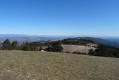
The Mourre Nègre, the highest point in the Luberon mountain range, offers breathtaking views from its crest, stretching from the Étang de Berre to the Southern Alps and including the Sainte-Victoire and Mont Ventoux peaks.
On the way down, passing through the Vallon du Roumi, you can get close to the ruins (currently being restored) of the ancient Château Saint-Pierre and the adjoining chapel of the same name.
Le Mourre Nègre from Auribeau
 4.07 mi
+1,742 ft
-1,745 ft
3h 25
Moderate
Departure from Auribeau (Vaucluse)
4.07 mi
+1,742 ft
-1,745 ft
3h 25
Moderate
Departure from Auribeau (Vaucluse)
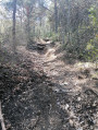
Short path to access Mourre Nègre via the shaded slopes of the northern side of the Luberon.
Along the Aigue Brun
5.11 mi
+837 ft
-837 ft
3h 05
Easy
Departure from Saignon (Vaucluse)
A pleasant route along the Aigue Brun, a tributary of the Durance, which over the years has wound its way between the two Luberon mountains, the Grand to the east and the Petit to the west.
The Claparèdes plateau: between drystone shelters and lavender fields
 5.81 mi
+236 ft
-236 ft
2h 55
Easy
Departure from Buoux (Vaucluse)
5.81 mi
+236 ft
-236 ft
2h 55
Easy
Departure from Buoux (Vaucluse)
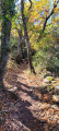
This easy hike can be enjoyed in any season. The blue of the lavender gives way to the warm tones of autumn or the green colours of spring. Along the route, you will discover hidden drystone shelters or majestic structures built in the middle of fields. You will alternate between small paths in the undergrowth and paths through fields offering magnificent views of the Luberon mountain.
From Céreste to Apt via the plain, Auribeau and Saignon
 13.87 mi
+1,532 ft
-2,051 ft
7h 45
Difficult
Departure from Céreste (Alpes-de-Haute-Provence)
13.87 mi
+1,532 ft
-2,051 ft
7h 45
Difficult
Departure from Céreste (Alpes-de-Haute-Provence)
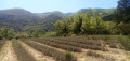
The final stage of this route is long and varied. The first section takes place on the plain at the foot of the Luberon ridges, which were traversed in the opposite direction during the second stage. We then gain altitude, climbing successively to the villages of Glorivette, Castellet-en-Lubéron and Auribeau, the latter two boasting a rich heritage. We then descend all the way, passing through the beautiful village of Saignon along the way.
Route around Montjustin from Céreste
 5.42 mi
+843 ft
-817 ft
3h 15
Moderate
Departure from Céreste (Alpes-de-Haute-Provence)
5.42 mi
+843 ft
-817 ft
3h 15
Moderate
Departure from Céreste (Alpes-de-Haute-Provence)
Route around the village of Montjustin. Magnificent views of the Grand Lubéron and the Encrême valley.
The Priory of Carluc from Céreste
 3.91 mi
+387 ft
-387 ft
2h 10
Easy
Departure from Céreste (Alpes-de-Haute-Provence)
3.91 mi
+387 ft
-387 ft
2h 10
Easy
Departure from Céreste (Alpes-de-Haute-Provence)
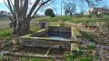
An easy hike from Céreste to the Priory of Carluc, along farmland, lavender fields and oak woods.
The Petarelle valley, the ridge and the Rocher gorge
 6.91 mi
+1,670 ft
-1,667 ft
4h 40
Moderate
Departure from Sivergues (Vaucluse)
6.91 mi
+1,670 ft
-1,667 ft
4h 40
Moderate
Departure from Sivergues (Vaucluse)
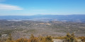
This walk begins with a refreshing stroll along the Aiguebrun, then climbs up to the ridge of the massif via the Petarelle valley. The descent is along a path that passes through the Rocher gorge. The landscapes are splendid and peaceful.
Throughout this hike, you will encounter numerous vestiges of a time when this mountain range was a place of life and resources. Best done in spring or autumn.
Route des Agasses – Piegros
5.36 mi
+1,125 ft
-1,106 ft
3h 25
Moderate
Departure from Céreste (Alpes-de-Haute-Provence)
Wooded areas and panoramic views punctuate this route north of Vitrolles-en-Lubéron
The first 1,000 metres of the Grand Lubéron on the eastern side
 7.17 mi
+1,417 ft
-1,421 ft
4h 30
Moderate
Departure from Céreste (Alpes-de-Haute-Provence)
7.17 mi
+1,417 ft
-1,421 ft
4h 30
Moderate
Departure from Céreste (Alpes-de-Haute-Provence)
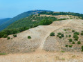
The Luberon massif, whether the ‘small’ or ‘large’ Luberon, is mainly forested.It is only from an altitude of 1,000 metres that the forest gives way to open areas offering a 360° panoramic view of the entire region, provided you are on the ridge.Starting from the Col de l’Aire Deï Masco at 700 m, between Céreste-en-Lubéron and Vitrolles-en-Lubéron, the route heads westwards to tackle the first two peaks of the Grand Lubéron, both over 1,000 m in altitude. From there, the view is magnificent, both to the south and to the north.As an added bonus, there’s the signal at the summit of Mourre Nègre on the western side.Whilst the climb along the GR® on the way out may leave you feeling there’s no hope of ever making it, the reward is complete after just 4 km.On the return journey, the suggested route follows the track, which is easy, open and offers some lovely views to the south at the start of the descent.The fittest walkers will probably not hesitate to continue along the ridge to Mourre Nègre… but not on a scorching hot day!
From Aire des Mascas to Coteau de la Combe and back via Vallon des Roumis
6.86 mi
+1,302 ft
-1,312 ft
4h 15
Moderate
Departure from Vitrolles-en-Lubéron (Vaucluse)
A lovely hike along the Luberon ridges, often through woodland with views on both sides. Views of the Pre-Alps and the Vaucluse mountains during the first part and of the Aigues valley and the Durance valley and beyond, weather permitting. A few kilometres on the DFCI track overlooking the valleys, but the view is well worth it.
Around Buoux
 3.92 mi
+561 ft
-548 ft
2h 20
Easy
Departure from Buoux (Vaucluse)
3.92 mi
+561 ft
-548 ft
2h 20
Easy
Departure from Buoux (Vaucluse)
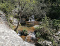
A short loop from Buoux follows a balcony path above the Aigue Brun valley and returns along the stream.
Tour of the Buoux cliffs
 5.59 mi
+1,696 ft
-1,706 ft
4h 05
Moderate
Departure from Buoux (Vaucluse)
5.59 mi
+1,696 ft
-1,706 ft
4h 05
Moderate
Departure from Buoux (Vaucluse)
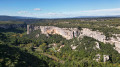
This hike starts in the village of Buoux, in the heart of the Luberon massif, and takes you to the banks of the Aiguebrun, at the foot of Fort de Buoux (open to visitors), then through the woods to the impressive cliffs of Buoux, world-renowned for their climbing sites.
Once at the foot of these impressive walls, you will walk around them and then along the top, enjoying some breathtaking views of the Vallon de l'Aiguebrun, before returning leisurely to the village.
More walks in Rustrel
Select a point of interest below: