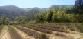
The first 1,000 metres of the Grand Lubéron on the eastern side

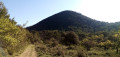
The Luberon massif, whether the ‘small’ or ‘large’ Luberon, is mainly forested.
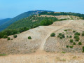
It is only from an altitude of 1,000 metres that the forest gives way to open areas offering a 360° panoramic view of the entire region, provided you are on the ridge.
Starting from the Col de l’Aire Deï Masco at 700 m, between Céreste-en-Lubéron and Vitrolles-en-Lubéron, the route heads westwards to tackle the first two peaks of the Grand Lubéron, both over 1,000 m in altitude. From there, the view is magnificent, both to the south and to the north.
As an added bonus, there’s the signal at the summit of Mourre Nègre on the western side.
Whilst the climb along the GR® on the way out may leave you feeling there’s no hope of ever making it, the reward is complete after just 4 km.
On the return journey, the suggested route follows the track, which is easy, open and offers some lovely views to the south at the start of the descent.
The fittest walkers will probably not hesitate to continue along the ridge to Mourre Nègre… but not on a scorching hot day!

Details

100606688
Creation:
Last update:
Last review:
  • Walking
    Activity: Walking
  • ↔
    Distance: 7.17 mi
  • ◔
    Average duration: 4h 30 
  • ▲
    Difficulty: Moderate

  • ⚐
    Back to start: Yes
  • ↗
    Ascent: + 1,417 ft
  • ↘
    Descent: - 1,421 ft

  • ▲
    Highest point: 3,488 ft
  • ▼
    Lowest point: 2,264 ft

Photos

Description of the walk

If there is no space left to park your vehicle at the pass, there is a car park on the D33 just below the pass.

(S/E) From the Col de l’Aire des Mascas, take the stony path heading west along the GR®9 towards Les Cours.

(1) Continue straight on for about 250 m along the Piste des Méritants, then turn right to follow the GR®9 towards the Coteau de la Combe, ignoring all the paths and tracks on either side.

(2) At this large crossroads, look out for the Coteau de la Combe signpost on the other side of the track and continue along the GR®9 towards Mourre Nègre. The first peak over 1,000 m is just a few hundred metres away.

(3) Take in the 360° view. Look out for the second summit and its hut (= your destination) and continue down the GR®9 to the Pas de Marseille.

(4) Carry on straight ahead, ignoring the DFCI track. The climb is steep but fairly short.

(5) You’ve reached your destination. Take in the 360° view and spot the Mourre Nègre signal to the west. Turn back to the large crossroads you passed on the way there.

(2) Take the DFCI track to the right.

(6) At the track junction, ignore the track leading down to the right and carry on straight ahead. Return to the original fork.

(1) Stay on the track throughout and join the D33 at the foot of the Col des Mascas. Climb straight on to the Col de l’Aire (S/E).

Waypoints

  1. S/E : mi 0 - alt. 2,287 ft - Col de l’Aire Deï Masco
  2. 1 : mi 1.44 - alt. 2,743 ft - Les Cours. Initial junction for the two circular loops
  3. 2 : mi 2.44 - alt. 3,084 ft - Coteau de la Combe. Crossroads. Return to the summits
  4. 3 : mi 2.82 - alt. 3,386 ft - The first 1,000 metres from the east
  5. 4 : mi 3.03 - alt. 3,307 ft - The Pas de Marseille
  6. 5 : mi 3.23 - alt. 3,488 ft - The second 1,000-metre peak from the east
  7. 6 : mi 4.85 - alt. 2,999 ft - Crossroads of tracks
  8. S/E : mi 7.17 - alt. 2,287 ft - Col de l’Aire Deï Masco

Notes

If there is no space to park your vehicle at the pass, there is a car park on the D33 just below the pass.

Worth a visit

A 360° view and the Mourre Nègre signal

Always be cautious and plan ahead when you're outdoors. Visorando and the author of this route cannot be held responsible for any accidents occurring on this route.

The GR® and PR® markings are the intellectual property of the Fédération Française de Randonnée Pédestre.

Other walks in the area

For more walks, use our search engine .

The GPS track and description are the property of this route's author. Please do not copy them without permission.