Castor and Travignon

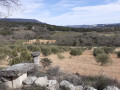
A superb hike combining magnificent views across the whole region with unmissable sights. Challenging sections are followed by pleasant, shaded paths or those running along ridges. One of the most beautiful yet little-known hikes around Saint-Saturnin-lès-Apt.

Details

7478636
Creation:
Last update:
Last review:
  • Walking
    Activity: Walking
  • ↔
    Distance: 10.24 mi
  • ◔
    Average duration: 6h 50 
  • ▲
    Difficulty: Difficult

  • ⚐
    Back to start: Yes
  • ↗
    Ascent: + 2,457 ft
  • ↘
    Descent: - 2,467 ft

  • ▲
    Highest point: 3,169 ft
  • ▼
    Lowest point: 1,194 ft

Photos

Description of the walk

Please note that certain sections require particular attention to navigation; the use of the Visorando app or a hiking GPS is recommended.

To the east of Saint-Saturnin-lès-Apt, take the small road towards Villars/Rustrel and turn left onto the small road signposted ‘les Heaths’. Continue along this small road to the right until you reach the Pas de Léouse, where there is a car park just past a ruin.

(S/E) Start the walk by heading back down the small road to the first junction on the right and follow it for a few metres. The path branches off immediately to the right. It is marked with green dots.
Follow this path northwards then north-westwards, skirting a beautiful estate. Keep following the green dots, ignoring the track on the right opposite the estate. Continue to the next junction.

(1) Turn right. Follow the path which crosses a track and descends to join theGR® 9.

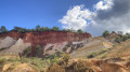
(2) Take theGR® 9to the left. Pass through the spectacular Portes de Castor, and shortly afterwards leave theGR® 9to take a barely marked climb on the left.

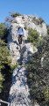
(3) Follow the GPS route carefully as the path is barely visible. This climb crosses a fairly short but steep scree slope where you’ll need to hold on to branches and rocks. Finally, this climb joins a proper path, also marked with green dots.

(4) Take this path to the right. Then leave it to follow a track to the left.

(5) Be sure to follow the GPS route closely, as the track is barely visible and climbs steeply through scrub towards the Piste des Lays, which can be seen above. Just before reaching the track, a path branches off to the right.

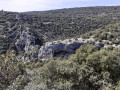
(6) Take this well-marked path to the right. Pass close to the magnificent Rocher de la Cadière and continue straight on, descending back down to theGR®9.

(7) Take theGR®9to the left. Follow the north-boundGR®9uphill for quite some time until you reach the junction on the right signposted Travignon.

(8) Ignore the path to Travignon and continue along the main path to the left (north-west), which leads towards the Piste des Lays. As you approach the Piste des Lays, at a hairpin bend to the left, there is a small path on the right in the valley floor.

(9) Take this small path to the right to avoid having to go back down and take a long detour along the track. This path is unkempt but marked in places and very pleasant. Follow the trail carefully. This path approaches the track, which you join on the left in the final few metres through some scrub.
Take the Piste des Lays to the right and follow it until just past the water tank, where there is a path to the right.

(10) Follow this lovely path, keeping well to the right, for quite a while; it is signposted ‘Travignon’. Shortly before reaching the ruins of Travignon, there is a small path on the left.

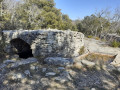
(11) Please note: the junction is not very visible, so follow the GPS track carefully. Follow this small path until it joins a track. Take this track to the right and you will come to the rain water reservoirs carved into rock at Travignon almost immediately.
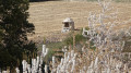
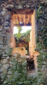
After walking around the rain water reservoirs carved into rock, take the well-marked track leading to the ruins of the village of Travignon. Walk through the village until you reach the junction with theGR®9.

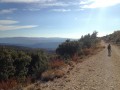
(12) Do not take theGR®9to the right, but instead take the lovely green-marked path which continues to the left, heading north-east. This scenic path descends gently for a long time, offering superb views. Continue to the first junction.

(13) Take the hairpin bend to the right onto the lovely Combe de Freissinière path and follow it for a very long time through a pretty, bucolic valley. After a long, gentle descent, you’ll reach a V-shaped junction.

(14) Take the left-hand fork towards Ayguier Neuf and, shortly afterwards, join a wide track on the right. Follow this track to the Cabane du Garde.

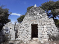
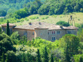
(15) Leave the track and take the path on the right which passes in front of the beautiful “Cabane du Garde” drystone shelter. Follow this well-marked path, although it diverges from the one shown on the IGN map. Follow the GPS track (close to that on the OSM map) until the next junction.

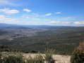
(16) Take the left-hand track, following either the GPS track or the OSM route. This panoramic path offers spectacular views as it passes high above the Portes du Castor. Although it is poorly marked on the IGN map, it is very clearly visible and descends gently towards the valley, where it joins theGR®9.
Take theGR®9to the left and follow it down to a small path running alongside olive groves, which branches off to the right.

(17) Take this path to the right, go round the olive groves and head for the Pas de Léouse and the car park next to the ruins (S/E).


Waypoints

  1. S/E : mi 0 - alt. 1,260 ft - Pas de Léouse car park
  2. 1 : mi 0.5 - alt. 1,234 ft - Path junction: turn right
  3. 2 : mi 1.29 - alt. 1,335 ft - Junction with the GR9
  4. 3 : mi 1.85 - alt. 1,539 ft - The left-hand scree path is poorly marked
  5. 4 : mi 2.08 - alt. 1,834 ft - Path on the right
  6. 5 : mi 2.19 - alt. 1,775 ft - Path on the left through scrub
  7. 6 : mi 2.31 - alt. 1,932 ft - Path on the right towards Rocher de Cadière
  8. 7 : mi 2.78 - alt. 1,893 ft - GR9 to the left
  9. 8 : mi 3.69 - alt. 2,828 ft - Junction towards Travignon
  10. 9 : mi 4.03 - alt. 2,602 ft - Path on the right near the Piste des Lays
  11. 10 : mi 4.61 - alt. 2,943 ft - Path on the right towards Travignon
  12. 11 : mi 5.15 - alt. 3,045 ft - Path towards Ayguiers Travignon
  13. 12 : mi 5.46 - alt. 3,028 ft - Ruines du Village de Travignon
  14. 13 : mi 6.09 - alt. 2,785 ft - Path on the right into the Freissinière valley
  15. 14 : mi 7.36 - alt. 2,195 ft - Left-hand path – Ayguier Neuf
  16. 15 : mi 7.86 - alt. 2,267 ft - Path on the right – The warden’s hut
  17. 16 : mi 8.36 - alt. 1,978 ft - Left-hand path
  18. 17 : mi 9.9 - alt. 1,220 ft - Right-hand path – Pas de Léouse
  19. S/E : mi 10.24 - alt. 1,263 ft - Pas de Léouse car park

Notes

Crossing scree slopes requires good walking boots with deep-treaded soles.
Some scrub requires long trousers and long sleeves.
At least 1 litre of water.

Worth a visit

View of the village of Saint-Saturnin-lès-Apt.
The rain water reservoirs carved into rock at Travigon.
The ruins of the village of Travignon.
The Ayguier Neuf.
The warden’s hut.

Always be cautious and plan ahead when you're outdoors. Visorando and the author of this route cannot be held responsible for any accidents occurring on this route.

The GR® and PR® markings are the intellectual property of the Fédération Française de Randonnée Pédestre.

Reviews and comments

4.1 / 5
Based on 4 reviews

Reliability of the description
3.7 / 5
Ease of following the route
4.3 / 5
Route interest
4.3 / 5
frantz840
frantz840

Overall rating : 4 / 5

Date of your route : Jun 11, 2026
Reliability of the description : ★★★★☆ Good
Ease of following the route : ★★★★☆ Good
Route interest : ★★★★☆ Good
Very busy route : No

It’s a lovely walk, but perhaps a bit too long given how challenging it is.
The scree slope at point 3 is really very steep and it’s best to avoid it. The climb up to the Lays track is indeed a bit overgrown and steep... (point 9).
The views are nevertheless superb and the sights are remarkable.

Machine-translated

User 16344962

Overall rating : 4 / 5

Date of your route : Sep 23, 2025
Reliability of the description : ★★★★☆ Good
Ease of following the route : ★★★★☆ Good
Route interest : ★★★★☆ Good
Very busy route : No

reconnaissance carried out on 23/9 for a group hike on 10/10/25
the passage through the rocky scree is quite difficult, discovered during reconnaissance and avoided by the group
beautiful landscapes and sights (rain water reservoirs carved into rock and abandoned village)
long climb …………

Machine-translated

moniquemz
moniquemz

Thank you very much for your comment.
Monique

Machine-translated

goelandsud
goelandsud

Overall rating : 5 / 5

Date of your route : Aug 09, 2021
Reliability of the description : Not used / Not applicable
Ease of following the route : ★★★★★ Very good
Route interest : ★★★★★ Very good
Very busy route : No

A lovely walk with beautiful paths. The climb is gradual, apart from the scree slope at point 3, but it’s manageable...
I highly recommend this walk in this magnificent region.
Thanks to the author

Machine-translated

pbrion
pbrion

Overall rating : 3.7 / 5

Date of your route : May 23, 2021
Reliability of the description : ★★★☆☆ Average
Ease of following the route : ★★★★☆ Good
Route interest : ★★★★☆ Good
Very busy route : No

There are no difficulties on this route, apart from the climb (at point 3) up a steep, rather treacherous scree slope, though this can be avoided by continuing straight on along the GR9. The path along the ridge isn’t particularly interesting.
Also take care at Point 9, where the path to the right is barely marked and overgrown, and the short climb at the end to join the Lays track is very steep and off-track.
It should be noted that between points 14 and 15, the Aiguier Neuf is situated to the left of the track and overlooks it, just before you take the track on the right that descends towards the Cabane du Garde.
A GPS is essential to ensure you don’t miss the narrow paths.

Machine-translated

Other walks in the area

For more walks, use our search engine .

The GPS track and description are the property of this route's author. Please do not copy them without permission.