


Refine your search for walks in Roz-Landrieux
Roz-Landrieux walks


 The Marais Noir as seen from Dol-de-Bretagne
 Association / Club / Walk leader
 8.74 mi
 +62 ft
 -62 ft
 4h 05
 Moderate
 Departure from Roz-Landrieux (Ille-et-Vilaine)
The route winds its way through the Marais Noir, in the countryside near Dol. The paths are dirt or gravel, with a short stretch on the road. The Marais de Dol, in the broadest sense, covers approximately 12,000 ha. It comprises: the Marais Blanc (a coastal marsh with soils consisting of salt marshes covering 10,500 ha) and the Marais Noir (a central, peaty depression that is regularly flooded, covering 1,500 ha). The drainage of the marsh (La Grande Bruyère) dates back to the 18th century.
Circular route to Mont-Dol via the river and the two Biez
 9.34 mi
+7 ft
-7 ft
4h 20
Moderate
Departure from Mont-Dol (Ille-et-Vilaine)
This walk takes you along the paths of the Marais Blanc, and alongside the Guyolut, as well as the Cardequin and Ceinture Nord watercourses. The terrain is flat and easy, but can be exposed to the wind.The section of the route through the Marais Blanc allows you to discover old stone farmhouses that have retained the charm of their original stone construction. Some are listed as heritage sites.
The Forges route in Baguer-Morvan
 6.01 mi
+141 ft
-141 ft
2h 55
 Easy
Departure from Baguer-Morvan (Ille-et-Vilaine)
This route runs largely through the countryside and follows sunken lanes. It passes through several hamlets whose names raise questions about their origins: Les Forges, Le Portail des Forges and La Ville Feu.
Circular routes via Pont Allain and Le Perray from Étang de Beaufort
 7.18 mi
+266 ft
-266 ft
3h 30
Moderate
Departure from Plerguer (Ille-et-Vilaine)
The route links two of the water retention ponds in the Plerguer area. It alternates between sections on small country roads and stretches through the undergrowth. The route is mainly on hard ground, small roads or stony paths; it is particularly uninteresting during the wet months from autumn to March but can be enjoyed in the other months of the year.The route presents no particular difficulties.
A short walk around the Étang de Beaufort
 5.51 mi
+236 ft
-253 ft
2h 45
Easy
Departure from Plerguer (Ille-et-Vilaine)
The route covers a variety of terrain, but mainly hard ground, small country lanes, picturesque footpaths or stony tracks. It is particularly uninteresting during the wet months (from autumn to March) but can be enjoyed thoroughly during the rest of the year.The route presents no particular difficulties.
Circular route to the Étang de Beaufort via Mireloup and Le Tronchet
 8.39 mi
+361 ft
-361 ft
4h 10
Moderate
Departure from Plerguer (Ille-et-Vilaine)
The route links two of the reservoirs in the Plerguer region. It alternates between small country roads and sections in the undergrowth, particularly in the Mesnil Forest, along the Mireloup Reservoir.The route does not present any particular difficulties despite the significant cumulative elevation gain (for the region).
Circular route in Dol-de-Bretagne via La Belle Étoile
 5.71 mi
+112 ft
-102 ft
2h 45
Easy
Departure from Dol-de-Bretagne (Ille-et-Vilaine)
This circular route takes you on a tour of Dol-de-Bretagne, a former episcopal city, notably the 13th-century Saint-Samson Cathedral and beautifully restored half-timbered houses. The route follows the Promenade des Remparts and country lanes along the Guyoult coastal river.
Route Nominoë in Dol-de-Bretagne
 Visorando Member
 5.03 mi
+66 ft
-69 ft
2h 20
Easy
Departure from Dol-de-Bretagne (Ille-et-Vilaine)
Throughout the walk, visitors can explore the town of Dol-de-Bretagne, the Guyoult and the Dol marshes.
Le Clos Chapelle, south-west of Dol-de-Bretagne
 8.91 mi
+167 ft
-164 ft
4h 15
Moderate
Departure from Dol-de-Bretagne (Ille-et-Vilaine)
This route allows us to alternate between the discovery of a hilly landscape, marked by hedgerows and embankments, and the open landscape of the Dol marshes, criss-crossed by its vast network of canals and ditches and punctuated by the omnipresence of Mont-Dol and Dol-de-Bretagne Cathedral.
Le Vivier and the Canal des Planches from Mont-Dol
7.70 mi
+187 ft
-190 ft
3h 40
Moderate
Departure from Mont-Dol (Ille-et-Vilaine)
Walk along small country roads, with the exception of the coastal stretch near Vivier-sur-Mer. In Vivier-sur-Mer, a point of interest is where the River Guyoult meets three estuaries flowing from the Marias de Dol: the Canal des Planches, the Banche and the Biez de Cardequin. To see them, head to the bridge at the village exit towards Cherrueix.
Le Marais Blanc and Le Haut Pont via the Mont Dol hill
 8.40 mi
+194 ft
-217 ft
4h 00
Moderate
Departure from Dol-de-Bretagne (Ille-et-Vilaine)
The route is mainly in the countryside, through the Marais Blanc and Marais Noir marshes, with no particular difficulties except for the ascent of the Mont-Dol hill via the north face (slippery in wet weather) and the descent to the town hall (uneven steps). The route takes the Chemin Vert between Dol de Bretagne and Mont-Dol. Beautiful view of the Marais Blanc and the Bay of Mont Saint-Michel from the top of the Mont Dol hill.
Circular Eastern of Dol-de-Bretagne via Champ Dolent
6.86 mi
+108 ft
-115 ft
3h 15
Moderate
Departure from Dol-de-Bretagne (Ille-et-Vilaine)
Dol-de-Bretagne is a small town full of character offering numerous hiking opportunities, the most popular being the Marais Blanc and Marais Noir trails. The route suggested here follows part of the Nominöe route, but differs in that it passes through the countryside further south, taking in the Menhir du Champ Dolent and the Fontaine Saint-Samson.
Circular starting from Dol-de-Bretagne via Epiniac and the Chemin des Évêques.
 8.19 mi
+233 ft
-236 ft
4h 00
Moderate
Departure from Dol-de-Bretagne (Ille-et-Vilaine)
A peaceful hike along grassy paths and a few quiet roads. You will follow part of the Chemin des Évêques, which was used by bishops to reach their summer residence. The nearby Château du Domaine des Ormes was once (in the early 14th century) the summer residence of the bishops of Dol-de-Bretagne. Today, it is a campsite. The paths are shaded. If you walk them in autumn, you can collect lots of chestnuts.
The Marais Blanc as seen from La Fresnais
 4.56 mi
+10 ft
-10 ft
2h 05
Easy
Departure from La Fresnais (Ille-et-Vilaine)
A walk through the Marais Blanc in the Bay of Mont-Saint-Michel, starting from the village of La Fresnais.
In fine weather, the view stretches from Cancale to Granville, with Mont-Saint-Michel (a UNESCO World Heritage Site) visible at the far end of the bay.
Running alongside the sea wall built from 1625 onwards by Anne of Brittany to protect the low-lying fields from the sea’s onslaught, the Greenway passes numerous windmills, including the one at La Ville-es-Brune in Hirel; most are now without sails and have been converted into homes.
The Marais Blanc and La Banche starting from Quercourt.
8.07 mi
+7 ft
-3 ft
3h 45
Moderate
Departure from Dol-de-Bretagne (Ille-et-Vilaine)
This is an easy route through the Marais Blanc and along the Canal de la Banche and the Banche itself. It allows you to discover a few old farms scattered throughout the marsh.
From Château du Haut Mesnil to Notre-Dame de Tronchet Abbey
 5.46 mi
+46 ft
-46 ft
2h 35
Easy
Departure from Le Tronchet (Ille-et-Vilaine)
A pleasant walk to discover the Abbey of Notre-Dame du Tronchet. The route takes you through a heavily wooded landscape, including the Mesnil State Forest, the Château du Haut Mesnil with its chapel, and then Lake Mireloup. It is a route rich in both natural and cultural interest.
Route through the Mesnil Forest via the Maison des Fées
 7.85 mi
+92 ft
-92 ft
3h 40
Moderate
Departure from Le Tronchet (Ille-et-Vilaine)
A walk starting from the village of Le Tronchet for a route through the Mesnil Forest. A pleasant walk in the shade, passing by the ‘Maison des Fées’ dolmen and then skirting the Étang de Mireloup. With a bit of luck, you’ll come across the Rocher du Diable. To finish, you’ll cross the golf course, but only on authorised paths.
Circular route starting from Miniac-Morvan via Gué Briand and Saint-Gré.
 7.51 mi
+148 ft
-167 ft
3h 35
Moderate
Departure from Miniac-Morvan (Ille-et-Vilaine)
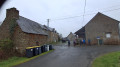
This route, in the hills above Miniac-Morvan, will take you to the "little" Mesnil State Forest via the village of Vieux-Bourg and the old Rennes-Saint-Malo tramway line.From Saint-Gré, on a clear day, you can enjoy a beautiful view of the Cancale coast.This route takes you along numerous paths on land and in the undergrowth. Very pleasant in good weather, but sometimes very wet otherwise.
Les Hauts de Miniac-Morvan
 8.35 mi
+246 ft
-269 ft
4h 05
Moderate
Departure from Miniac-Morvan (Ille-et-Vilaine)
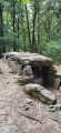
This route, in the hills above Miniac-Morvan, will take you to the Mesnil National Forest, passing through the hamlet of Vieux-Bourg and the old Rennes-Saint-Malo tram line.This route takes you along numerous paths on land and in the undergrowth. Very pleasant in fine weather, but sometimes very wet otherwise.
Dol Marshes and Mont-Dol
 12.65 mi
+180 ft
-180 ft
6h 00
Moderate
Departure from Cherrueix (Ille-et-Vilaine)
This is a route with a very distinctive elevation profile: 95% of the route is at sea level, with only the Mont-Dol rising above it.
But the main attractions of this route are, on the one hand, the Bay, a landscape listed as a UNESCO World Heritage Site in 1979, and on the other hand, the 350 km of canals, leats and ditches that help regulate the water level in the marsh.
Saint-Léonard, Les Ormes and the ‘White City’
 7.41 mi
+108 ft
-105 ft
3h 30
Moderate
Departure from Epiniac (Ille-et-Vilaine)
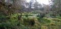
The route takes you through the Domaine des Ormes Park, which has been developed as a luxury campsite. It then leads you through the countryside along wooded paths and small roads. With a bit of luck, if you keep quiet, you might spot some large game, including wild boar, and no doubt some birds such as little egrets, great egrets or grey herons.
No particular difficulty.
Jardin d'Amour and the covered walkway at La Roche aux Fées in the Mesnil Forest
 4.95 mi
+66 ft
-66 ft
2h 20
Easy
Departure from Tressé (Ille-et-Vilaine)
This route takes you through wooded and hedgerow landscapes. Running exclusively through the undergrowth, it takes you through the Mesnil State Forest (600 ha), formerly owned by the privateer Surcouf. The paths are well-maintained but numerous, particularly in the southern section; follow the route carefully, ideally using a smartphone, as it is easy to take a wrong turn. The covered walkway, known as ‘La Roche aux Fées’, should not be confused with another walkway of the same name, which is more monumental and located in Janzé.
Route de la Mancelière from Baguer-Pican
 6.71 mi
+213 ft
-230 ft
3h 15
Moderate
Departure from Baguer-Pican (Ille-et-Vilaine)
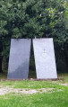
A fairly easy walk, following sunken paths through the countryside and woodland. Very pleasant in fine weather, it can also be enjoyed in winter, although the ground is wetter.There are some beautiful houses in the hamlet of Le Chatel, which was a strategic location during the French Revolution and the Second World War. The route also follows part of the ancient Roman road that linked Corseul to Avranches.
Circular route between Tressé and Mesnil-Roch through the two forests.
 13.57 mi
+315 ft
-308 ft
6h 30
 Difficult
Departure from Tressé (Ille-et-Vilaine)
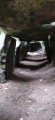
This route will take you through wooded and hedgerow landscapes. Mostly in the undergrowth, it will take you through the Mesnil State Forest (600 ha), formerly owned by the privateer Surcouf, as well as a very small part of the Coëtquen Forest (557 ha). Due to land consolidation policies, many hedgerows have disappeared over the last 50 years. However, hedges and embankments play an important role in the diversity of fauna and flora. They shelter livestock from the wind, limit water runoff and slow down the wind. Birds, insects and small mammals find shelter and food in these areas. Hedgerows are also a source of renewable energy and carbon sinks. For the past twenty years or so, local authorities have been encouraging the restoration of hedgerows and copses.
La Gouesnière circular via Bois Renou
5.04 mi
+164 ft
-174 ft
2h 30
Easy
Departure from La Gouesnière (Ille-et-Vilaine)
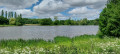
This is a short, peaceful walk, partly through built-up areas and partly through what is known locally as the white marsh. In fact, the only remaining evidence of the marsh is the leat Jean. The route follows part of the GRP® Tour du Pays Malouin.
Circular starting from Bonnemain via La Perinne and Les Ormes.
 8.02 mi
+164 ft
-164 ft
3h 50
Moderate
Departure from Bonnemain (Ille-et-Vilaine)
Bonnemain is one of the twenty-six communes in the canton of Combourg (also known as Romantic Brittany). This walk complements the one to the north-east, which runs between the village and the Domaine des Ormes. It winds its way through the countryside, via sunken paths and a few pretty little houses.
Circular Belle Noë in Épiniac
 5.53 mi
+144 ft
-171 ft
2h 40
Easy
Departure from Epiniac (Ille-et-Vilaine)
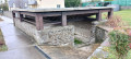
A gentle walk north of Epiniac. It winds through the woods around the village, along pleasant paths with no particular difficulty.The route can be muddy between November and March but is not flooded. The area is rich in wildlife; you may occasionally encounter a herd of wild boar in the undergrowth, especially during the hunting season! So please take care.
Circular route via Lannoué and Parc de la Higourdais from Epiniac
 8.39 mi
+223 ft
-217 ft
4h 05
Moderate
Departure from Epiniac (Ille-et-Vilaine)
The route consists almost equally of small roads and grassy paths. It is suitable for all seasons. No particular difficulty. The route winds through the various woods of the commune, which are fairly rich in game. The section near the Parc de la Higourdais is particularly pleasant, with paths running alongside the two ponds.
Around Bonnemain
 4.60 mi
+98 ft
-98 ft
2h 10
Easy
Departure from Bonnemain (Ille-et-Vilaine)
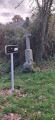
Bonnemain is one of the twenty-six communes in the canton of Combourg (also known as Romantic Brittany). This walk complements the one to the north-east, which runs between the village and the Domaine des Ormes. It winds its way through the countryside via sunken paths and past some pretty little houses.
The Breil and Moulin de la Corbonnais route in Epiniac
 5.03 mi
+338 ft
-318 ft
2h 35
Easy
Departure from Epiniac (Ille-et-Vilaine)
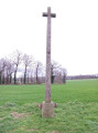
A short, peaceful walk near Epiniac. It takes you along some pleasant sunken lanes that are passable in almost all seasons and not too difficult. Here and there you’ll find listed buildings. It’s not impossible to come across a herd of wild boars in the undergrowth, especially during the hunting season! So be careful.
Circular around the Fort de Saint-Père-Marc-en-Poulet
5.13 mi
+148 ft
-174 ft
2h 30
Easy
Departure from Saint-Père (Ille-et-Vilaine)
The main attraction of this hike is the Fort de Saint-Père, built between 1777 and 1785 to protect Saint-Malo from English attacks by land and to complete the defence system designed by the famous Vauban. Part of its enclosure was destroyed in 1944 by the Germans as they fled during the Liberation. Today, the fort has become a cultural and leisure space. Every year, it hosts various trail events, flower markets, festivals and concerts. The fort is open to the public during the events it hosts, but the outer rampart walk is accessible to walkers all year round.
The Fort of Saint-Père-Marc-en-Poulet
 4.56 mi
+167 ft
-171 ft
2h 15
Easy
Departure from Saint-Père (Ille-et-Vilaine)
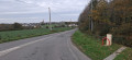
Built in the 18th century, the fort completes the coastal fortifications designed by Vauban to protect the bay of Saint-Malo from English attacks. With a capacity of 3,000 men, 26 casemates and a 46-metre-long powder magazine, it was delivered too late to play a defensive role. During the 1914-1918 war, it housed German prisoners and, during the last war, it was converted into an ammunition depot by the Germans, who blew up part of the casemates during their evacuation. Decommissioned in 1988, it is now owned by the municipality of Saint-Père-Marc-en-Poulet, which has restored it; shows are organised there.
The Domaine des Ormes from Bonnemain
 5.67 mi
+72 ft
-69 ft
2h 40
Easy
Departure from Bonnemain (Ille-et-Vilaine)
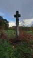
Located in the north-west of the Ille-et-Vilaine department, Bonnemain is one of the twenty-six parishes in the canton of Combourg, also known as Romantic Brittany. This gentle walk allows you to discover the surrounding countryside and the Domaine des Ormes, renowned for its campsite. The path is lined with some beautiful stone houses and two wayside crosses. The path around the Étang de la Sablonnière is particularly pleasant.
Circular route in Cherrueix via La Larronnière and La Banche
 6.57 mi
+13 ft
-13 ft
3h 00
Moderate
Departure from Cherrueix (Ille-et-Vilaine)
This easy walk takes you along the coast between the towns of Cherrueix and Le Vivier-sur-Mer, with beautiful views of Mont St Michel Bay to the east and Pointe du Grouin and Cancale to the west.It then continues inland, running alongside the River Banche, a bucolic stretch accompanied by the chirping of birds if there are no farmers at work.The circular route ends with a fairly quiet stretch of road.
Cherrueix beaches and marshes
 5.11 mi
+10 ft
-10 ft
2h 20
Easy
Departure from Cherrueix (Ille-et-Vilaine)
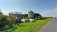
An easy route to explore the marsh, then return to the seaside via the beach.
Le Val Hervelin, the valley and the Manor of Saint-Meleuc
 5.39 mi
+272 ft
-272 ft
2h 45
Easy
Departure from Pleudihen-sur-Rance (Côtes-d'Armor)
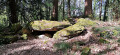
A pleasant walk that takes you through the charming valley of the Ruisseau de Coëtquen, also known as the Val Hervelin – which is also the name of the village – on a return trip. The route is generally very pleasant and the path runs largely through woodland. It also offers the chance to discover a few old houses, particularly in St-Méleuc and La Forge. It takes you to a megalithic site in the Tougeais forest, north of the hamlet known as ‘Les Rouchiviers’. There are no significant difficulties, but the valley floor may be very wet during wet weather and the stream may even burst its banks.
Circular route via La Ville ès Gris to Cancale
 5.53 mi
+328 ft
-328 ft
2h 50
Easy
Departure from Saint-Méloir-des-Ondes (Ille-et-Vilaine)
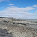
A pleasant little walk that takes you across the fields to the Cancale plateau, then heads back towards the beach to return along the coast via Les Roches Noires and Le Vauleraud. A beautiful view of the bay from the top of the cliff above Cancale.This route is not difficult.
The Bay of Mont-Saint-Michel from Saint-Méloir-des-Ondes to Cancale
 5.39 mi
+131 ft
-135 ft
2h 35
Easy
Departure from Saint-Méloir-des-Ondes (Ille-et-Vilaine)
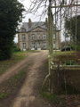
Discover the Bay of Mont-Saint-Michel along the coast from the village of Saint-Méloir-des-Ondes to Cancale. Choose a day when the tide is ebbing or at low tide to walk the outward leg along the foreshore; the return journey follows theGR® 34, which overlooks the bay and offers stunning views of its vast expanse, its oyster beds and Mont-Saint-Michel in the distance.
Route de Tertre Guy in Mesnil-Roc'h and Saint-Pierre-de-Plesguen
 8.37 mi
+138 ft
-144 ft
4h 00
Moderate
Departure from Saint-Pierre-de-Plesguen (Ille-et-Vilaine)
Saint-Pierre-de-Plesguen borders the Mesnil forest to the south-east. The route is very wooded and lined with a few picturesque hamlets where you can see some old stone houses weathered by time, in varying states of repair.
A magnificent bread oven can be seen just off the route at a place called La Planche, at the first house on the right.
More walks in Roz-Landrieux
Select a point of interest below: