A short walk around the Étang de Beaufort

The route covers a variety of terrain, but mainly hard ground, small country lanes, picturesque footpaths or stony tracks. It is particularly uninteresting during the wet months (from autumn to March) but can be enjoyed thoroughly during the rest of the year.
The route presents no particular difficulties.

Details

n°111170990
Creation:
Last update:
Last review:
–
  • Walking
    Activity: Walking
  • ↔
    Distance: 5.51 mi
  • ◔
    Average duration: 2h 45 
  • ▲
    Difficulty: Easy

  • ⚐
    Back to start: Yes
  • ↗
    Ascent: + 236 ft
  • ↘
    Descent: - 253 ft

  • ▲
    Highest point: 246 ft
  • ▼
    Lowest point: 43 ft
  • ⚐ Country: France
  • ⚐ City: Plerguer (35540)
  • ⚑
    Start/End: N 48.51157° / W 1.82501°
  • ❏
    IGN map(s): Ref. 1116ET, 1216O
  • Hour-by-hour weather

Photos

Description of the walk

Start from the car park situated to the north of the Étang de Beaufort. (48.51239, -1.825431)

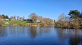
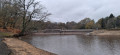
(S/E) Head down towards the edge of the lake and follow the path on the right. It winds round an arm of the lake. At the junction, turn left and head towards the western shore for a view of the whole lake. You can make out the abbey to the south, amongst the trees.

(1) Retrace your steps and take the path on the left, which climbs through the woodland. When you reach the farm track, turn right and follow it to the road (it curves in an S-shape).

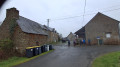
(2) Take the road to the left. In the distance, you’ll see a telecoms tower. At the tower, turn left and pass the houses , the last of which dates from 1783.

(3) Take the dirt track and, after about ten metres, take the path on the right which runs alongside the farm, descends through the woodland and joins a road. Follow it to the left until you come out onto the D78 at a place called La Villejoie.

(4) Continue straight on to the left, leaving the wayside cross on your left. Carry on towards Beaufort (signposted). Cross the Pont Menet bridge over the Biez Jean and walk for about 800 metres along the D78.

(5) Turn left onto the dead-end road. When you reach the houses, turn right onto a stony track and continue for about 750 m.

(6) Then turn left onto the road towards the abbey, then stay on the right-hand road (wooden bus stop on the right). Carry on and walk alongside a wall of cut stone. Begin the descent and you’ll see, on the left, the Menhir de La Pierre du Domaine. Continue to the hamlet of Pont Allain.

(7) Keep straight on at the bend. You can take a detour to the edge of the pond. Walk past the foot of the dam.

(8) Just after the dam, take the path on the left which climbs back up along the bank. Follow it to return to the starting point (S/E).

Waypoints

  1. S/E : mi 0 - alt. 69 ft - Car park - Étang de Beaufort
  2. 1 : mi 0.76 - alt. 62 ft - Viewpoint overlooking the - Étang de Beaufort
  3. 2 : mi 1.43 - alt. 177 ft - Sign for Les Rochers Richard, road
  4. 3 : mi 1.83 - alt. 240 ft - Stone house dating from 1783
  5. 4 : mi 2.5 - alt. 213 ft - D78 - Biez Jean (fleuve) - Manche
  6. 5 : mi 3.62 - alt. 167 ft - Dead-end track
  7. 6 : mi 4.31 - alt. 230 ft - Crossroads leading to the monastery
  8. 7 : mi 5.08 - alt. 62 ft - Gravel path, the Pont Allain - Étang de Beaufort
  9. 8 : mi 5.2 - alt. 62 ft - Western end of the dam - Étang de Beaufort
  10. S/E : mi 5.51 - alt. 79 ft - Car park - Étang de Beaufort

Notes

Picnic area at the car park at the start of the route.

Worth a visit

Menhir on the estate
On private property, visible from the road if the vegetation isn’t hiding it! According to legend, this menhir is said to have risen to the surface just as two brothers were about to kill one another. This menhir was listed as a historic monument in 1889. It is a monolith of fine-grained granite in the shape of a quadrangular obelisk, 4.5 metres high. The main faces face east and west, measuring 1.20 metres and 1 metre in width respectively.

Beaufort Monastery
About fifty years ago, the Dominican nuns came to live in the granite manor house formerly owned by the Lords of Beaufort, some twelve kilometres from the Rance estuary.
As the buildings were in danger of falling into ruin, restoration work had to be undertaken. This work was carried out in successive phases. The buildings of the former castle were fully restored in 1996.

Beaufort Castle
Form partofthe monastery and is not open to the public. The site has been home to no fewer than three different castles: first, a motte-and-bailey castle, built inthe 12th century; second, a stone castle, erected in the17th century; and finally, a converted manor house, which is the present-day castle.

Other walks in the area

For more walks, use our search engine .

The GPS track and description are the property of this route's author. Please do not copy them without permission.