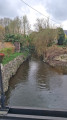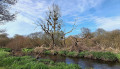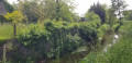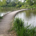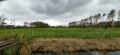
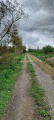
The Marais Noir as seen from Dol-de-Bretagne

The route winds its way through the Marais Noir, in the countryside near Dol. The paths are dirt or gravel, with a short stretch on the road. The Marais de Dol, in the broadest sense, covers approximately 12,000 ha. It comprises: the Marais Blanc (a coastal marsh with soils consisting of salt marshes covering 10,500 ha) and the Marais Noir (a central, peaty depression that is regularly flooded, covering 1,500 ha). The drainage of the marsh (La Grande Bruyère) dates back to the 18th century.

Details

n°89331876
Creation:
Last update:
–
Last review:
–
  • Walking
    Activity: Walking
  • ↔
    Distance: 8.74 mi
  • ◔
    Average duration: 4h 05 
  • ▲
    Difficulty: Moderate

  • ⚐
    Back to start: Yes
  • ↗
    Ascent: + 62 ft
  • ↘
    Descent: - 62 ft

  • ▲
    Highest point: 69 ft
  • ▼
    Lowest point: 7 ft
  • ⚐ Country: France
  • ⚐ City: Roz-Landrieux (35120)
  • ⚑
    Start/End: N 48.542847° / W 1.809369°
  • ❏
    IGN map(s): Ref. 1116ET, 1215OT, 1216O
  • Hour-by-hour weather

Photos

Description of the walk

Start from the cemetery car park, Rue du Prieuré (D8).

(S/E) With your back to the cemetery, turn right and head downhill. After about a hundred metres, take a path on the left.

(1) You’ll come out onto a small road (with the Manoir de la Grande Mettrie opposite) and follow it to the left. Cross the bridge over the N176.

(2) On the other side, turn right onto a road which, shortly afterwards, gives way to a stony track. The track soon turns left and runs alongside a ditch. You’ll reach the Biez du Milieu and turn right to quickly reach a lock.

(3) Turn left onto a track and follow the Biez du Cardequin.

(4) Turn left onto the track and now follow the Biez de la Ceinture Nord.

(5) Cross the D78 with care and continue straight ahead along a grassy path.

(6) At the junction, turn left. Continue straight on (south) along a tree-lined path. At the end, cross the bridge over the Biez du Milieu.

(7) On the other side, turn right onto a stony track and follow the Biez du Milieu on your right for about 2 km.

(8) Then take a path on the left. At the junction (marker 2), continue along the path opposite until you reach the hamlet of Langas. Go round the hamlet on the right.

(9) You’ll come out onto a road; follow it to the left and immediately ignore another road on the right. Follow the road and pass through the hamlet of La Tresse.

(10) At the hamlet of Plainfossé, first turn right then left and continue along a small road. Pass the La Motte farm and shortly afterwards you’ll reach a junction at the entrance to the hamlet of La Petite Rivière.

(11) Then turn onto a grassy track that runs alongside a property. The track then turns left and passes through the hamlet of La Petite Motte. Continue along a small road.

(12) Cross the D78 with care and carry on straight ahead along a small road. Pass the La Ville ès Bouilli farm on your left until you reach the bridge over the N176.

(2) Cross the bridge on this road once more.

(1) At the junction by the Manoir de la Grande Mettrie, carry on straight ahead. At the next junction, turn right. Join the D8 and follow it to the right to return to the starting point (S/E).

Waypoints

  1. S/E : mi 0 - alt. 69 ft - Cemetery car park – Roz-Landrieu
  2. 1 : mi 0.19 - alt. 30 ft - Junction on the short circular loop - Manoir de la Grande Mettrie
  3. 2 : mi 0.52 - alt. 36 ft - Junction with the circular route – Bridge over the N176
  4. 3 : mi 1.52 - alt. 13 ft - Lock – Footbridge
  5. 4 : mi 2.58 - alt. 10 ft - Left-hand bend
  6. 5 : mi 2.96 - alt. 10 ft - Crossing the D78
  7. 6 : mi 3.4 - alt. 10 ft - Junction
  8. 7 : mi 4.24 - alt. 10 ft - Bridge over the - Le Biez du Mileu
  9. 8 : mi 5.5 - alt. 10 ft - Crossroads
  10. 9 : mi 6.37 - alt. 39 ft - T-junction – Langas
  11. 10 : mi 6.99 - alt. 23 ft - Junction
  12. 11 : mi 7.49 - alt. 20 ft - Junction – La Petite Rivière
  13. 12 : mi 7.75 - alt. 23 ft - Crossing the D78
  14. S/E : mi 8.74 - alt. 69 ft - Cemetery car park – Roz-Landrieu

Notes

Take care when crossing the road.

Worth a visit

Le Manoir du Han, La Mettrie
This former manor house was built around 1400 for Robin du Han, husband of Melchiore Le Bouteiller, heiress to a prominent family whose name derives from the hereditary office of cupbearer to the bishops of Dol. This manor house, which is of the type featuring a low-ceilinged hall beneath the roof truss, was extended in the first half of the 16th century and converted into a farm by the end of the 18th century.
Not open to visitors.
Click here for more details.

St Pierre’s Parish Church
A former 12th-century church that once belonged to Tronchet Abbey. It was completely rebuilt in the 19th century in several phases. The sarcophagus of Saint Caradeuc is preserved and on display inside the church; it is situated on the right, just beneath the entrance porch in the narthex.

The Marais Noir
Located to the north of the village, this flat landscape criss-crossed by canals (known as ‘biez’) has its own distinctive architecture, notably old schist-stone farmhouses built on the few elevated areas.

The Cordon de Langas
A former natural dyke of shells and sand (a fossilised ‘coastal cordon’) bears witness to the distant era when the sea lapped at the shores of Roz-Landrieux. A more recent equivalent can be found along the bay on the shore between the villages of Cherrueix and Saint-Benoit-des-Ondes

Other walks in the area

For more walks, use our search engine .

The GPS track and description are the property of this route's author. Please do not copy them without permission.