


Refine your search for walks in Marche-en-Famenne
Marche-en-Famenne walks


 Towards La Hédrée and La Wamme, setting off from Waha
 Visorando Member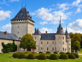
 11.45 mi
 +1,112 ft
 -1,086 ft
 6h 15
6h 15
 Moderate
 Departure from Marche-en-Famenne (Province de Luxembourg)
From Waha church, the walk begins by heading due east before climbing up through the countryside and then into woodland. After passing through the very pretty Bois de Waha, the route returns to open countryside as far as Harsin, offering beautiful panoramic views over the Hédrée and Wamme valleys. The walk then takes you to explore the Prés de la Wamme and the splendid Château Jemeppe in Hargimont, before gently winding its way back up to the hills of Waha.
Geological trail in the Fond des Vaulx nature reserve
 2.48 mi
+151 ft
-151 ft
1h 15
2.48 mi
+151 ft
-151 ft
1h 15
 Easy
Departure from Marche-en-Famenne (Province de Luxembourg)
Easy
Departure from Marche-en-Famenne (Province de Luxembourg)
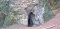
The Fond des Vaulx is part of the Famenne-Ardenne Geopark, the first UNESCO Global Geopark in Belgium.
A stone's throw from the town centre, this small, steep-sided valley offers a landscape that contrasts with the expanse of the Marche plain. It is home to several caves, chantoirs and holes, including the Trotti-aux-Fosses chasm, which is unique in Belgium and remarkable for its collapse chasm morphology.
Countryside between Marche-en-Famenne and Verdenne
 5.15 mi
+289 ft
-292 ft
2h 35
Easy
Departure from Marche-en-Famenne (Province de Luxembourg)
5.15 mi
+289 ft
-292 ft
2h 35
Easy
Departure from Marche-en-Famenne (Province de Luxembourg)
This route takes you to the village of Verdenne, on the plateau to the east of Marche-en-Famenne.
Walk to the sources of the Hédrée from Lignières
 8.98 mi
+830 ft
-843 ft
4h 50
Moderate
Departure from Marche-en-Famenne (Province de Luxembourg)
8.98 mi
+830 ft
-843 ft
4h 50
Moderate
Departure from Marche-en-Famenne (Province de Luxembourg)
The Hédrée river forms in the marshy area of the forest on the outskirts of Marche-en-Famenne between the villages of Gênes (Rendeux) and Bande (Nassogne).The route crosses this rushing stream at the ford on the path shortly after kilometre 2 and then follows one of its tributaries, whose bed runs alongside the path for just under the next kilometre.This is not the only wet spot on the walk: you often have to take a path through the undergrowth instead of the road until you reach the junction with Rue des Fagnes at kilometre 4.4.After a well-deserved break, it's back to the same thing for about 2 kilometres after crossing the national road.The last 4 kilometres are much drier.A short stop on the bridge at the bottom of Grimbièmont allows you to see how much the waters of the Hédrée have swollen over the first few kilometres of its course.In autumn, the circular offers not only the beautiful colours of nature but also an incredible diversity of mushrooms.
Ardennes walk in Nassogne
 9.97 mi
+1,473 ft
-1,447 ft
5h 50
Moderate
Departure from Nassogne (Province de Luxembourg)
9.97 mi
+1,473 ft
-1,447 ft
5h 50
Moderate
Departure from Nassogne (Province de Luxembourg)
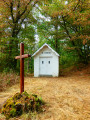
Here is a walk in Nassogne without running water, without the iconic Masblette, Diglette and other local tributaries of the Lomme.The walk is no less enjoyable for it! You’ll discover some lovely countryside scenery in a hilly setting, along with woodland sections featuring a variety of tree species typical of the region. The icing on the cake: there’s a giant sequoia in the small park surrounding the pond at the foot of Nassogne’s water tower.The Chapel of Saint-Léonard, the site itself and the Way of the Cross leading to it are a wonderful discovery. An information board there recounts the history – or perhaps, more likely, a version fuelled by the legend – of the hermit and his brother.
From Nassogne to Masbourg and Ambly
 9.09 mi
+1,394 ft
-1,424 ft
5h 25
Moderate
Departure from Nassogne (Province de Luxembourg)
9.09 mi
+1,394 ft
-1,424 ft
5h 25
Moderate
Departure from Nassogne (Province de Luxembourg)
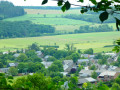
A pleasant hike through the hills and valleys of the Nassogne countryside and woods. It first takes you to the Chapel and Calvary of St-Léonard before descending towards the Masblette stream and the village of Masbourg. This is followed by a very steep climb up a very stony path on the agricultural plateau between Masbourg and Ambly. You may need a machete to approach Ambly, but the view on arrival is magnificent. The return to Nassogne is still a bit of a challenge for your calves, but you won't need a machete: the path is a little wider and properly cleared.
Broom walk from Waharday
 9.93 mi
+965 ft
-981 ft
5h 25
Moderate
Departure from Rendeux (Province de Luxembourg)
9.93 mi
+965 ft
-981 ft
5h 25
Moderate
Departure from Rendeux (Province de Luxembourg)
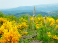
The deforested hillsides in the Waharday, Chéoux and Hodister area have been repopulated with various species of shrubs, notably broom, which has taken root there in their thousands.When they flower in May, they light up the whole area with their characteristic magnificent yellow colour.The icing on the cake is that the numerous meadows are also illuminated in yellow by buttercups.A real feast for the eyes.
Around Nassogne
11.12 mi
+1,286 ft
-1,316 ft
6h 15
Moderate
Departure from Nassogne (Province de Luxembourg)
A lovely walk through the forests of the municipality of Nassogne. However, you mustn’t be put off by the steep gradients and muddy paths.
Between Lomme and Masblette
12.02 mi
+1,663 ft
-1,663 ft
7h 00
Moderate
Departure from Nassogne (Province de Luxembourg)
A walk through the rolling Ardennes countryside around two rivers that are emblematic of the region.
The Masblette is a tributary of the Lomme (also spelled L'Homme in some sources). Their confluence is located between the villages of Lesterny and Masbourg, south of Forrières.
On the Art Trails between Sinsin, Heure and Nettinne
 10.99 mi
+840 ft
-863 ft
5h 45
Moderate
Departure from Somme-Leuze (Province de Namur)
10.99 mi
+840 ft
-863 ft
5h 45
Moderate
Departure from Somme-Leuze (Province de Namur)
Every May, the paths and trails of the Namur Condroz are enriched by a number of land art and street art installations. The most fragile ones, made from natural materials, deteriorate over time. Others, unfortunately, disappear as a result of vandalism.This circular walk allows you to discover a few of them. In order: ‘Bourgeons’, ‘Cercle des sentiers’, ‘Artbri cubique’, ‘Chemin des 4 lunes’, ‘Hé fée papillon’ (which has replaced ‘Les Nids du Marsupilami’), and ‘À l’ombre de la gaillarde’.In terms of atmosphere, the walk has a rather rural feel, with a stretch through the Bois d’Heure woodland, whilst the natural undulating terrain of the Condroz ensures a variety of landscapes.As for tarmac, there’s about 1 km before Les Bourgeons, 1 km on leaving Heure, 1 km in Nettinne and just over 1 km shortly before the end – that’s roughly a quarter of the route.
Hotton, a typical village in La Famenne
 9.38 mi
+1,040 ft
-1,033 ft
5h 15
Moderate
Departure from Hotton (Province de Luxembourg)
9.38 mi
+1,040 ft
-1,033 ft
5h 15
Moderate
Departure from Hotton (Province de Luxembourg)
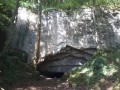
Limestone and blue stones make up a significant part of the habitat. Rue Haute is a fine example of this. Several limestone houses dating from the 18th century stand side by side. Among these are two listed buildings, the Moulin Faber and the Maison Godenir, which houses the Royal Tourist Office.The Aïve Cave/Neolithic cave, Ti Château/Roman camp, Trou Fré Djame... are other places you will encounter along this route.
The wooded heights of the Ourthe river at the start of Hotton
 10.42 mi
+1,155 ft
-1,152 ft
5h 50
Moderate
Departure from Hotton (Province de Luxembourg)
10.42 mi
+1,155 ft
-1,152 ft
5h 50
Moderate
Departure from Hotton (Province de Luxembourg)
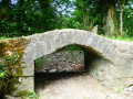
This walk begins by following one of Wallonia's iconic rivers, with some beautiful rocks as a bonus, before offering a pleasant loop through the forests and countryside south of the tourist town.
Fields and woods in Rochefort
4.39 mi
+735 ft
-715 ft
2h 40
Moderate
Departure from Rochefort (Belgique) (Province de Namur)
A short walk through fields and woods starting from the centre of Rochefort. After crossing the Lomme twice, a climb through the woods leads to the Lorette Chapel. The route then continues through fields and housing estates and climbs through the woods on the Tier des Falizes to the Rond-Point du Roi. Here you will find a viewpoint overlooking the town and its surroundings. The walk ends with a descent through the woods to the town centre.
On the way to the Fourneau Saint-Michel
 6.70 mi
+928 ft
-928 ft
3h 55
Moderate
Departure from Nassogne (Province de Luxembourg)
6.70 mi
+928 ft
-928 ft
3h 55
Moderate
Departure from Nassogne (Province de Luxembourg)
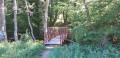
Starting from Masbourg, the forest trails will take you halfway to the Fourneau Saint-Michel, an estate comprising the open-air museum of rural life in Wallonia and the Iron Museum, with a return trip through the heights of the Masblette valley.
When Mother Nature awakens, starting from Navaugle
 10.46 mi
+702 ft
-686 ft
5h 25
Moderate
Departure from Rochefort (Belgique) (Province de Namur)
10.46 mi
+702 ft
-686 ft
5h 25
Moderate
Departure from Rochefort (Belgique) (Province de Namur)
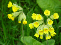
When Mother Nature awakens, all our senses come alive! A lovely walk to take in early spring, when the leaves on the trees are a vibrant green and the first flowers are beginning to bloom and bring colour to the verges.
The Hermitage of St-Thibaut
 4.94 mi
+607 ft
-600 ft
2h 50
Moderate
Departure from Rendeux (Province de Luxembourg)
4.94 mi
+607 ft
-600 ft
2h 50
Moderate
Departure from Rendeux (Province de Luxembourg)
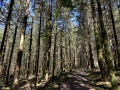
The hike starts at the end of Rue du Belvédère and crosses the woods to reach the village of Hodister. It then heads towards the site of St-Thibaut. Be sure to admire the view halfway along the route before returning to the starting point.
In search of a lost cross in Rendeux
 9.44 mi
+1,155 ft
-1,142 ft
5h 20
Moderate
Departure from Rendeux (Province de Luxembourg)
9.44 mi
+1,155 ft
-1,142 ft
5h 20
Moderate
Departure from Rendeux (Province de Luxembourg)
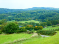
We went in search of the Croix Monseur-Kinet located near the Chapelle Saint-Thibaut. We didn't find it! But we found others. A mainly forestroute offering panoramic views of the Ourthe valley and its tributaries here and there.
Around Rendeux
11.20 mi
+1,112 ft
-1,119 ft
6h 05
Moderate
Departure from Rendeux (Province de Luxembourg)
Start at Robert Lenoir Park in Rendeux and head towards Bois d'Arlogne. Once there, the hike passes through Marcouray. Then, from the village, head towards Cielle and descend towards La Boverie to finally follow the Ourthe to Rendeux via Jupille and Marcourt. A beautiful circular route to discover the villages of our municipality!
Forest walk in Rochefort
11.62 mi
+696 ft
-689 ft
5h 55
Moderate
Departure from Rochefort (Belgique) (Province de Namur)
A magnificent, airy forest where, with a bit of luck, you may see a deer or two frolicking.The view opens up and offers countryside landscapes as you approach the villages of Frandeux, Laloux, Briquemont and Éprave.
Circuit in the Saint-Hubert forest starting from Fourneau Saint-Michel
8.67 mi
+814 ft
-814 ft
4h 40
Easy
Departure from Saint-Hubert (Belgique) (Province de Luxembourg)
This is a very easy route through one of Belgium's largest deciduous forests, on comfortable gravel paths and a little tarmac, but very secluded, completely away from 'civilisation'. It passes by the Étang de Bilaude bird observatory, which is superb in its moorland setting. In several places, beautiful benches carved from tree trunks invite you to rest and contemplate.
Notre-Dame des Pauvres Chapel and Pont des Cloyes
 6.05 mi
+656 ft
-650 ft
3h 20
Moderate
Departure from Tellin (Province de Luxembourg)
6.05 mi
+656 ft
-650 ft
3h 20
Moderate
Departure from Tellin (Province de Luxembourg)
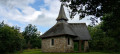
Discover the Notre-Dame des Pauvres Chapel, whose stained-glass windows, dedicated to the Virgin Mary, allow light to penetrate under the arch sheltering the Virgin of Banneux. Beforehand, cross the Pont des Cloyes, a prime spot for observing herons, mallards, kingfishers and other birds of the Lomme.
Circular in the Heart of the Ardennes starting from La Roche
 11.00 mi
+945 ft
-945 ft
5h 55
Moderate
Departure from La Roche-en-Ardenne (Province de Luxembourg)
11.00 mi
+945 ft
-945 ft
5h 55
Moderate
Departure from La Roche-en-Ardenne (Province de Luxembourg)
Starting from the Ronchamps pond, the walk begins by winding through the countryside before heading into the forest.Make sure you’re wearing suitable footwear, as the route follows a stream along a path overgrown with tall grass at the start and flooded with water towards the end. This valley is magnificent and wonderfully wild!The first climb of the route leads out into the countryside with a lovely view to the north over the hills of the Ourthe Valley.A short detour (off the route) to the centre of Beausaint allows you to admire its castle.From Beausaint to Vecmont, it’s (almost) straight ahead and through the countryside. There’s a small chapel and a picnic table between Ronchampay and Vecmont.Shortly after Vecmont, there is (unfortunately) a short kilometre of minor road before entering the woods, which the route leaves only briefly to cross the N89 again and finally return to the starting point.
Between rock and water in Han-sur-Lesse
9.92 mi
+1,237 ft
-1,230 ft
5h 40
Moderate
Departure from Rochefort (Belgique) (Province de Namur)
Welcome to Han-sur-Lesse, where nature and mystery meet. Between rivers and ponds, the Lesse winds its way between limestone cliffs and dry hills with rare flora, contrasting with the damp valleys. Underground, a fascinating world: rocks sculpted by water, caves, sinkholes and cavities bear witness to millions of years of erosion. In woods such as the Banalbois or the Griffaloux, the atmosphere becomes wilder. Ancient hermitages remind us of the presence of recluses in search of peace. A walk amidst rock, water and forest, rich in history and sensations.
Han-sur-Lesse geological walk
 5.93 mi
+554 ft
-551 ft
3h 15
Moderate
Departure from Rochefort (Belgique) (Province de Namur)
5.93 mi
+554 ft
-551 ft
3h 15
Moderate
Departure from Rochefort (Belgique) (Province de Namur)
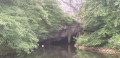
UNESCO created the Geopark label to promote geological heritage. On this walk, you will discover part of Belgium's first Geopark, Famenne-Ardenne. On the agenda: caves, clay pits and resurgences.
Caves and resurgences near Han-sur-Lesse
 10.42 mi
+1,066 ft
-1,066 ft
5h 45
Moderate
Departure from Rochefort (Belgique) (Province de Namur)
10.42 mi
+1,066 ft
-1,066 ft
5h 45
Moderate
Departure from Rochefort (Belgique) (Province de Namur)
This beautiful nature walk takes you close to Belgium's most famous resurgences: the Lomme and the Lesse, as well as the associated caves. It also offers some lovely views of the surrounding valleys.
From La Passerelle to the Petit-Han woods
5.42 mi
+243 ft
-243 ft
2h 40
Moderate
Departure from Durbuy (Province de Luxembourg)
Hike starting from the La Passerelle hotel-restaurant (free parking on site). Round trip walk in the village of Grand-Han (along the village road) and in the Petit-Han woods. The hike is accessible to pushchairs.
Between Ardenne and Famenne
 11.15 mi
+1,276 ft
-1,273 ft
6h 15
Moderate
Departure from Tellin (Province de Luxembourg)
11.15 mi
+1,276 ft
-1,273 ft
6h 15
Moderate
Departure from Tellin (Province de Luxembourg)
Part countryside, part woodland, the walk offers lovely views across the slopes of the Lomme Valley and its surroundings.Of particular note are the Notre-Dame de Haurt Chapel and the nearby disused quarry (a protected site), the Clusure viewpoint, the Maison Espagnole, the Château de Burlin estate, the beautifully renovated farmhouse on Rue Belair, and the Notre-Dame des Pauvres Chapel – to name but a few of the walk’s highlights.
From La Passerelle to Durbuy
8.48 mi
+492 ft
-489 ft
4h 20
Moderate
Departure from Durbuy (Province de Luxembourg)
Hike starting from the La Passerelle hotel-restaurant (free parking on site).
For a day's walk that includes the town of Durbuy, stop off to visit the old town.
At Petit-Han, you must cross the Adventure Valley barrier to reach Durbuy.
On the heights of the Lomme, starting from Bure
 12.01 mi
+1,198 ft
-1,198 ft
6h 35
12.01 mi
+1,198 ft
-1,198 ft
6h 35
 Difficult
Departure from Tellin (Province de Luxembourg)
Difficult
Departure from Tellin (Province de Luxembourg)
Starting from the Chapel of Notre-Dame de la Salette, the walk begins in the countryside before entering the woodland, quickly reaching the Lomme stream, which it follows upstream for over 4 km to the provincial fish farm at Mirwart.The ponds stretch out one after the other along the course of the Marsault or Marsolle stream to the former site of the Marsolle blast furnace, which operated from 1536 to 1568 on behalf of the Lord of Mirwart.The route then zigzags through the forest for around 9 kilometres to reach the rural heights of Bure and return to the starting point.
Circular via Briquemont
13.36 mi
+912 ft
-909 ft
6h 55
Difficult
Departure from Rochefort (Belgique) (Province de Namur)
A magnificent circular that takes you through unspoilt woods, starting from Éprave and connecting Briquemont, Ciergnon and Jamblinne, for experienced walkers.
In Briquemont, take the path that climbs up to the farm next to the remains of a bus stop, continuing straight ahead until you reach the road, which you cross. Then continue straight ahead until you reach Ciergnon.
Scy and Mohiville circular in Hamois
 4.67 mi
+285 ft
-302 ft
2h 25
Easy
Departure from Hamois (Province de Namur)
4.67 mi
+285 ft
-302 ft
2h 25
Easy
Departure from Hamois (Province de Namur)
A simple but very beautiful region that conceals treasures in the valley of flavours. The Hamois region is a treasure trove of architectural, natural and historical riches: castles, mills and barns, with traces of the past along the Bocq, which has its source in the heart of the village of Scy. But above all, it is a little paradise where it is good to stop for a while.
Partly corresponds to the Red Rectangle trail, in the opposite direction at the start and abandoned at the end.
Condruzian circular starting from the source of the Bocq
 9.09 mi
+673 ft
-666 ft
4h 45
Moderate
Departure from Hamois (Province de Namur)
9.09 mi
+673 ft
-666 ft
4h 45
Moderate
Departure from Hamois (Province de Namur)
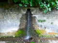
This beautiful walk in the Namur Condroz region takes you to the source of the Bocq river, which flows like a fountain through the surrounding wall of the Château de Scy estate. Although the estate is private, you can see the rear façade, the park and the magnificent tree-lined avenue.
The castles from Barvaux-Condroz
12.37 mi
+1,181 ft
-1,207 ft
6h 45
Moderate
Departure from Havelange (Province de Namur)
Set off to discover the few "visible" castles during a hike that is mainly through forest in the beautiful valleys of the Namur Condroz.
From the Linçon Valley to the Masblette Valley
 6.77 mi
+850 ft
-840 ft
3h 50
Moderate
Departure from Tellin (Province de Luxembourg)
6.77 mi
+850 ft
-840 ft
3h 50
Moderate
Departure from Tellin (Province de Luxembourg)
Walk in the Land of the Awenne Clog Makers. This slightly hilly route, mostly through forest, will take you past the Notre-Dame de Lourdes cave and the Ri Bellerose stream to the heights of the Prairies de Gimbes ridge, passing by the open views at a place called La Justice.
In the valley of flavours, a walk between the Condroz and the Famenne
 6.14 mi
+436 ft
-440 ft
3h 10
Moderate
Departure from Havelange (Province de Namur)
6.14 mi
+436 ft
-440 ft
3h 10
Moderate
Departure from Havelange (Province de Namur)
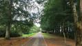
A pleasant, quiet and secluded setting. The route, which is often through woodland, is ideal for observing wildlife and remarkable trees, including an old oak and a sequoia. There are several interesting viewpoints.
This is a variation of a local walk called 'du Chêne au Gibet' (from the oak tree to the gallows). The route also follows part ofthe GR®575.
In the beautiful region marking the boundary between the Condroz and the Famenne, you can enjoy a superb forest walk with beautiful views.
Medium-length walk around the Grottes de Han estate
 9.56 mi
+1,332 ft
-1,352 ft
5h 35
Difficult
Departure from Rochefort (Belgique) (Province de Namur)
9.56 mi
+1,332 ft
-1,352 ft
5h 35
Difficult
Departure from Rochefort (Belgique) (Province de Namur)
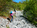
This medium-length walk around the Grottes de Han estate naturally differs in a few respects from the walk known as the ‘Grand Tour of the Grottes de Han estate’. It does not follow the course of the Lesse between Belvaux and Resteigne Castle, but it does take in the hermitage site and, above all, involves climbing to the top of the rocky cliff face to the north of the estate via an alpine-style path. This walk is probably not suitable for all children, but the bravest and most determined will enjoy the small playground at the starting point, the famous ‘alpine’ trail, and spotting animals on the outskirts of the park or from the Griffaloux viewpoint.
From the Petit-Han Woods to the N833
2.28 mi
+72 ft
-52 ft
1h 05
Easy
Departure from Durbuy (Province de Luxembourg)
Hike starting from the Petit-Han municipal school. There is a football pitch (easy and free parking, Rue des Pinèdes), a playground and picnic benches.Fully paved round trip, ideal for a stroll with a pushchair
Walk in Famenne-Ardenne from Petit-Han
 10.95 mi
+397 ft
-410 ft
5h 25
Moderate
Departure from Durbuy (Province de Luxembourg)
10.95 mi
+397 ft
-410 ft
5h 25
Moderate
Departure from Durbuy (Province de Luxembourg)
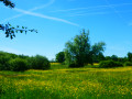
Located mainly in Famenne, on the border with the Ardennes, this circular route alternates between woodland and countryside, with a short section along the River Ourthe.With very little elevation gain and plenty of hard-surfaced paths (cycle paths, local roads or access roads to residential estates), it presents no difficulty other than the odd slightly muddy footpath or forest track. Lovely views over the northern part of the Famenne and the Ourthe valley between the residential area of Plain de Holset (Monteuville) and Melreux.
Circular in the Petit-Han Woods
4.23 mi
+131 ft
-118 ft
2h 05
Easy
Departure from Durbuy (Province de Luxembourg)
This is a walk starting from the Petit-Han community school and the football pitch (easy and free parking). Playground and picnic benches available on site.Part of the route is paved, the other part is accessible with a sturdy pushchair.
Hermitage and Resteigne Castle
 10.20 mi
+922 ft
-892 ft
5h 30
Moderate
Departure from Tellin (Province de Luxembourg)
10.20 mi
+922 ft
-892 ft
5h 30
Moderate
Departure from Tellin (Province de Luxembourg)
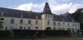
A walk starting from Tellin to discover the villages of Resteigne and Belvaux via the La Lesse valley and the Bois de Niau (woodland) where a hermit lived. There are still ruins of the hermitage of this former officer of Napoleon and heir to the Château de Resteigne (castle). On the way go past the Rocher à Pic viewpoint, the Belvaux chapel, the Hermitage, the Mill, the Castle and the old Resteigne quarry.
Grand tour of the Han Caves estate
 13.20 mi
+1,257 ft
-1,240 ft
7h 10
Difficult
Departure from Rochefort (Belgique) (Province de Namur)
13.20 mi
+1,257 ft
-1,240 ft
7h 10
Difficult
Departure from Rochefort (Belgique) (Province de Namur)
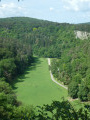
A visit to the Caves of Han is a must. At least once in your life, you must go there to admire the natural beauty shaped by water in the Boine limestone massif over millions of years! Of course, the walk suggested here does not go inside, but takes a wide loop around the forest estate, which has been privately owned and fenced off since the 1960s to preserve its condition. As a result, whilst you can still see the Lesse resurgence, it is unfortunately no longer possible to see beyond the top of the rock at the point where it disappears into the Gouffre de Belvaux. That said, this walk also offers the chance to discover the Ry d’Ave, the Rocher d’Hérimont, the limestone hill on the north side, the viewpoint at the Rocher de Griffaloux on the east side, the village of Belvaux, the old Lesse quarry, Resteigne Castle, the Tiennes and Pairées nature reserves, the juniper-covered meadows, and the undergrowth carpeted with daffodils, lilies of the valley and other flowers depending on the season.
Ardennes circular starting from Champlon
 10.52 mi
+961 ft
-935 ft
5h 40
Moderate
Departure from Tenneville (Province de Luxembourg)
10.52 mi
+961 ft
-935 ft
5h 40
Moderate
Departure from Tenneville (Province de Luxembourg)
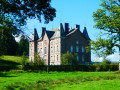
The hike takes you on a journey of discovery through the countryside and forests on the heights of the Deux Ourthes Natural Park. The balanced alternation between panoramic views and deciduous and coniferous forests provides all the ingredients for a beautiful and enjoyable outing in nature.
L’Ermitage via the Bois de Niaux
 2.62 mi
+154 ft
-154 ft
1h 20
Easy
Departure from Rochefort (Belgique) (Province de Namur)
2.62 mi
+154 ft
-154 ft
1h 20
Easy
Departure from Rochefort (Belgique) (Province de Namur)
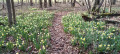
Magnificent in spring when the daffodils are in bloom, in autumn for the flamboyant colours of the deciduous trees, and largely shaded during the summer months. Set off to explore the Ermitage halfway along the route and the Réserve des Pairées, a juniper-lined reserve that you’ll pass on both the outward and return journeys.
Rhododendron alley from Porcheresse
 10.94 mi
+725 ft
-705 ft
5h 40
Moderate
Departure from Havelange (Province de Namur)
10.94 mi
+725 ft
-705 ft
5h 40
Moderate
Departure from Havelange (Province de Namur)
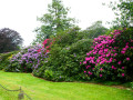
In May, the driveway to Château de Ramezée is even more beautiful than usual thanks to the impressive array of colours provided by the numerous majestic rhododendrons in bloom.It is a magical place that you will never tire of!
Passing through La Basseille
 5.27 mi
+673 ft
-673 ft
3h 00
Easy
Departure from Tenneville (Province de Luxembourg)
5.27 mi
+673 ft
-673 ft
3h 00
Easy
Departure from Tenneville (Province de Luxembourg)
Set off to explore the River La Basseille, a tributary of the Ourthe which rises in Saint-Hubert. The river, whose banks form a Nature Reserve, flows exclusively through the Forest of Freyr for around 10 km.
Please note: there are two sections that are more difficult to follow; a GPX track is recommended.
Around the Basseille Stream
 10.57 mi
+1,043 ft
-1,027 ft
5h 45
Moderate
Departure from Tenneville (Province de Luxembourg)
10.57 mi
+1,043 ft
-1,027 ft
5h 45
Moderate
Departure from Tenneville (Province de Luxembourg)
The Ruisseau de Basseille has its source in the Fagne de la Borne near the Saint-Hubert Aerodrome and flows into the western Ourthe near Ortheuville. This walk follows its course more or less closely for about 6 km.
A Condroz getaway between Mohi-sco-ville and Porcheresse
 10.01 mi
+574 ft
-558 ft
5h 05
Moderate
Departure from Hamois (Province de Namur)
10.01 mi
+574 ft
-558 ft
5h 05
Moderate
Departure from Hamois (Province de Namur)
Mohiville or Scoville? The school and the playground appear to be on the site of the former village of Mohiville, whilst the cemetery right next to it seems to belong to the former village of Scoville. Well, now that all these villages have merged into a single municipality, it doesn’t really matter.Starting from the ‘Les murmures du Bocq’ hall, the walk heads out into the countryside and the Hamois communal forest before crossing over to the Havelange countryside. Same trees, same paths, but perhaps a bit more mud between kilometres 4 and 9 than on the rest of the route… except near the Fond du Moulin farm, just before the ponds of the same name at the 13th kilometre and just after the source of the Bocq (off the route) in Scy.Don’t worry if the dog from the farm next to the starting point tags along for a few kilometres around its home. Covered in mud as you’d expect but full of life and attentive to the walkers, it makes for pleasant company.
Walk from Resteigne to Belvaux
 5.00 mi
+630 ft
-607 ft
2h 50
Easy
Departure from Rochefort (Belgique) (Province de Namur)
5.00 mi
+630 ft
-607 ft
2h 50
Easy
Departure from Rochefort (Belgique) (Province de Namur)
A delightful mix of sights to discover throughout these 8 km: some lovely viewpoints, including Rocher à Pic and the La Lesse quarry, the Ellinchamps Forest Reserve, the bread oven and the Belvaux Chapel, as well as the Herdal Resurgence on the way back.
Circular Daffodil Walk to Edmond d’Hoffschmidt’s hermitage
 10.17 mi
+1,070 ft
-1,047 ft
5h 35
Moderate
Departure from Rochefort (Belgique) (Province de Namur)
10.17 mi
+1,070 ft
-1,047 ft
5h 35
Moderate
Departure from Rochefort (Belgique) (Province de Namur)
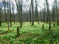
Starting from the old Resteigne Quarry, set off to explore Resteigne Castle, the old watermill, the new footbridge over the Lesse, the nature reserves (pastures, juniper bushes, etc.), millions of wild daffodils (in season), the former hermitage of Edmond d’Hoffschmidt, the pretty village of Belvaux and the viewpoint overlooking the Lesse valley from the Rocher à Pic.
Around La Haie Jadot, in the Condroz countryside
 8.72 mi
+538 ft
-541 ft
4h 30
Moderate
Departure from Hamois (Province de Namur)
8.72 mi
+538 ft
-541 ft
4h 30
Moderate
Departure from Hamois (Province de Namur)
A route combining roads and trails in the Namur Condroz, confirming that the region is a ‘corrugated landscape’. The trails are beautiful and can be accessed with children and people with reduced mobility using a Joëlette.
The start point is easily accessible, including by bus, during school terms (bus stop less than 50 m away).
This route is a mix of various local walks, RAVeL routes and theGR® 575-576 "Through the Condroz".
Along the Ourthe between Bohon and Bomal
 11.31 mi
+1,289 ft
-1,266 ft
6h 20
Difficult
Departure from Durbuy (Province de Luxembourg)
11.31 mi
+1,289 ft
-1,266 ft
6h 20
Difficult
Departure from Durbuy (Province de Luxembourg)
No, the walk doesn’t follow the banks of the Ourthe for 18 km… that would probably be very pretty but too monotonous over such a distance.Starting from the centre of Barvaux, the route begins by climbing the hill on the western side towards Durbuy (which you can visit off the trail) and reaches the Ourthe at the new relief car park.From there, the walk follows the river for just over 3 km before leaving it to reach the plateau between Tohogne and Herbet.After descending to the Ourthe and passing through Bomal, the walk climbs up the other side of the Ourthe and follows the lovely ridge path through the Mont des Pins and Mont Pelé Nature Reserve.
From Hamois to Barvaux-Condroz and back
15.34 mi
+928 ft
-925 ft
7h 50
Difficult
Departure from Hamois (Province de Namur)
A hike through the Condroz countryside, in the “Pays des Tiges et des Chavées”, covering the municipalities of Hamois and Havelange, with a small section on the Sentiers d’Art (2 artworks) and on various PR® trails, local walks or Grande Randonnée de Pays (GRP® 575 “À travers le Condroz”) routes.Whilst the route from Hamois to Barvaux is mainly on footpaths, the return leg includes a few more tarmac sections, regularly interspersed with sections unsuitable for vehicles.The circular route starts from the car park of the Hamois Office de la Culture (OC) on Rue de la Boverie. Unless an event is announced, this car park is usually empty, or nearly so.
A short walk around Hamois
3.79 mi
+148 ft
-151 ft
1h 50
Easy
Departure from Hamois (Province de Namur)
A route mainly on tarmac and hard surfaces (pavements, Ravel cycle path) based on walks of varying degrees of popularity, including aGR® route, along the Ravel cycle path and on streets of varying sizes in and around Hamois.
A short stretch of footpath, which can be quite muddy in wet weather and impassable with a pushchair, adds variety to this route. An alternative route is suggested in the description, but this reduces the distance covered.