L’Ermitage via the Bois de Niaux

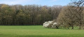
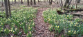
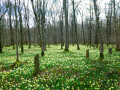
Magnificent in spring when the daffodils are in bloom, in autumn for the flamboyant colours of the deciduous trees, and largely shaded during the summer months. Set off to explore the Ermitage halfway along the route and the Réserve des Pairées, a juniper-lined reserve that you’ll pass on both the outward and return journeys.

Details

92385828
Creation:
Last update:
Last review:
  • Walking
    Activity: Walking
  • ↔
    Distance: 2.62 mi
  • ◔
    Average duration: 1h 20 
  • ▲
    Difficulty: Easy

  • ⚐
    Back to start: Yes
  • ↗
    Ascent: + 154 ft
  • ↘
    Descent: - 154 ft

  • ▲
    Highest point: 945 ft
  • ▼
    Lowest point: 778 ft

Photos

Description of the walk

Coming from Resteigne Castle, take Rue de la Carrière towards Belvaux. Drive for about 1.5 km; the car park is along the road on your left.

(S/E) With your back to the road, take the dirt track to the right of the information boards. Walk alongside the Réserve des Pairées Ouest.

(1) When the road begins an S-bend, carry on straight ahead along the unmarked track. Walk until you reach the path on your right, just before the fence of the meadow opposite. Go under the trees and follow the path; head uphill and continue until you reach a junction with a tree on your left bearing orange markings on its trunk.

(2) Turn left and follow the path.

(3) Join a path and continue along it to the left. Follow the path, keeping straight on at the various junctions you come to, until you reach the information boards for the Hermitage.

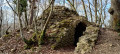
(4) Carry on for a few steps to see the remains of the tower, then return to the information boards.

(4) Turn right to walk through the ruins of the Hermitage and its arboretum. Leave the site boundaries and continue along the descending path. At the bottom, turn left, and at the next junction turn right. Ignore the path branching off to your left, and further on, the one to your right. Walk until you reach the wide dirt track on your left.

(5) Turn left and walk along the meadows until you reach a Fork in the road.

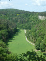
(6) Take the path on the right, walk alongside the Réserve des Pairées and its juniper trees, and return to the car park (S/E) keeping to your left.

Waypoints

  1. S/E : mi 0 - alt. 791 ft - Car park with information board
  2. 1 : mi 0.3 - alt. 807 ft - Start of the trail
  3. 2 : mi 0.67 - alt. 873 ft - Junction with a tree bearing inscriptions
  4. 3 : mi 0.9 - alt. 896 ft - Junction
  5. 4 : mi 1.44 - alt. 925 ft - Ermitage de Resteigne
  6. 5 : mi 2 - alt. 820 ft - Junction
  7. 6 : mi 2.25 - alt. 801 ft - Crossroads
  8. S/E : mi 2.62 - alt. 791 ft - Car park with information board

Notes

The perfect Sunday walk – parking spaces can be hard to come by on some weekends.

There is no water along the route. You can quench your thirst in the cafés near Resteigne Castle.

From October to the end of January, please check the hunting dates on the ‘Partageons la forêt ’ website or the ‘Chasse on web’ app

Worth a visit

Along the way

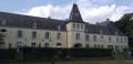
Resteigne Hermitage: built in the early 19th century by Edmond d’Hoffschmidt (1777–1861), son of the lord of Resteigne, and situated in the Bois de Niaux. It consisted of a stately cottage with a cellar, outbuilding, garden and aviary. Information panels are on display at the site.

Nearby

Han-sur-Lesse Cave.

Other walks in the area

For more walks, use our search engine .

The GPS track and description are the property of this route's author. Please do not copy them without permission.