


There are two picnic huts at a place called Nauchêne (3), a bench at the Vieux Bon Dieu cross (6), another at the Saint-Léonard Chapel (7) and several benches and picnic tables near the pond (8).
Car park for an alternative starting point at (9).
Ardennes walk in Nassogne


Here is a walk in Nassogne without running water, without the iconic Masblette, Diglette and other local tributaries of the Lomme.
The walk is no less enjoyable for it! You’ll discover some lovely countryside scenery in a hilly setting, along with woodland sections featuring a variety of tree species typical of the region. The icing on the cake: there’s a giant sequoia in the small park surrounding the pond at the foot of Nassogne’s water tower.
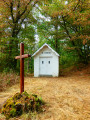
The Chapel of Saint-Léonard, the site itself and the Way of the Cross leading to it are a wonderful discovery. An information board there recounts the history – or perhaps, more likely, a version fuelled by the legend – of the hermit and his brother.
Details
Creation:
Last update:
Last review:
–
–
-
 Activity: Walking
 -
 Distance: 9.97 mi
 -
 Average duration: 5h 50
 -
 Difficulty: Average
 -
-
 Back to start: Yes
 -
 Ascent: + 1,473 ft
 -
 Descent: - 1,447 ft
 -
-
 Highest point: 1,352 ft
 -
 Lowest point: 781 ft
-
 Country:
Belgium
Country:
Belgium
-
 Area: Massif des Ardennes
 -
 City:
Nassogne
City:
Nassogne -
 Start/End: N 50.131375° / E 5.337119°
 -


 Hour-by-hour weather
Photos
Waypoints
- S/E : mi 0 - alt. 1,237 ft - Nassogne Cemetery
- 1 : mi 1.26 - alt. 856 ft - Fork in the road above Ambly
- 2 : mi 2.09 - alt. 830 ft - Crossroads to the east of Forrières
- 3 : mi 3.78 - alt. 932 ft - Nauchêne
- 4 : mi 4.47 - alt. 781 ft - Masbourg
- 5 : mi 5.86 - alt. 1,102 ft - Biermonfoy
- 6 : mi 6.27 - alt. 955 ft - Vieux Bon Dieu
- 7 : mi 8.09 - alt. 1,112 ft - Saint-Léonard Chapel
- 8 : mi 9.16 - alt. 1,345 ft - Nassogne Pond
- 9 : mi 9.48 - alt. 1,293 ft - Local school and sports centre
- S/E : mi 9.97 - alt. 1,237 ft - Nassogne Cemetery
Notes
Worth a visit
The Fourneau Saint-Michel museums, on the road between Masbourg and Saint-Hubert.
Other walks in the area
From Nassogne to Masbourg and Ambly
 Visorando Member
 9.09 mi
+1,394 ft
-1,424 ft
5h 25
Average
9.09 mi
+1,394 ft
-1,424 ft
5h 25
Average
 Departure from Nassogne (Province de Luxembourg)
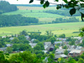
A pleasant hike through the hills and valleys of the Nassogne countryside and woods. It first takes you to the Chapel and Calvary of St-Léonard before descending towards the Masblette stream and the village of Masbourg. This is followed by a very steep climb up a very stony path on the agricultural plateau between Masbourg and Ambly. You may need a machete to approach Ambly, but the view on arrival is magnificent. The return to Nassogne is still a bit of a challenge for your calves, but you won't need a machete: the path is a little wider and properly cleared.
On the way to the Fourneau Saint-Michel
 6.70 mi
+928 ft
-928 ft
3h 55
Average
Departure from Nassogne (Province de Luxembourg)
6.70 mi
+928 ft
-928 ft
3h 55
Average
Departure from Nassogne (Province de Luxembourg)
Starting from Masbourg, the forest trails will take you halfway to the Fourneau Saint-Michel, an estate comprising the open-air museum of rural life in Wallonia and the Iron Museum, with a return trip through the heights of the Masblette valley.
Between Lomme and Masblette
12.02 mi
+1,663 ft
-1,663 ft
7h 00
Average
Departure from Nassogne (Province de Luxembourg)
A walk through the rolling Ardennes countryside around two rivers that are emblematic of the region.
The Masblette is a tributary of the Lomme (also spelled L'Homme in some sources). Their confluence is located between the villages of Lesterny and Masbourg, south of Forrières.
Circuit in the Saint-Hubert forest starting from Fourneau Saint-Michel
8.67 mi
+814 ft
-814 ft
4h 40
 Easy
Departure from Saint-Hubert (Belgique) (Province de Luxembourg)
Easy
Departure from Saint-Hubert (Belgique) (Province de Luxembourg)
This is a very easy route through one of Belgium's largest deciduous forests, on comfortable gravel paths and a little tarmac, but very secluded, completely away from 'civilisation'. It passes by the Étang de Bilaude bird observatory, which is superb in its moorland setting. In several places, beautiful benches carved from tree trunks invite you to rest and contemplate.
Notre-Dame des Pauvres Chapel and Pont des Cloyes
 6.05 mi
+656 ft
-650 ft
3h 20
Average
Departure from Tellin (Province de Luxembourg)
6.05 mi
+656 ft
-650 ft
3h 20
Average
Departure from Tellin (Province de Luxembourg)
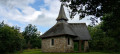
Discover the Notre-Dame des Pauvres Chapel, whose stained-glass windows, dedicated to the Virgin Mary, allow light to penetrate under the arch sheltering the Virgin of Banneux. Beforehand, cross the Pont des Cloyes, a prime spot for observing herons, mallards, kingfishers and other birds of the Lomme.
From the Linçon Valley to the Masblette Valley
 6.77 mi
+850 ft
-840 ft
3h 50
Average
Departure from Tellin (Province de Luxembourg)
6.77 mi
+850 ft
-840 ft
3h 50
Average
Departure from Tellin (Province de Luxembourg)
Walk in the Land of the Awenne Clog Makers. This slightly hilly route, mostly through forest, will take you past the Notre-Dame de Lourdes cave and the Ri Bellerose stream to the heights of the Prairies de Gimbes ridge, passing by the open views at a place called La Justice.
Between Ardenne and Famenne
 11.15 mi
+1,276 ft
-1,273 ft
6h 15
Average
Departure from Tellin (Province de Luxembourg)
11.15 mi
+1,276 ft
-1,273 ft
6h 15
Average
Departure from Tellin (Province de Luxembourg)
Part countryside, part woodland, the walk offers lovely views across the slopes of the Lomme Valley and its surroundings.Of particular note are the Notre-Dame de Haurt Chapel and the nearby disused quarry (a protected site), the Clusure viewpoint, the Maison Espagnole, the Château de Burlin estate, the beautifully renovated farmhouse on Rue Belair, and the Notre-Dame des Pauvres Chapel – to name but a few of the walk’s highlights.
On the heights of the Lomme, starting from Bure
 12.01 mi
+1,198 ft
-1,198 ft
6h 35
12.01 mi
+1,198 ft
-1,198 ft
6h 35
 Difficult
Departure from Tellin (Province de Luxembourg)
Difficult
Departure from Tellin (Province de Luxembourg)
Starting from the Chapel of Notre-Dame de la Salette, the walk begins in the countryside before entering the woodland, quickly reaching the Lomme stream, which it follows upstream for over 4 km to the provincial fish farm at Mirwart.The ponds stretch out one after the other along the course of the Marsault or Marsolle stream to the former site of the Marsolle blast furnace, which operated from 1536 to 1568 on behalf of the Lord of Mirwart.The route then zigzags through the forest for around 9 kilometres to reach the rural heights of Bure and return to the starting point.
For more walks, use our search engine .
The GPS track and description are the property of this route's author. Please do not copy them without permission.

