


A few benches at (2), on the Place de Grupont near (6), at (8) and at (10); no picnic tables.
Between Ardenne and Famenne


Part countryside, part woodland, the walk offers lovely views across the slopes of the Lomme Valley and its surroundings.
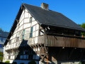
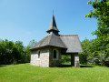
Of particular note are the Notre-Dame de Haurt Chapel and the nearby disused quarry (a protected site), the Clusure viewpoint, the Maison Espagnole, the Château de Burlin estate, the beautifully renovated farmhouse on Rue Belair, and the Notre-Dame des Pauvres Chapel – to name but a few of the walk’s highlights.
Details
Creation:
Last update:
Last review:
–
–
-
 Activity: Walking
 -
 Distance: 11.15 mi
 -
 Average duration: 6h 15
 -
 Difficulty: Moderate
 -
-
 Back to start: Yes
 -
 Ascent: + 1,276 ft
 -
 Descent: - 1,273 ft
 -
-
 Highest point: 1,260 ft
 -
 Lowest point: 735 ft
-
 Country:
Belgium
Country:
Belgium
-
 Area: Massif des Ardennes
 -
 City:
Tellin
City:
Tellin -
 Start/End: N 50.088935° / E 5.259564°
 -


 Hour-by-hour weather
Photos
Waypoints
- S/E : mi 0 - alt. 928 ft - Bure Church
- 1 : mi 1.58 - alt. 804 ft - N899
- 2 : mi 2.93 - alt. 1,066 ft - Notre-Dame de Haurt Chapel
- 3 : mi 4.57 - alt. 919 ft - Route de Rochefort
- 4 : mi 5.19 - alt. 942 ft - La Clusure viewpoint
- 5 : mi 5.58 - alt. 778 ft - Wild boar
- 6 : mi 5.76 - alt. 751 ft - Spanish House
- 7 : mi 6.41 - alt. 1,027 ft - Burlin Castle
- 8 : mi 7.95 - alt. 965 ft - Queue du Chat
- 9 : mi 9.52 - alt. 899 ft - Notre-Dame des Pauvres Chapel
- 10 : mi 9.64 - alt. 843 ft - Bench
- 11 : mi 10.2 - alt. 797 ft - Lomme (rivière) - Belgique
- S/E : mi 11.15 - alt. 922 ft - Bure Church
Notes
Other walks in the area
On the heights of the Lomme, starting from Bure
 Visorando Member
 12.01 mi
+1,198 ft
-1,198 ft
6h 35
12.01 mi
+1,198 ft
-1,198 ft
6h 35
 Difficult
 Departure from Tellin (Province de Luxembourg)
Starting from the Chapel of Notre-Dame de la Salette, the walk begins in the countryside before entering the woodland, quickly reaching the Lomme stream, which it follows upstream for over 4 km to the provincial fish farm at Mirwart.The ponds stretch out one after the other along the course of the Marsault or Marsolle stream to the former site of the Marsolle blast furnace, which operated from 1536 to 1568 on behalf of the Lord of Mirwart.The route then zigzags through the forest for around 9 kilometres to reach the rural heights of Bure and return to the starting point.
Notre-Dame des Pauvres Chapel and Pont des Cloyes
 6.05 mi
+656 ft
-650 ft
3h 20
Moderate
Departure from Tellin (Province de Luxembourg)
6.05 mi
+656 ft
-650 ft
3h 20
Moderate
Departure from Tellin (Province de Luxembourg)
Discover the Notre-Dame des Pauvres Chapel, whose stained-glass windows, dedicated to the Virgin Mary, allow light to penetrate under the arch sheltering the Virgin of Banneux. Beforehand, cross the Pont des Cloyes, a prime spot for observing herons, mallards, kingfishers and other birds of the Lomme.
Hermitage and Resteigne Castle
 10.20 mi
+922 ft
-892 ft
5h 30
Moderate
Departure from Tellin (Province de Luxembourg)
10.20 mi
+922 ft
-892 ft
5h 30
Moderate
Departure from Tellin (Province de Luxembourg)
A walk starting from Tellin to discover the villages of Resteigne and Belvaux via the La Lesse valley and the Bois de Niau (woodland) where a hermit lived. There are still ruins of the hermitage of this former officer of Napoleon and heir to the Château de Resteigne (castle). On the way go past the Rocher à Pic viewpoint, the Belvaux chapel, the Hermitage, the Mill, the Castle and the old Resteigne quarry.
Discover the essentials of Mirwart
 4.41 mi
+505 ft
-486 ft
2h 30
4.41 mi
+505 ft
-486 ft
2h 30
 Easy
Departure from Saint-Hubert (Belgique) (Province de Luxembourg)
Easy
Departure from Saint-Hubert (Belgique) (Province de Luxembourg)
Glacière, ponds, arboretum, Croix des Bûcherons: circular around Mirwart Castle.
The grand tour of Mirwart
 9.92 mi
+1,086 ft
-1,056 ft
5h 30
Moderate
Departure from Saint-Hubert (Belgique) (Province de Luxembourg)
9.92 mi
+1,086 ft
-1,056 ft
5h 30
Moderate
Departure from Saint-Hubert (Belgique) (Province de Luxembourg)
Glacière, ponds, arboretum, Croix des Bûcherons, but also Croix des Morts, La Lomme, Rocher de Marie Gobaille. Let's set off on the grand tour of Mirwart.
A woodland walk to Mirwart Castle
 9.87 mi
+876 ft
-896 ft
5h 20
Moderate
Departure from Saint-Hubert (Belgique) (Province de Luxembourg)
9.87 mi
+876 ft
-896 ft
5h 20
Moderate
Departure from Saint-Hubert (Belgique) (Province de Luxembourg)
Set off to explore the vast forest of Saint-Hubert from Mirwart, taking a more open route through the rural hills of Arville. On the return journey, the route follows the meandering course of the River Lomme and its numerous passages under the railway line before climbing up the avenue leading to Mirwart Castle, which was splendidly renovated at the start ofthe 21st centuryand transformed into a hotel, restaurant and venue for receptions, seminars and outdoor events.
From the Linçon Valley to the Masblette Valley
 6.77 mi
+850 ft
-840 ft
3h 50
Moderate
Departure from Tellin (Province de Luxembourg)
6.77 mi
+850 ft
-840 ft
3h 50
Moderate
Departure from Tellin (Province de Luxembourg)
Walk in the Land of the Awenne Clog Makers. This slightly hilly route, mostly through forest, will take you past the Notre-Dame de Lourdes cave and the Ri Bellerose stream to the heights of the Prairies de Gimbes ridge, passing by the open views at a place called La Justice.
Eaux & Forêts in Mirwart
 12.48 mi
+1,398 ft
-1,398 ft
6h 55
Difficult
Departure from Saint-Hubert (Belgique) (Province de Luxembourg)
12.48 mi
+1,398 ft
-1,398 ft
6h 55
Difficult
Departure from Saint-Hubert (Belgique) (Province de Luxembourg)
Eaux & Forêts (Water & Forests): older people will certainly remember this former name of the Wallonia public service Direction Nature et Forêt (Nature and Forestry Department). The former name perfectly reflects the intrinsic characteristics of this long hike starting from the provincial estate of Mirwart, which takes you on a journey of discovery along the Lomme, the Parfond Ry and a few other nameless streams. Nothing but forest and aquatic bliss... especially when the rivers and streams are in flood! That said, the paths and trails in this region of the Belgian Ardennes are in much better condition in the middle of winter after heavy rains than in other regions such as Limburg or the Pays des Collines, to name but two. Of course, the ruts dug by forestry machinery during various felling or clearing operations do not always help to keep the paths in good condition for hiking.
Hike without description to be followed with the Visorando app.
For more walks, use our search engine .
The GPS track and description are the property of this route's author. Please do not copy them without permission.

