


Not too far away:
The Han-sur-Lesse Caves and the wildlife park
Lavaux-Sainte-Anne Castle
Circular Daffodil Walk to Edmond d’Hoffschmidt’s hermitage


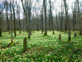
Starting from the old Resteigne Quarry, set off to explore Resteigne Castle, the old watermill, the new footbridge over the Lesse, the nature reserves (pastures, juniper bushes, etc.), millions of wild daffodils (in season), the former hermitage of Edmond d’Hoffschmidt, the pretty village of Belvaux and the viewpoint overlooking the Lesse valley from the Rocher à Pic.
Details
Creation:
Last update:
Last review:
–
–
-
 Activity: Walking
 -
 Distance: 10.17 mi
 -
 Average duration: 5h 35
 -
 Difficulty: Moderate
 -
-
 Back to start: Yes
 -
 Ascent: + 1,070 ft
 -
 Descent: - 1,047 ft
 -
-
 Highest point: 945 ft
 -
 Lowest point: 558 ft
-
 Country:
Belgium
Country:
Belgium
-
 Area: Massif des Ardennes
 -
 City:
Rochefort (Belgique)
City:
Rochefort (Belgique) -
 Start/End: N 50.09037° / E 5.176575°
 -


 Hour-by-hour weather
Photos
Waypoints
- S/E : mi 0 - alt. 597 ft - The former Resteigne quarry - lesse (rivière) - Belgique
- 1 : mi 0.42 - alt. 610 ft - lesse (rivière) - Belgique
- 2 : mi 1.54 - alt. 761 ft - Fork in the road
- 3 : mi 2.01 - alt. 771 ft - Nature reserve
- 4 : mi 2.26 - alt. 797 ft - Juniper trees
- 5 : mi 4.52 - alt. 659 ft - Alpaca farm
- 6 : mi 4.82 - alt. 610 ft - Gethsénani Monastery
- 7 : mi 5.99 - alt. 594 ft - A barely visible path to the right
- 8 : mi 6.27 - alt. 925 ft - The former hermitage of Edmond d’Hoffschmidt
- 9 : mi 6.33 - alt. 935 ft - Daffodils
- 10 : mi 7.63 - alt. 561 ft - Belvaux
- 11 : mi 8.83 - alt. 886 ft - Rocher à Pic (viewpoint)
- 12 : mi 9.91 - alt. 751 ft - The Lesse Quarry
- S/E : mi 10.17 - alt. 597 ft - The former Resteigne quarry
Worth a visit
Other walks in the area
Walk from Resteigne to Belvaux
 Visorando Member
 5.00 mi
+630 ft
-607 ft
2h 50
5.00 mi
+630 ft
-607 ft
2h 50
 Easy
Easy
 Departure from Rochefort (Belgique) (Province de Namur)
A delightful mix of sights to discover throughout these 8 km: some lovely viewpoints, including Rocher à Pic and the La Lesse quarry, the Ellinchamps Forest Reserve, the bread oven and the Belvaux Chapel, as well as the Herdal Resurgence on the way back.
L’Ermitage via the Bois de Niaux
 2.62 mi
+154 ft
-154 ft
1h 20
Easy
Departure from Rochefort (Belgique) (Province de Namur)
2.62 mi
+154 ft
-154 ft
1h 20
Easy
Departure from Rochefort (Belgique) (Province de Namur)
Magnificent in spring when the daffodils are in bloom, in autumn for the flamboyant colours of the deciduous trees, and largely shaded during the summer months. Set off to explore the Ermitage halfway along the route and the Réserve des Pairées, a juniper-lined reserve that you’ll pass on both the outward and return journeys.
Circular forest from Chanly
 11.91 mi
+1,631 ft
-1,608 ft
6h 55
Moderate
Departure from Wellin (Province de Luxembourg)
11.91 mi
+1,631 ft
-1,608 ft
6h 55
Moderate
Departure from Wellin (Province de Luxembourg)
Based on sections of Grande Randonnée trails and marked walks, in particular the new 'Par Monts et par Vaulx' circulars inaugurated in 2025 by the Wellin Tourist Office, the walk takes place mainly in magnificent deciduous forests where beech and oak trees reign supreme.
Grand tour of the Han Caves estate
 13.20 mi
+1,257 ft
-1,240 ft
7h 10
13.20 mi
+1,257 ft
-1,240 ft
7h 10
 Difficult
Departure from Rochefort (Belgique) (Province de Namur)
Difficult
Departure from Rochefort (Belgique) (Province de Namur)
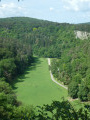
A visit to the Caves of Han is a must. At least once in your life, you must go there to admire the natural beauty shaped by water in the Boine limestone massif over millions of years! Of course, the walk suggested here does not go inside, but takes a wide loop around the forest estate, which has been privately owned and fenced off since the 1960s to preserve its condition. As a result, whilst you can still see the Lesse resurgence, it is unfortunately no longer possible to see beyond the top of the rock at the point where it disappears into the Gouffre de Belvaux. That said, this walk also offers the chance to discover the Ry d’Ave, the Rocher d’Hérimont, the limestone hill on the north side, the viewpoint at the Rocher de Griffaloux on the east side, the village of Belvaux, the old Lesse quarry, Resteigne Castle, the Tiennes and Pairées nature reserves, the juniper-covered meadows, and the undergrowth carpeted with daffodils, lilies of the valley and other flowers depending on the season.
Le Sourd d'Ave and La Croix de Jeumont
 7.51 mi
+614 ft
-591 ft
4h 00
Moderate
Departure from Wellin (Province de Luxembourg)
7.51 mi
+614 ft
-591 ft
4h 00
Moderate
Departure from Wellin (Province de Luxembourg)
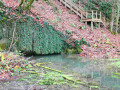
The route takes turns along the GR® Monts d'Ardenne trail and the Wellin circular, via Monts and Vaulx.The Sourd d'Ave is a resurgence of the Ry d'Ave located opposite the N835, between the E411 and the N94. There are better places, but there is no choice. The route is equipped with stairs and ropes, making it safe and secure. You can admire the work of the beavers there!The stone Jeumont Cross dated from the late 19th century. It fell during a storm in 1984 (remains can be seen on the site), and a wooden version was erected by the Fraternité de Tibériade in 2022. The site is part of the Natura 2000 network and the chapel at the top of the hill is listed as protected heritage in Wallonia.In addition to opening up onto rolling countryside landscapes, the trail comes quite close to two gigantic quarries, Fond des Vaulx and Les Limites. Both are worth a closer look where possible!
Around Ave-et-Auffe
 6.47 mi
+446 ft
-446 ft
3h 20
Moderate
Departure from Rochefort (Belgique) (Province de Namur)
6.47 mi
+446 ft
-446 ft
3h 20
Moderate
Departure from Rochefort (Belgique) (Province de Namur)
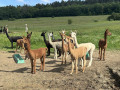
An easy hike accessible via the E411 motorway. Just 5 km from the Caves of Han-sur-Lesse, come and discover the charming village of Ave-et-Auffe, the village of my childhood. Formed by a merger in 1820, it stretches on either side of the Ry d’Ave, on the border with the province of Luxembourg but still within the province of Namur. Beautiful views over the Famenne and the foothills of the Ardennes. Breeding of Ardennes horses and alpacas. In March and April, daffodils, flowerbeds and hawthorns will delight you.
Hermitage and Resteigne Castle
 10.20 mi
+922 ft
-892 ft
5h 30
Moderate
Departure from Tellin (Province de Luxembourg)
10.20 mi
+922 ft
-892 ft
5h 30
Moderate
Departure from Tellin (Province de Luxembourg)
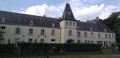
A walk starting from Tellin to discover the villages of Resteigne and Belvaux via the La Lesse valley and the Bois de Niau (woodland) where a hermit lived. There are still ruins of the hermitage of this former officer of Napoleon and heir to the Château de Resteigne (castle). On the way go past the Rocher à Pic viewpoint, the Belvaux chapel, the Hermitage, the Mill, the Castle and the old Resteigne quarry.
Han-sur-Lesse geological walk
 5.93 mi
+554 ft
-551 ft
3h 15
Moderate
Departure from Rochefort (Belgique) (Province de Namur)
5.93 mi
+554 ft
-551 ft
3h 15
Moderate
Departure from Rochefort (Belgique) (Province de Namur)
UNESCO created the Geopark label to promote geological heritage. On this walk, you will discover part of Belgium's first Geopark, Famenne-Ardenne. On the agenda: caves, clay pits and resurgences.
For more walks, use our search engine .
The GPS track and description are the property of this route's author. Please do not copy them without permission.

