


At (2): muddy path for a few hundred metres.
From (4) to (5): please note that the route runs alongside a main road on the footpath.
At (8): a difficult ford since the footbridge shown on the base map has disappeared. To avoid it, turn right at (7) onto the small path leading to the residential area, Rue des Mésanges, then turn left at the first junction onto Rue des Chênes, and rejoin the route at (9).
From (10) to (11): the route follows a local road with no hard shoulder.
Walk in Famenne-Ardenne from Petit-Han


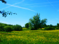
Located mainly in Famenne, on the border with the Ardennes, this circular route alternates between woodland and countryside, with a short section along the River Ourthe.
With very little elevation gain and plenty of hard-surfaced paths (cycle paths, local roads or access roads to residential estates), it presents no difficulty other than the odd slightly muddy footpath or forest track.
Lovely views over the northern part of the Famenne and the Ourthe valley between the residential area of Plain de Holset (Monteuville) and Melreux.
Details
Creation:
Last update:
Last review:
–
–
-
 Activity: Walking
 -
 Distance: 10.95 mi
 -
 Average duration: 5h 25
 -
 Difficulty: Moderate
 -
-
 Back to start: Yes
 -
 Ascent: + 397 ft
 -
 Descent: - 410 ft
 -
-
 Highest point: 801 ft
 -
 Lowest point: 535 ft
-
 Country:
Belgium
Country:
Belgium
-
 Area: Massif des Ardennes
 -
 City:
Durbuy
City:
Durbuy -
 Start/End: N 50.330893° / E 5.442219°
 -


 Hour-by-hour weather
Photos
Waypoints
- S/E : mi 0 - alt. 627 ft - Petit-Han Primary School
- 1 : mi 0.8 - alt. 636 ft - After the ponds – continue straight on
- 2 : mi 1.37 - alt. 696 ft - Muddy path ahead
- 3 : mi 2.71 - alt. 548 ft - The Ourthe, footbridge
- 4 : mi 4.44 - alt. 574 ft - /!\ /!\ /!\ N898 - pedestrian verge
- 5 : mi 4.75 - alt. 561 ft - The Ourthe, the Melreux bridge - Ourthe (rivière) - Belgique
- 6 : mi 4.99 - alt. 574 ft - Melreux-Hotton station
- 7 : mi 6.25 - alt. 633 ft - Turn right to avoid the ford
- 8 : mi 6.36 - alt. 614 ft - Difficult ford
- 9 : mi 6.47 - alt. 610 ft - End of diversion
- 10 : mi 7.03 - alt. 659 ft - Local road to Biron
- 11 : mi 8.03 - alt. 686 ft - Saint-Pierre Church in Biron
- 12 : mi 8.34 - alt. 719 ft - Forest track (almost) to the finish
- S/E : mi 10.95 - alt. 627 ft - Petit-Han Primary School
Notes
Worth a visit
Durbuy & Hotton
Other walks in the area
Circular in the Petit-Han Woods
 Visorando Member4.23 mi
+131 ft
-118 ft
2h 05
Visorando Member4.23 mi
+131 ft
-118 ft
2h 05
 Easy
Easy
 Departure from Durbuy (Province de Luxembourg)
This is a walk starting from the Petit-Han community school and the football pitch (easy and free parking). Playground and picnic benches available on site.Part of the route is paved, the other part is accessible with a sturdy pushchair.
From the Petit-Han Woods to the N833
2.28 mi
+72 ft
-52 ft
1h 05
Easy
Departure from Durbuy (Province de Luxembourg)
Hike starting from the Petit-Han municipal school. There is a football pitch (easy and free parking, Rue des Pinèdes), a playground and picnic benches.Fully paved round trip, ideal for a stroll with a pushchair
From La Passerelle to Durbuy
8.48 mi
+492 ft
-489 ft
4h 20
Moderate
Departure from Durbuy (Province de Luxembourg)
Hike starting from the La Passerelle hotel-restaurant (free parking on site).
For a day's walk that includes the town of Durbuy, stop off to visit the old town.
At Petit-Han, you must cross the Adventure Valley barrier to reach Durbuy.
From La Passerelle to the Petit-Han woods
5.42 mi
+243 ft
-243 ft
2h 40
Moderate
Departure from Durbuy (Province de Luxembourg)
Hike starting from the La Passerelle hotel-restaurant (free parking on site). Round trip walk in the village of Grand-Han (along the village road) and in the Petit-Han woods. The hike is accessible to pushchairs.
Along the Ourthe between Bohon and Bomal
 11.31 mi
+1,289 ft
-1,266 ft
6h 20
11.31 mi
+1,289 ft
-1,266 ft
6h 20
 Difficult
Departure from Durbuy (Province de Luxembourg)
Difficult
Departure from Durbuy (Province de Luxembourg)
No, the walk doesn’t follow the banks of the Ourthe for 18 km… that would probably be very pretty but too monotonous over such a distance.Starting from the centre of Barvaux, the route begins by climbing the hill on the western side towards Durbuy (which you can visit off the trail) and reaches the Ourthe at the new relief car park.From there, the walk follows the river for just over 3 km before leaving it to reach the plateau between Tohogne and Herbet.After descending to the Ourthe and passing through Bomal, the walk climbs up the other side of the Ourthe and follows the lovely ridge path through the Mont des Pins and Mont Pelé Nature Reserve.
On the edge of the Condroz region around Borlon
11.10 mi
+833 ft
-863 ft
5h 50
Moderate
Departure from Durbuy (Province de Luxembourg)
This variation of our Three Provinces Walk in Bonsin is a little shorter but, it should be noted, involves a little more tarmac on fairly quiet country roads.
Around Heyd and Morville
 10.44 mi
+1,194 ft
-1,198 ft
5h 50
Moderate
Departure from Durbuy (Province de Luxembourg)
10.44 mi
+1,194 ft
-1,198 ft
5h 50
Moderate
Departure from Durbuy (Province de Luxembourg)
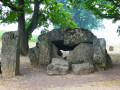
A walk offering varied scenery, alternating between countryside and woodland, paths, tracks, village streets, short stretches of country roads and cycle paths, starting from Wéris, one of Wallonia’s most beautiful villages, well known for its megaliths and its museum.
For more walks, use our search engine .
The GPS track and description are the property of this route's author. Please do not copy them without permission.

