Country:

 City:
City:


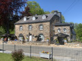
Car park along the Route de Freyr in Laneuville-au-bois, near the sign for “Parking Aire de Vision des Amonys”.
(S/E) Set off along the road towards the N89 until you reach the entrance to the Aire de Vision on your left.
Walk to the observation hut. Go inside to enjoy a superb view. Then leave the hut.
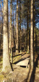
(1) On your left, look for a tree serving as a landmark: a thick red and white stripe on the trunk – a red dot below it – and a white ‘T’ in a White Diamond shape above it. Take the forest path running alongside the fir forest.
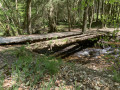
At the crossroads, carry on straight ahead. Keep following the thick red and white stripes on the tree trunks (which are not to be confused with theGR® markings) until you reach some large tree trunks lying on the ground.
(2) Take a sharp right-hand bend and head back up towards the road. At the road, turn left and follow the path for about 600 m.
At the forest track on your left, turn off, go round the barrier and ignore the path on your right flanked by two stone markers on either side. Cross over the Ru des Chevaux, ignore the path on your left and head up to the deer feeders.
(3) Turn left and walk straight on for 650 m. At the crossroads, take the path directly opposite, which runs diagonally to the left. Follow it downhill for just over 600 m until you reach a junction.
(4) Turn right onto the hairpin bend where a stream flows alongside the path. Walk gently uphill for 300 m until you reach a path on your left.
(5) Turn left. The path curves to the right. Cross a stream and continue downhill. Ignore the path on your right. You’ll come across the stream you crossed earlier on your left. Ignore the path on your left, cross the Basseille and walk to the road. Continue to the left for just under 1 km, ignoring the forest tracks on your right, until you reach a crossroads with forest tracks on either side.
(6) Turn left. The path then bends to the right. Pontoons have been installed so you can keep your feet dry if necessary. Take the footbridge over a stream, then the pontoon over the Basseille. Go uphill and, at the T-junction, turn right. The path bends to the left and leads to a T-junction.
(7) Turn right and go through the cattle grid. The path becomes a road. At the end of the road, turn left onto thefirst road. In the bend, walk past the Oratoire Saint-Louis de Monfort. Ignore the first forest track and take thesecond forest track on the right.
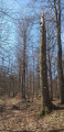
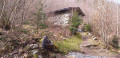
(8) Go round the barrier, head uphill and, at the fork in the road, turn left. At the next fork in the road, continue to the left. Head uphill for about 800 m. Be careful when you come to the standing dead tree with a rock on the ground acting as a marker (see photo), so that you can spot, a few metres further on to your left, some branches on the ground covered in moss.
(9) Turn left, step over the branches and you’ll come to a faint path. At the tree stump at your feet, head left onto the faint path, which is still easy to follow. You’ll see other standing dead trees on your right; give them a wide berth. Follow the better-marked path downhill to the road. Turn right and head back to the car park (S/E).


 Visorando Member
 Moderate
 Difficult