Country:

 City:
City:



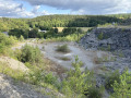
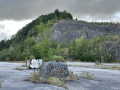
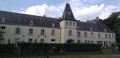
Car park in the former Lesse Quarry, accessible via the path in front of Resteigne Castle.
No signposting
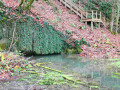
(S/E) At the entrance to the quarry, turn right towards the graffiti-covered walls. Take the path between the two walls and head uphill. Further up, the path turns left. Ignore a path on your right (not shown on maps, private property) and continue uphill until you reach a Fork in the road.
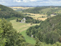
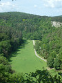
(1) Turn left; you’ll return via the right-hand path. Walk to the end of the path, ignoring a junction on your right, but first make the most of the small hills to enjoy a superb view.
(2) Turn sharply right and enter the Ellinchamps Nature Reserve. Beware of processionary caterpillars – do not stray from the paths. Walk for about 500 m, ignoring the less clearly marked paths, until you reach a junction. You’ll take this route on the way back.
Red Trail markings
(3) Carry on straight ahead. You’ll come out into open country and then pass the hamlet known as ‘Crête d’E Linchamps’. Ignore the path leading down to your left; you’ll return that way.
(4) Carry on along the ridge path and, about 500 m further on, pass the place known as Rocher à Pic. Enjoy the view from the viewpoint. Then continue to the T-junction and turn left.
(5) Head down the wide path. Ignore the path branching off to your right. Then, further down, ignore the one branching off to the left. Leave the woods and walk out into the open. Stay on the main path, which curves sharply to the left and leads to a road.
(6) Turn left. Walk along the road with care. Enter Belvaux and walk to a junction. Change of signposting.
Dark Blue Blue Rectangle Markings
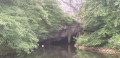
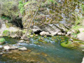
(7) Turn left onto Rue du Hambeau. Look out for the bread oven in front of the Saint-Laurent Chapel. Continue along the road, which turns into a stony track and then a dirt track. You’ll eventually enter the woods. Walk alongside the River Lesse and pass the Herdal resurgence. Walk to the hamlet known as the Ellinchamps Forest Reserve and take the path on your left. This connects with another set of signposts.
(8) Turn left and head uphill. At the top, at the place known as Crête d’E Linchamps, turn right.
Yellow Diamond markings
(4) Follow the path you took on the way there in the opposite direction, passing through the open stretch again.
(3) Continue to the left and, at the T-junction, turn left. Turn onto the hairpin bend on your right. Markings cease.
No signposting
(9) Walk along this forest track until you reach the Fork in the road from the outward journey.
(1) Turn left and head back down to the car park (S/E).

 , there are only two 500-metre sections in common with the outward route. Perhaps next time.


 Visorando Member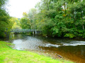
 Moderate
 Difficult